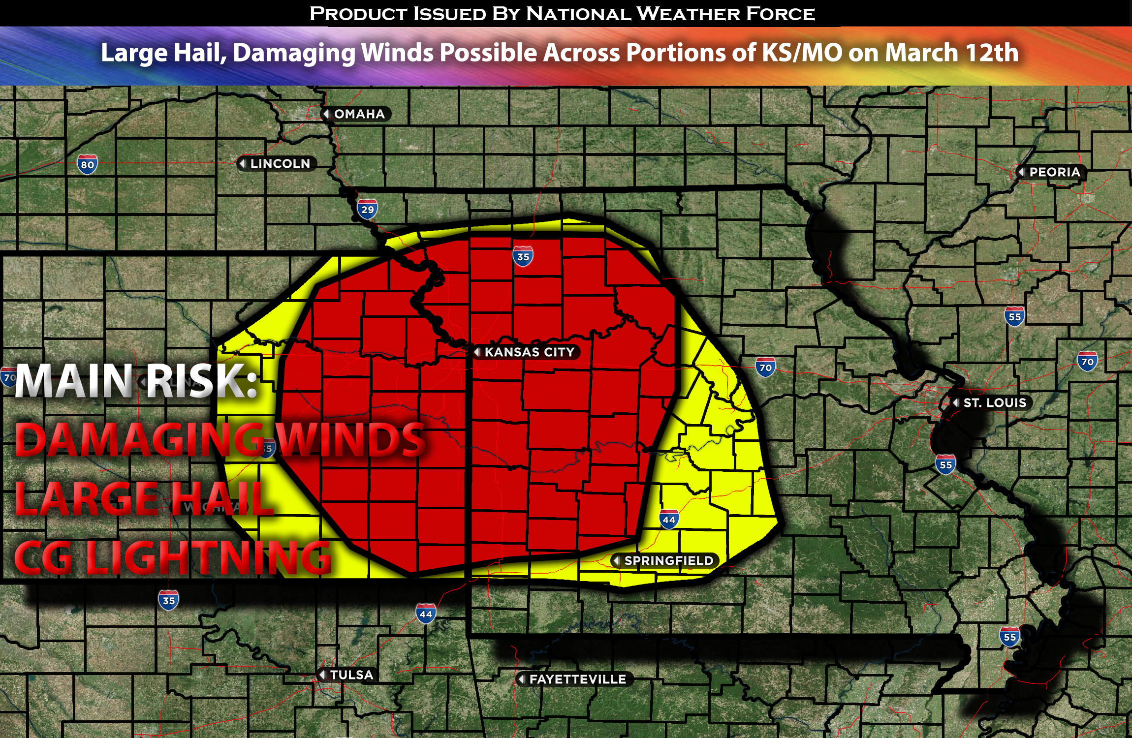
 Outlook for Portions of KS into MO:
An elevated severe weather risk is possible across portions of Kansas and Missouri, given some ingredients for severe weather during the late afternoon and evening hours. If these storms mature enough, they are capable of producing large hail and damaging winds across the impact area. Check below for more details.
Main impact: large hail damaging winds, very low tornado risk due to lack of low-level shear.
Approximate Timing: Depending on if destabilization can occur storms would be expected to pop around the afternoon/evening hours of Tuesday.
Overall Forecast: A low-amplitude shortwave trough is expected to move across the central Plains on Tuesday, reaching the Mid-Mississippi Valley by late Tuesday night or early Wednesday morning. The surface low associated with this shortwave is expected to move across Kansas for most of the day while gradually losing strength, positioning near the Kansas/Nebraska/Missouri border intersection by Tuesday evening.
Following this initial shortwave, westerly flow aloft will continue across the Plains, with upper troughing deepening across the western United States. This condition will sustain the troughing across the High Plains, possibly leading to further surface cyclogenesis on Tuesday evening. The resulting surface low is forecast to travel across southwest Kansas and the Oklahoma Panhandle into northwest Oklahoma and central Kansas by early Wednesday morning. In the area stretching from northeast Oklahoma and southeast Kansas into the Ozarks and Lower Missouri Valley, modest moisture advection from the southern Plains into the Ozark Plateau is expected. The warm sector in this region is forecast to experience mid-70s temperatures in central Oklahoma and southeast Kansas by late afternoon, with slightly cooler temperatures, such as low 70s highs, expected farther north in west-central Missouri. Despite these thermodynamic conditions, most guidance suggests that modest capping will likely persist. However, a slight increase in temperature or dewpoints could be sufficient to overcome convective inhibition or cap. Low-level confluence within the warm sector and some convergence along the dryline may provide enough lift for convective initiation, assuming minimal convective inhibition. Should initiation occur, steep mid-level lapse rates and moderate deep-layer vertical shear could support the development of a few strong to severe storms. These storms are expected to mainly produce large hail and damaging winds before diminishing overnight.
Timing & Impact:
If destabilization occurs, storms are anticipated to form around 6pm and continue into the night across Kansas and into Missouri, with more developing throughout the night before a more stable air mass moves in and cuts off their fuel, allowing them to diminish. These storms will be capable of producing large hail and damaging winds.
Stay tuned for more updates.
Sina⚡⚡
With over a decade of experience in forecasting severe thunderstorms, this individual is a seasoned forecaster and developer. Their expertise in severe weather forecasting and computer science is entirely self-taught, complemented by a foundation in Atmospheric Science from UNCO and an IT background from WGU. They have dedicated their efforts to developing innovative tools that enhance the accuracy of analyzing large hail and tornadoes. As a significant contributor to National Weather Force & Southern California Weather Force, they have played a crucial role in providing accurate and timely information, as well as developing tools to keep those affected well-informed.
