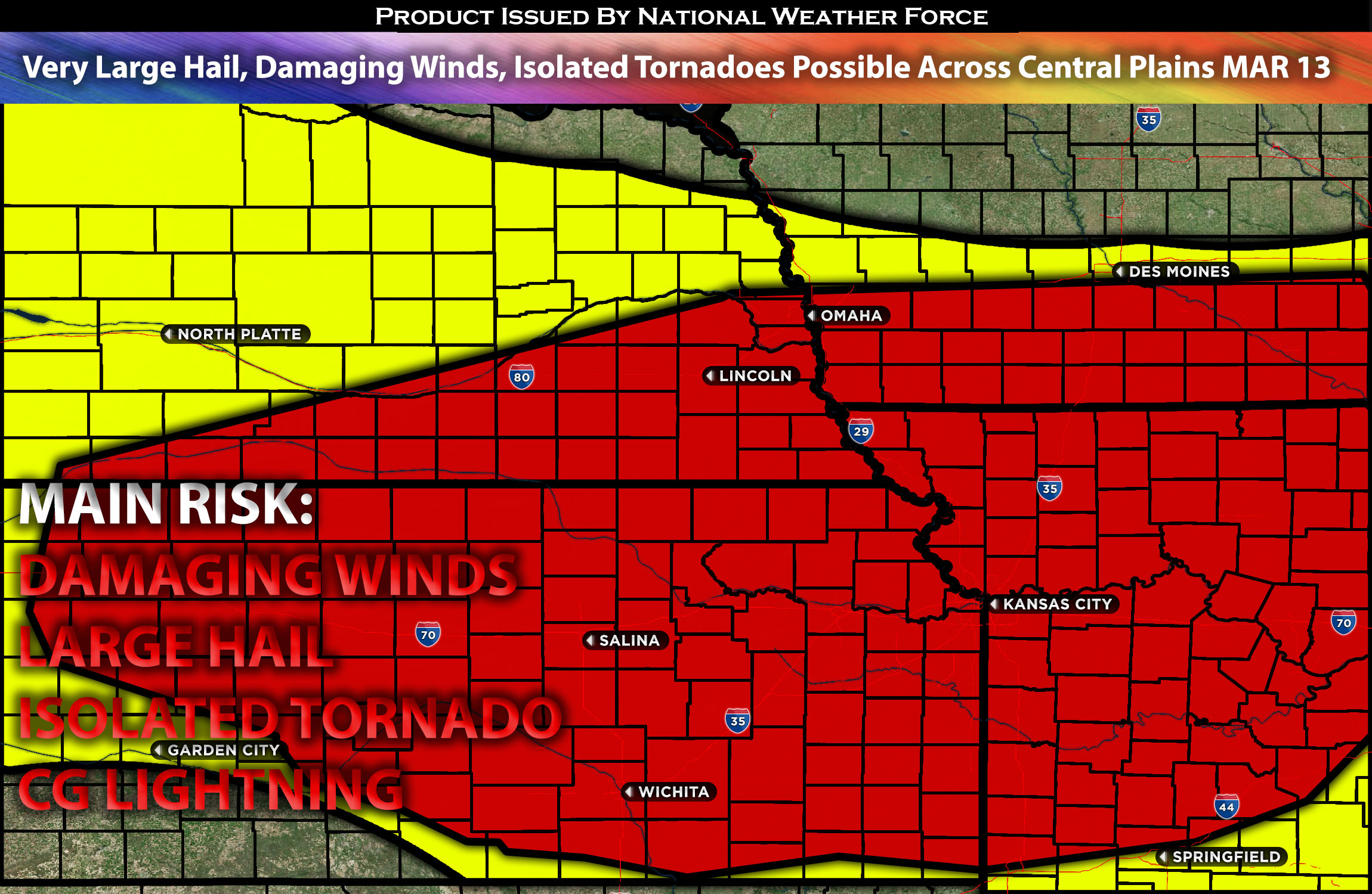
 Outlook for the Central Plains into MO Valley:
A severe weather setup is expected across the southern Plains into the Missouri Valley area on Wednesday, as the atmosphere is anticipated to become unstable in the evening and overnight hours. These storms will mainly be capable of producing large hail and damaging winds, along with an isolated tornado risk, primarily in the evening (though not the main threat). Check below for more details.
Main impact: large hail damaging winds, and isolated tornadoes.
Approximate Timing: Depending on if destabilization can occur storms would be expected to pop around the evening hours of Wednesday and continue into the overnight hours before diminishing.
Locations Impacted: Nebraska south/southeast, Kansas, and north and central Missouri, before diminishing into central/east Missouri.
Overall Forecast:
An upper-level low is moving into the Intermountain West, accompanied by a mid-level jet with speeds of 80 to 90 knots circling the system’s base. This will lead to the deepening of a surface low across southwest Kansas and the Oklahoma Panhandle. To the east of this low, strong moisture advection will result in elevated moisture levels in eastern Kansas and much of Missouri by the afternoon, creating a moderate instability corridor.
A dryline is expected to form further west over south-central Kansas. By late afternoon, scattered storms are likely to initiate along this instability axis, with storm activity significantly increasing into the early evening. This is expected to result in multiple organized thunderstorm clusters across the central Plains and lower Missouri Valley. The approaching mid-level jet will introduce very steep mid-level lapse rates into the central Plains in the afternoon.
Combined with strong instability and effective shear, this environment will be conducive to supercell formation, capable of producing large hail, with hailstones over 2 inches in diameter possible from the strongest supercells. Additionally, with elevated low-level shear, a tornado threat is also likely, especially in the early evening when the low-level jet intensifies, alongside the potential for wind damage.
Impact:
Destabilization is expected to occur, with storms anticipated to form around late evening and continue into the night across Nebraska southeast, northern central Kansas and north central Missouri, with more developing throughout the night. Initially, storms will be more discrete, with the strongest cells capable of producing large hail and perhaps isolated tornadoes, especially in the evening. However, due to the nature of the storms, they are expected to merge quickly into the overnight hours, becoming mainly a damaging wind threat as they move eastward. These storms will dissipate quickly as they move into a more stable airmass across MO central into the early morning hours.
Stay tuned for more updates.
Sina⚡⚡
With over a decade of experience in forecasting severe thunderstorms, this individual is a seasoned forecaster and developer. Their expertise in severe weather forecasting and computer science is entirely self-taught, complemented by a foundation in Atmospheric Science from UNCO and an IT background from WGU. They have dedicated their efforts to developing innovative tools that enhance the accuracy of analyzing large hail and tornadoes. As a significant contributor to National Weather Force & Southern California Weather Force, they have played a crucial role in providing accurate and timely information, as well as developing tools to keep those affected well-informed.
