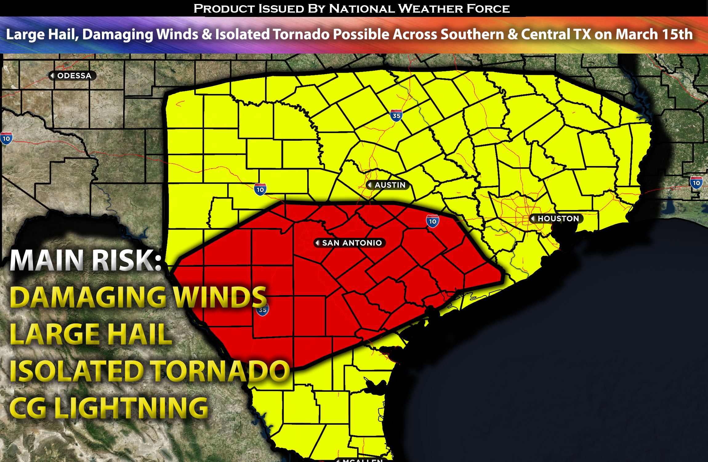
Outlook for the South and Central TX:
A somewhat elevated risk for severe storms is expected early Friday morning, with another round of numerous thunderstorms capable of becoming severe, given the (still limited) ingredients. These storms will mainly be capable of producing large hail and damaging winds. An isolated tornado is also possible but is definitely not the main risk. Check below for more details.
Main impact: large hail, damaging winds, and isolated tornado possible (short time frame).
Approximate Timing: Depending on when destabilization can occur storms would be expected to pop around early morning hours with another round late overnight into Saturday morning.
Locations Impacted: Texas south and central.
Overall Forecast:
On Friday early morning and again late Friday night, a deep upper-level low will remain over the Southwest, with the severe weather threat concentrated along a stalling boundary in south-central and southeast Texas. In this area, localized heating and strong low-level moisture beneath a mid-level flow of over 50 knots will support the potential for hail and damaging gusts. However, the extent of severe weather may be somewhat restricted due to a limited combination of necessary conditions. Additionally, there will be a very isolated tornado threat during a brief window, facilitated by somewhat elevated low-level shear.
Impact:
Multiple waves of storms are expected across the region. The first wave is expected to form from west to east, starting in southern Texas in the early morning hours of Friday, quickly becoming severe and moving as a cluster northeastward. Then, another round of storms is expected, with a few becoming severe; the main risks again are large hail and damaging winds from late Friday night into Saturday morning, moving as a cluster northeastward into northern Texas.
Stay tuned for more updates.
Sina⚡⚡
With over a decade of experience in forecasting severe thunderstorms, this individual is a seasoned forecaster and developer. Their expertise in severe weather forecasting and computer science is entirely self-taught, complemented by a foundation in Atmospheric Science from UNCO and an IT background from WGU. They have dedicated their efforts to developing innovative tools that enhance the accuracy of analyzing large hail and tornadoes. As a significant contributor to National Weather Force & Southern California Weather Force, they have played a crucial role in providing accurate and timely information, as well as developing tools to keep those affected well-informed.
