
 Outlook for the Deep South :
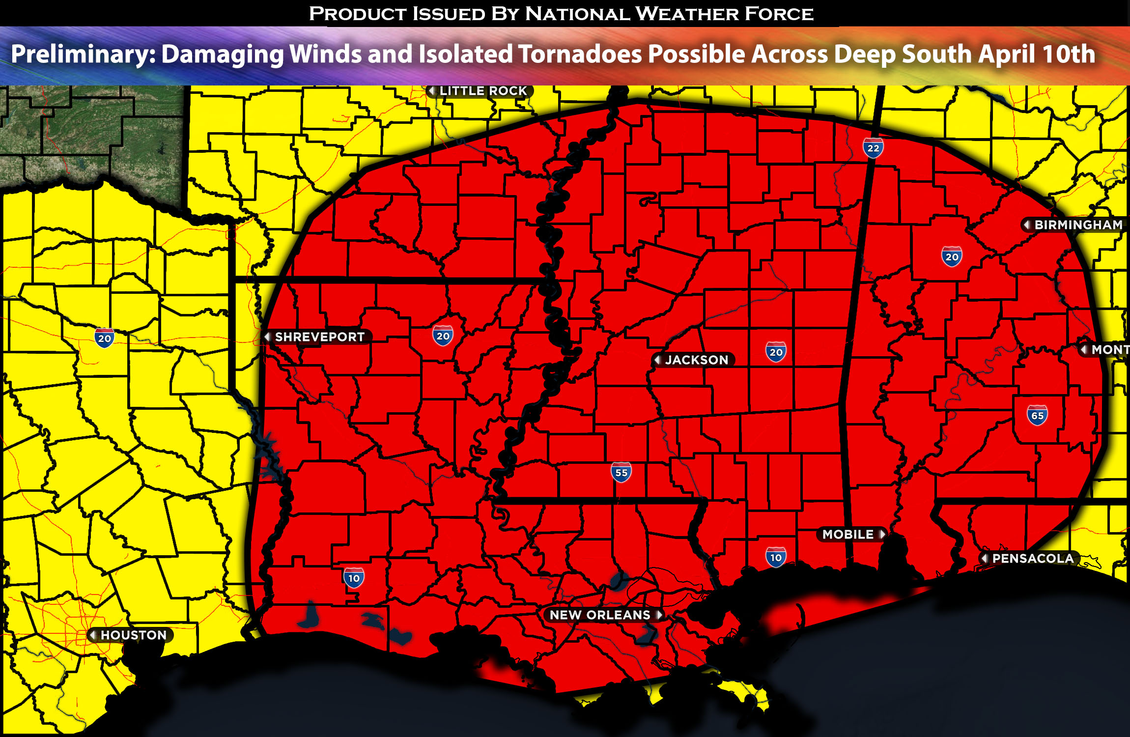
Severe thunderstorms are expected across the Gulf Coast States and the Deep South. The main hazards from these storms are expected to be isolated tornadoes and damaging winds. The tornado risk will be monitored, with a more defined threat provided in the next update. For a preliminary forecast, check below for details.
Preliminary Outlook:
An intriguing weather setup is on the horizon, starting with a southern shortwave trough over Texas that merges into a broader, amplified trough as a northern-stream wave plunges into the Upper Midwest. This interaction is set to significantly amplify atmospheric flow from Wednesday afternoon, marked by a deepening surface cyclone moving northeastward from southeast Texas across the Mid-South.
Overall, convection is expected from the lower Mississippi Valley’s vicinity by Wednesday morning, while moderately steep mid-level lapse rates persist ahead of this system over the northwest Gulf. A substantial influx of moist air from the Gulf is expected to move north-northeast, just ahead of the morning’s convection, providing moderate buoyancy, particularly in south-southeast Louisiana. The convective intensity is forecast to peak by late morning to midday amidst already strong low-level shear. This initial setup, along with a further strengthened tropospheric wind field, is likely to foster the development of strong supercells in the Louisiana to south Mississippi area, spreading northeastward through the afternoon. Over time, and as the system moves north/east, the severe threat may become somewhat constrained by a less favorable thermodynamic environment, marked by weaker lapse rates and convective regeneration shifting southwestward towards the buoyancy plume. However, by Wednesday night, the potent low-level winds could maintain a high-shear, low-instability tornado risk, especially where surface dew points reach at least the mid-60s, allowing for possible isolated tornadoes (still being monitored).
Potential risk: spotty hail, damaging straight-line winds, isolated tornadoes and CG (cloud-ground) lightning.
Stay tuned for the next update, which will provide timing details, more specific information on impacted locations, and threats for specific micro-zones in the coming day.
Sina⚡⚡
With over a decade of experience in forecasting severe thunderstorms, this individual is a seasoned forecaster and developer. Their expertise in severe weather forecasting and computer science is entirely self-taught, complemented by a foundation in Atmospheric Science from UNCO and an IT background from WGU. They have dedicated their efforts to developing innovative tools that enhance the accuracy of analyzing large hail and tornadoes. As a significant contributor and partner at National Weather Force Innovations LLC, they have played a crucial role in providing accurate and timely information. Additionally, they have been instrumental in developing tools and organizing projects that focus on accuracy and performance, ensuring those affected are well-informed.