Outlook:
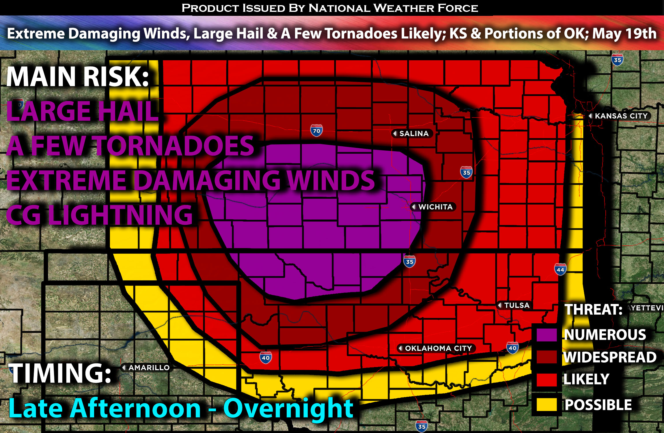
Severe storms are expected to form this late afternoon and continue into the evening hours mainly. These storms will be capable of producing all types of hazards. Eventually becoming a bow echo with potentially to be a derecho capable of violent damaging winds. For detailed information on timing, impacts, and more, refer below.
Overall Forecast:
A complex setup is anticipated over the Great Plains region, with a combination of ingredients leading to an extremely unstable airmass. A strengthening upper-level jet across the southern Rockies will help sharpen the dryline by late afternoon. Initial high-based thunderstorms are expected to form off the Raton Mesa behind the dryline, while other storms develop along the dryline near the Texas Panhandle/western Oklahoma border, and near the warm front in north-central Kansas.
Across KS & Into Portions of OK:
Upper 60s surface dewpoints will spread across much of central Oklahoma into central Kansas, beneath very steep mid-level lapse rates. This will develop a strongly unstable airmass with extreme instability, especially downward. The far southern dryline storms in northwest Oklahoma and those near the warm front in Kansas are expected to remain semi-discrete for a longer period, making them most capable of producing very large hail and a couple of tornadoes. Between these two areas, outflow-dominated clustering storms with embedded supercells will bow very intensely and move east-northeast during the evening hours. This also brings the expectation for intense rear-inflow jet development. Given the highly favorable thermodynamic environment and the impinging mid-level jet stream across the southern High Plains, there is potential for very powerful damaging winds.
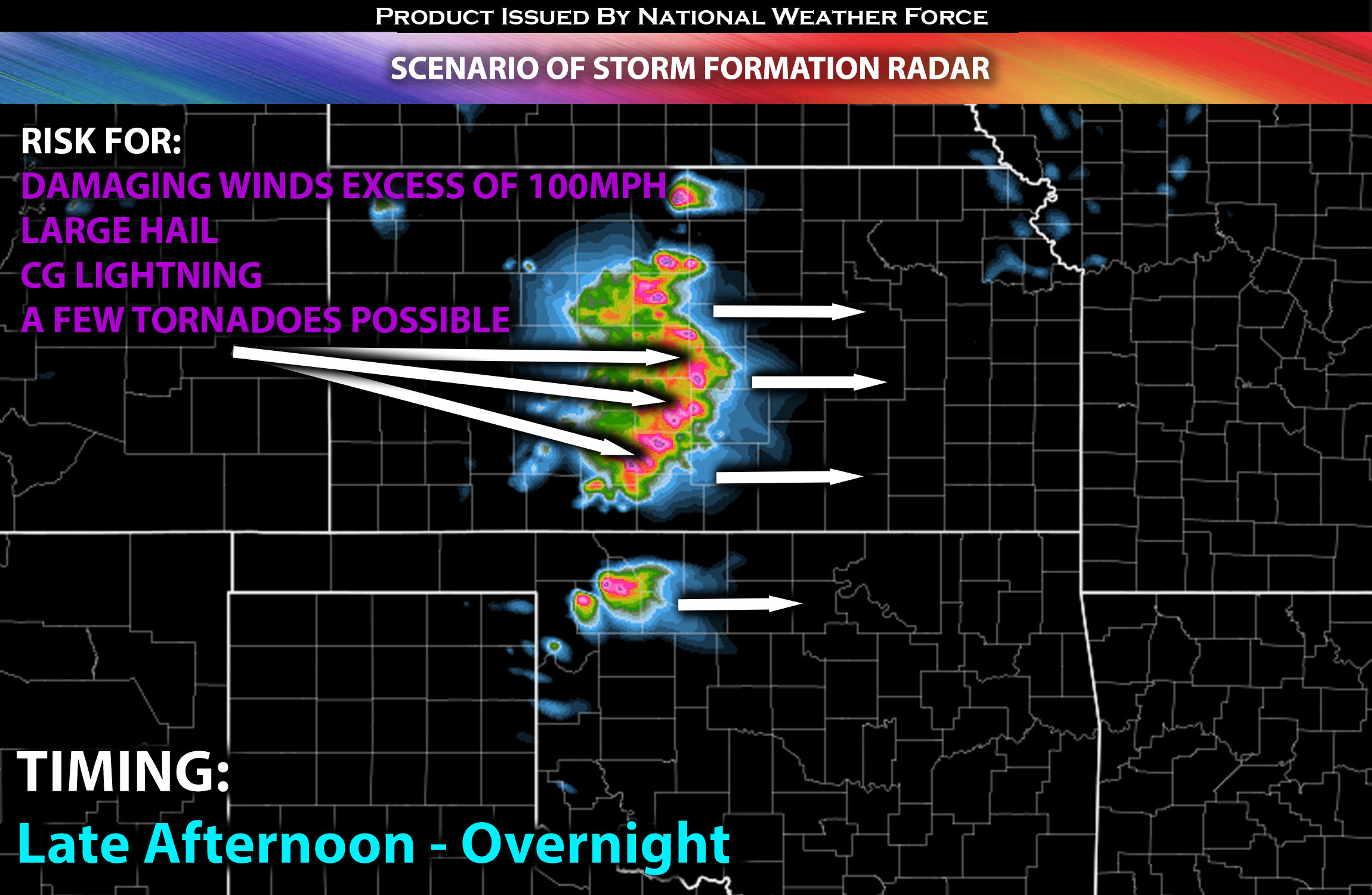
During the evening, the low-level jet across the southern to central Great Plains will strengthen, likely resulting in a large MCS with embedded bowing structures persisting into the night. These storms will be capable of producing extreme wind damage, potentially exceeding 100 mph. A derecho is therefore possible given the ingredients present.
Coverage Details:
Ongoing storms are anticipated before diminishing in the vicinity. Then, a more unstable airmass is expected across Kansas, especially south-central into northwest Oklahoma. As destabilization occurs around late afternoon and especially into the evening hours, storms are expected to develop and become severe very quickly, possibly in discrete mode. All hazard types will be possible before the storms transition into a bow echo MCS, with a very powerful QLCS expected, potentially producing violent winds. These storms will move eastward from the western portion of Kansas, stretching into parts of northern Oklahoma and central Kansas, eventually reaching eastern portions where they will dissipate quickly as they reach the border of Missouri overnight.
Future Radar Scenario:

Main Risk: large hail, extreme damaging winds in excess of 100mph, a few tornadoes (if ingredients align) and CG lightning (cloud to ground).
Stay tuned for more updates.
