
 Outlook:
An outbreak is more than likely to continue into IL and stretch north into WI on Tuesday late evening through the overnight hours. These storms will form a strong line (QLCS) moving eastward over time, capable of producing very strong damaging winds. For detailed information on timing, impacts, and more, refer below.
Overall Forecast:
At the mid-levels of the atmosphere, very strong, curved westerly winds with concentration will be over Upper Midwest and Upper Great Lakes on Tuesday.
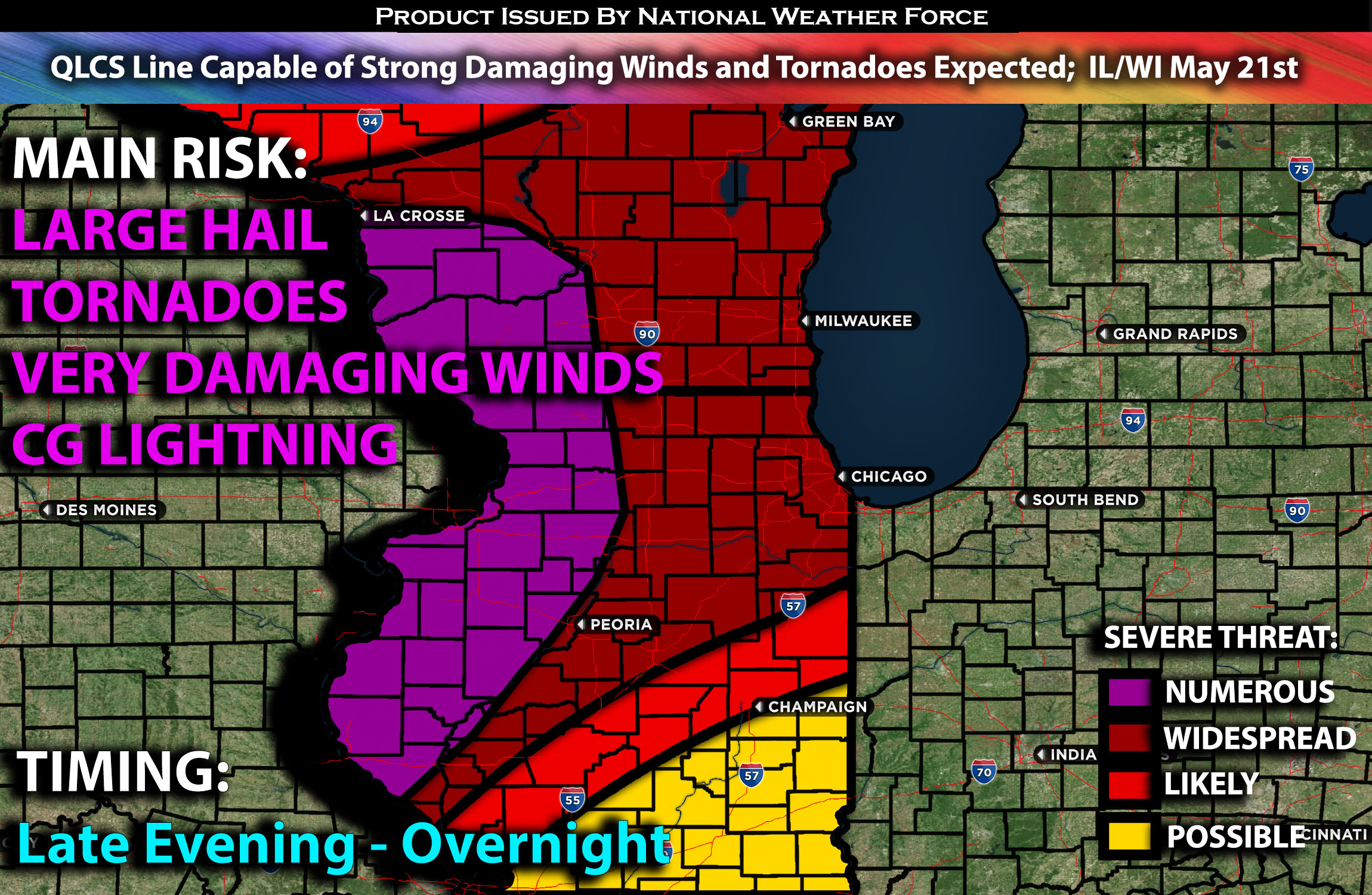
Portions of IL Stretching North Into WI:
Given the very unstable airmass likely across Illinois and portions of Wisconsin, with very strong deep-layer shear, extreme instability, and a concentrated low-level jet bringing low-level shear and peaking in the evening hours, storm mode will be more linear at this point, with more discrete activity expected further west. Nevertheless, an ongoing QLCS is expected to push through from Iowa and Missouri, capable of producing very damaging winds, large hail, and QLCS tornadoes.
Some of these storms will be capable of producing winds of 80-90 mph as a well-organized QLCS forms. The intensity should be most concentrated across parts of western Illinois and into stretching north into portions of Wisconsin overnight.
Coverage Details:
A powerful combination of discrete cells and QLCS is expected to move from IA and MO eastward into western IL, eventually reaching the rest of IL, while storms continue in WI through the late evening and overnight. The highest concentration of storm intensity is expected further west due to favorable ingredients. Nevertheless, these storms will be capable of producing very damaging winds and QLCS tornadoes.
Future Radar Scenario:
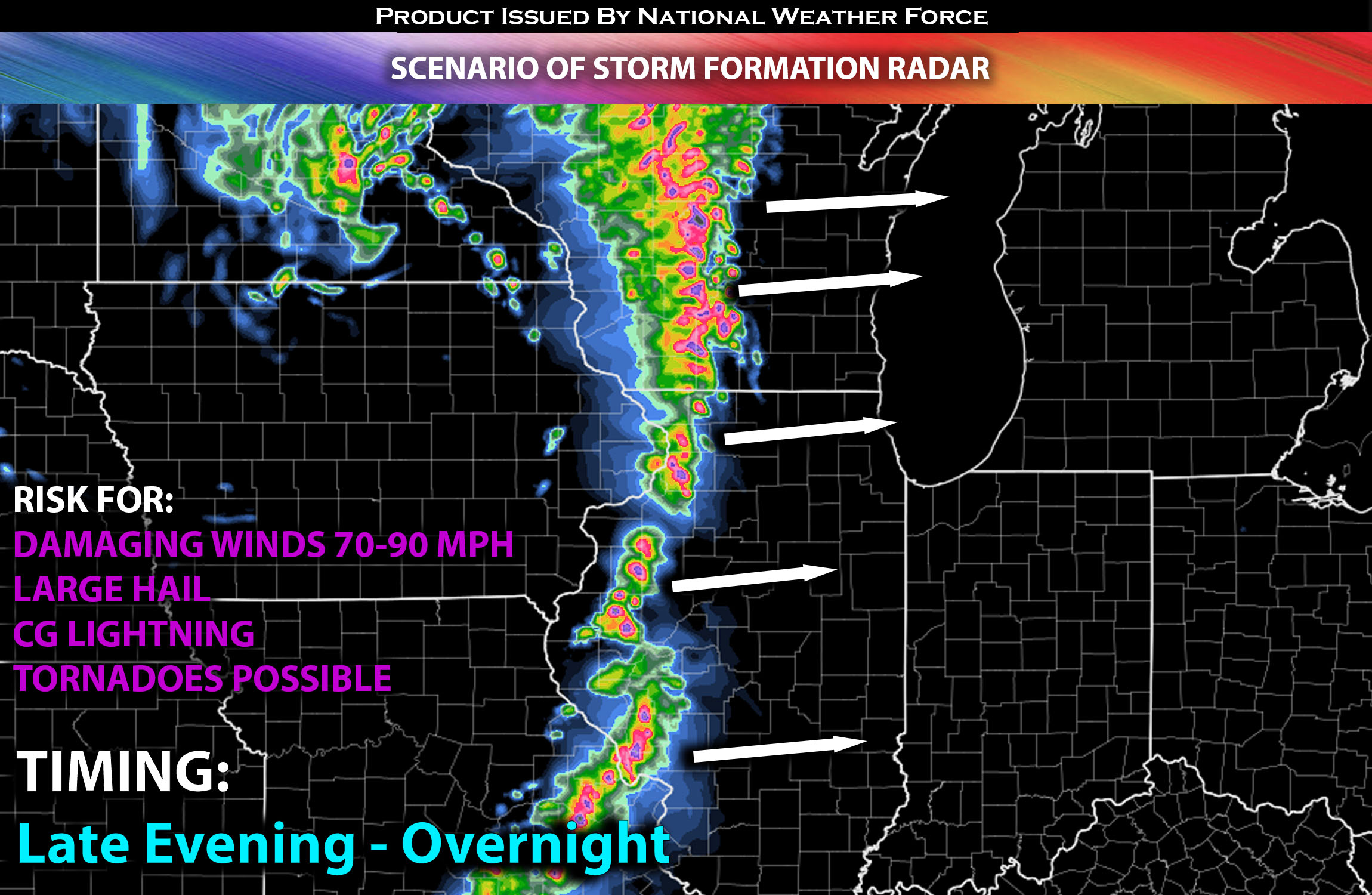 Main Risk: very large hail, damaging winds, tornadoes perhaps a few strong ones (if ingredients align) and CG lightning (cloud to ground).
Stay tuned for more updates.
Sina⚡⚡
With over a decade of experience in forecasting severe thunderstorms, this individual is a seasoned forecaster and developer. Their expertise in severe weather forecasting and computer science is entirely self-taught, complemented by a foundation in Atmospheric Science from UNCO and an IT background from WGU. They have dedicated their efforts to developing innovative tools that enhance the accuracy of analyzing large hail and tornadoes. As a significant contributor and partner at National Weather Force Innovations LLC, they have played a crucial role in providing accurate and timely information. Additionally, they have been instrumental in developing tools and organizing projects that focus on accuracy and performance, ensuring those affected are well-informed.