
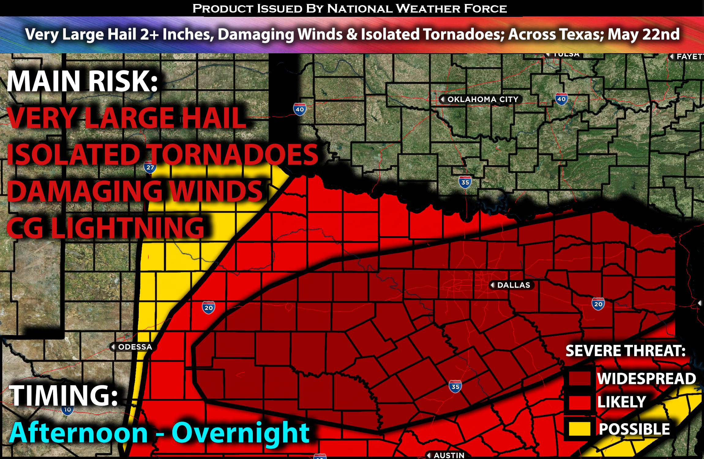
Outlook:
Severe storms are expected across much of Texas, particularly in the northern, western, central, and eastern regions, as they develop within an unstable airmass. These storms will be capable of producing all types of hazards, especially very large hail, from the afternoon through the overnight hours, eventually evolving into a Mesoscale Convective System (MCS). For detailed information on timing, impacts, and more, refer below.
Overall Forecast:
Across the Southern Great Plains, west to southwest mid-level flow will interact with a very moist and unstable airmass. Concurrently, a cold front will advance south-southeastward from Oklahoma into Texas by the afternoon. As surface temperatures rise and low-level convergence increases along and near the front, numerous storms are expected to develop and move east southeastward across Texas in the late afternoon and evening.
Across Texas:
Ahead of the cold front, strong to extreme instability combined with deep-layer effective shear will allow for severe storms capable of producing very large hail over 2 inches and damaging winds. The presence of low-level shear will support the potential for bowing storms (line of storms) to produce isolated tornadoes. These storms are expected to eventually merge into a line, with a Mesoscale Convective System (MCS) anticipated to continue moving east southeastward.
Coverage Details:
Storms are expected to form across northern Texas, extending down into central Texas, as destabilization occurs in the afternoon. Initially, these storms will be mostly discrete, capable of producing all types of hazards before transitioning into clusters in the evening. The storms will continue to move southeastward, eventually reaching eastern Texas and portions of southeast Texas, continuing overnight. The main risks at this point will be damaging winds and very large hail with any remaining discrete cells.
Future Radar Scenario:
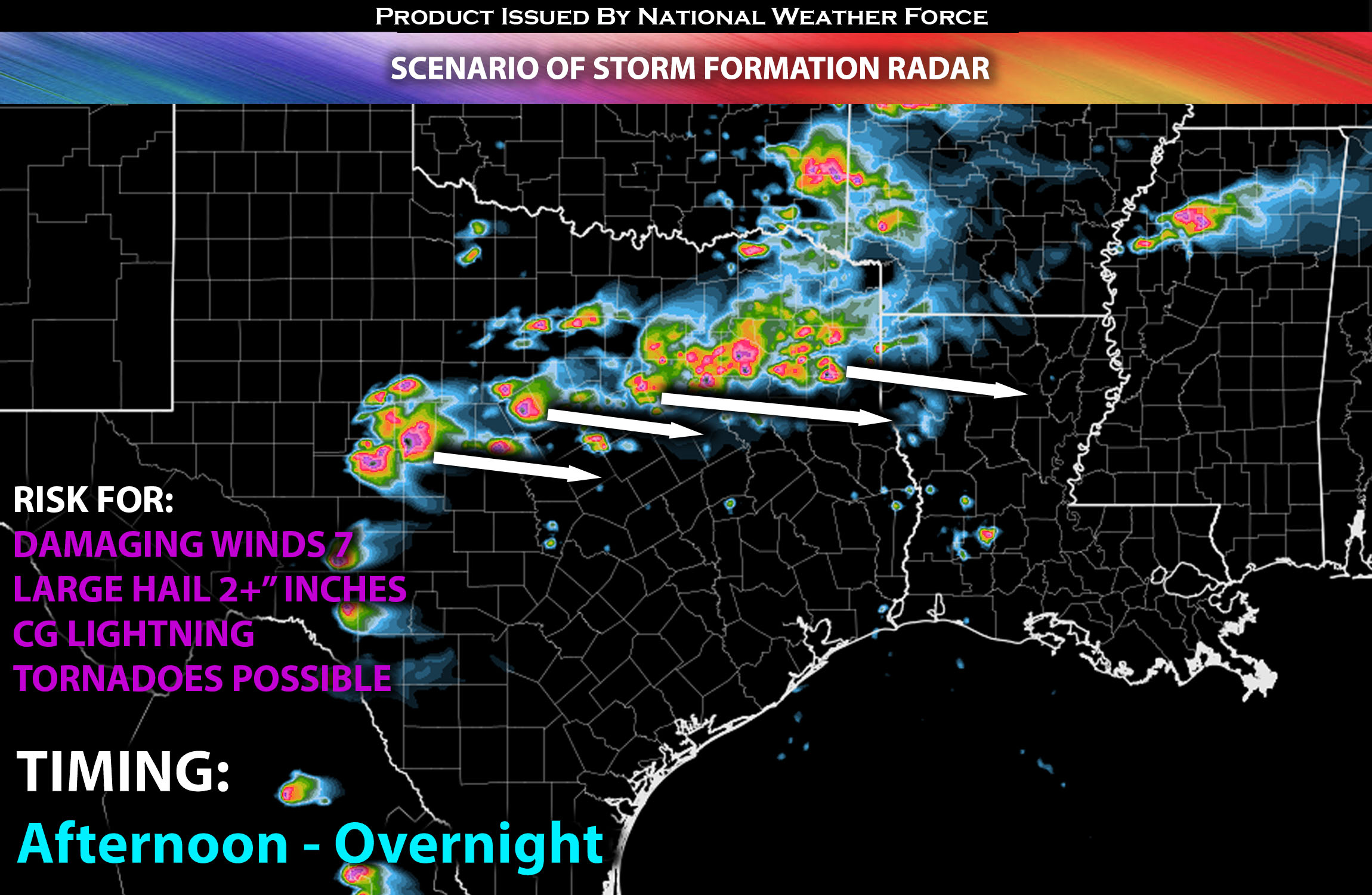
Main Risk: very large hail, damaging winds, isolated tornadoes (if ingredients align) and CG lightning (cloud to ground).
Stay tuned for more updates.
Sina⚡⚡
With over a decade of experience in forecasting severe thunderstorms, this individual is a seasoned forecaster and developer. Their expertise in severe weather forecasting and computer science is entirely self-taught, complemented by a foundation in Atmospheric Science from UNCO and an IT background from WGU. They have dedicated their efforts to developing innovative tools that enhance the accuracy of analyzing large hail and tornadoes. As a significant contributor and partner at National Weather Force Innovations LLC, they have played a crucial role in providing accurate and timely information. Additionally, they have been instrumental in developing tools and organizing projects that focus on accuracy and performance, ensuring those affected are well-informed.