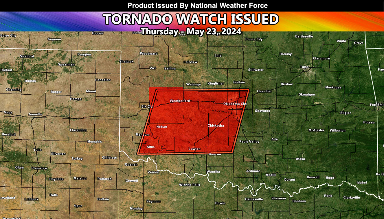
National Weather Force has issued a Tornado Watch, effective today, May 23, 2024, from this evening until midnight, a six to eight hour forecast window for the following areas:
Zones affected: Southwest, Western, and Central Oklahoma.
Discussion: An outflow boundary from severe thunderstorms in Northern Texas this morning will surge northward into Southwest Oklahoma later this afternoon. This will be a mesoscale focus spot for thunderstorm development as an impulse out of the west moves overhead.
Strong instability and low-level shear will be present, along with the surface dynamics along the outflow boundary. This will bring a large hail, damaging wind, and tornado threat with supercells that form there.
Given the unidirectional stance of the upper jet stream, these supercells would be isolated to scattered and not form a linear line, so tornado potential is there with them. Storms will form in the Western and Central part of the watch zone first, then move eastward toward the Oklahoma City forecast zones tonight.
– Raiden Storm –
https://www.nationalweatherforce.com
Master General Meteorologist – is the owner and CEO of National Weather Force and is the only one authorized to issue weather watches such as thunderstorm, tornado, hurricane, and severe. A consulting meteorologist with over 26 years’ experience for over 50 companies, including energy, agriculture, aviation, marine, leisure, and many more areas. He has certs from Mississippi State for broadcast met and Penn State forecasting certs MET 101, 241, 341 and 361 as a meteorologist, but before then was completely self-taught, barely learning a thing from the schools that he did not already know.

