
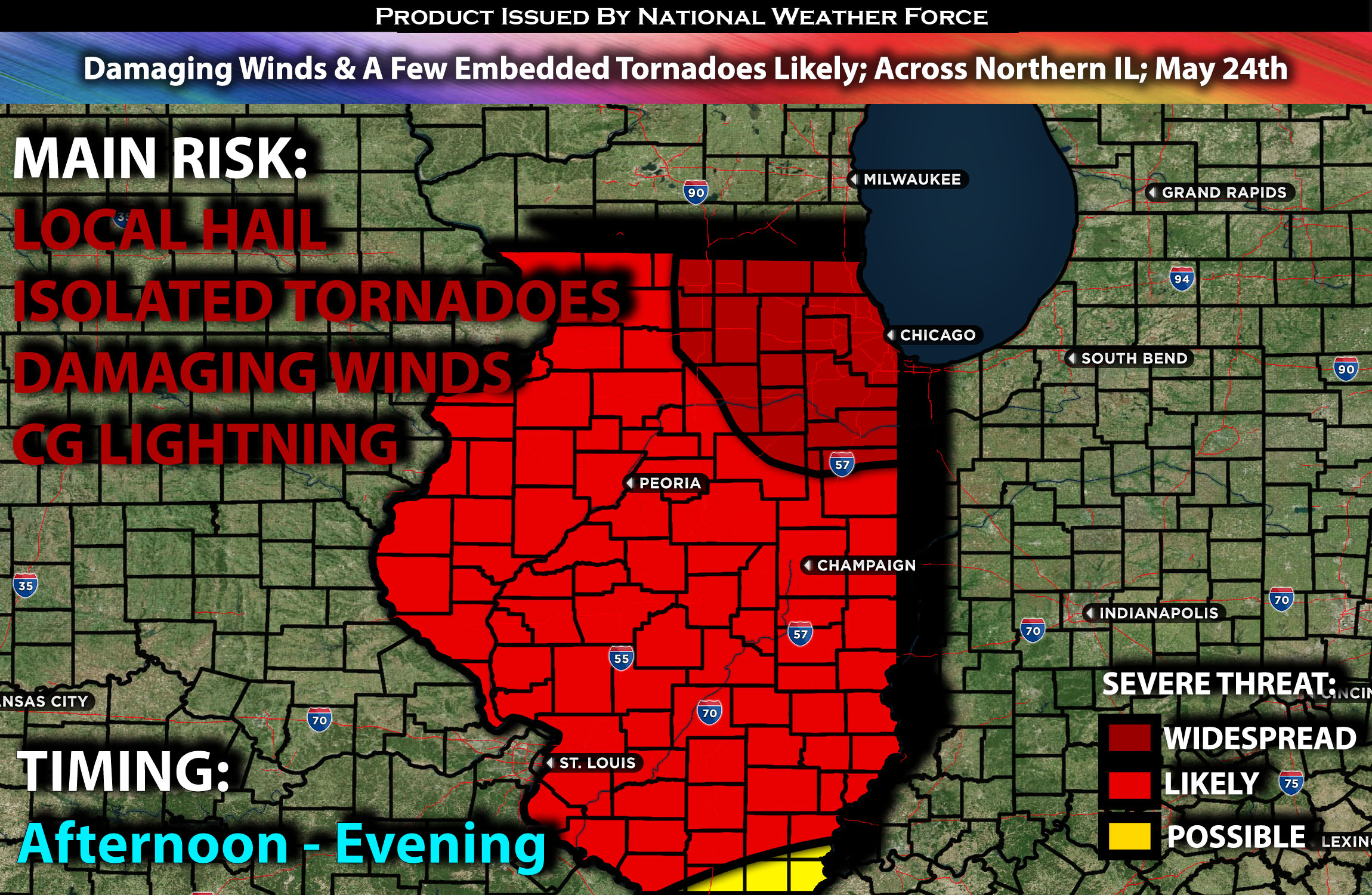
Outlook:
Severe storms are expected to sweep across Illinois on Friday, reaching the Chicago area by the evening. These storms are anticipated to bring damaging winds and potentially embedded tornadoes. For detailed information on timing, impacts, and more, refer below.
Overall Forecast:
The surface cyclone over North Dakota will become vertically stacked beneath its associated mid-level low. Daytime mid-level height falls, combined with stronger low-level shear, will be most pronounced over the upper Mississippi region into the Midwest.
Across Illinois:
Meanwhile, an ongoing MCS is expected to continue moving eastward across Iowa, weakening somewhat before encountering another area of very unstable airmass over Illinois. The concentration of low-level shear in this region, along with strong instability and deep-layer shear, will increase the likelihood of the MCS strengthening. This could result in a bowing storm pushing through northern Illinois and eventually reaching Chicago by the evening.
Some of these bowing storms will be capable of producing damaging winds in excess of 60-70 mph, especially when the MCS is at its most intense.
Coverage Details:
An ongoing MCS is expected to continue moving eastward from Iowa into Illinois. As it does, it will lose some strength in the morning hours before re-strengthening in the afternoon and evening as it sweeps across northern Illinois. These storms will be capable of producing mainly damaging winds and a few embedded tornadoes.
Future Radar Scenario:
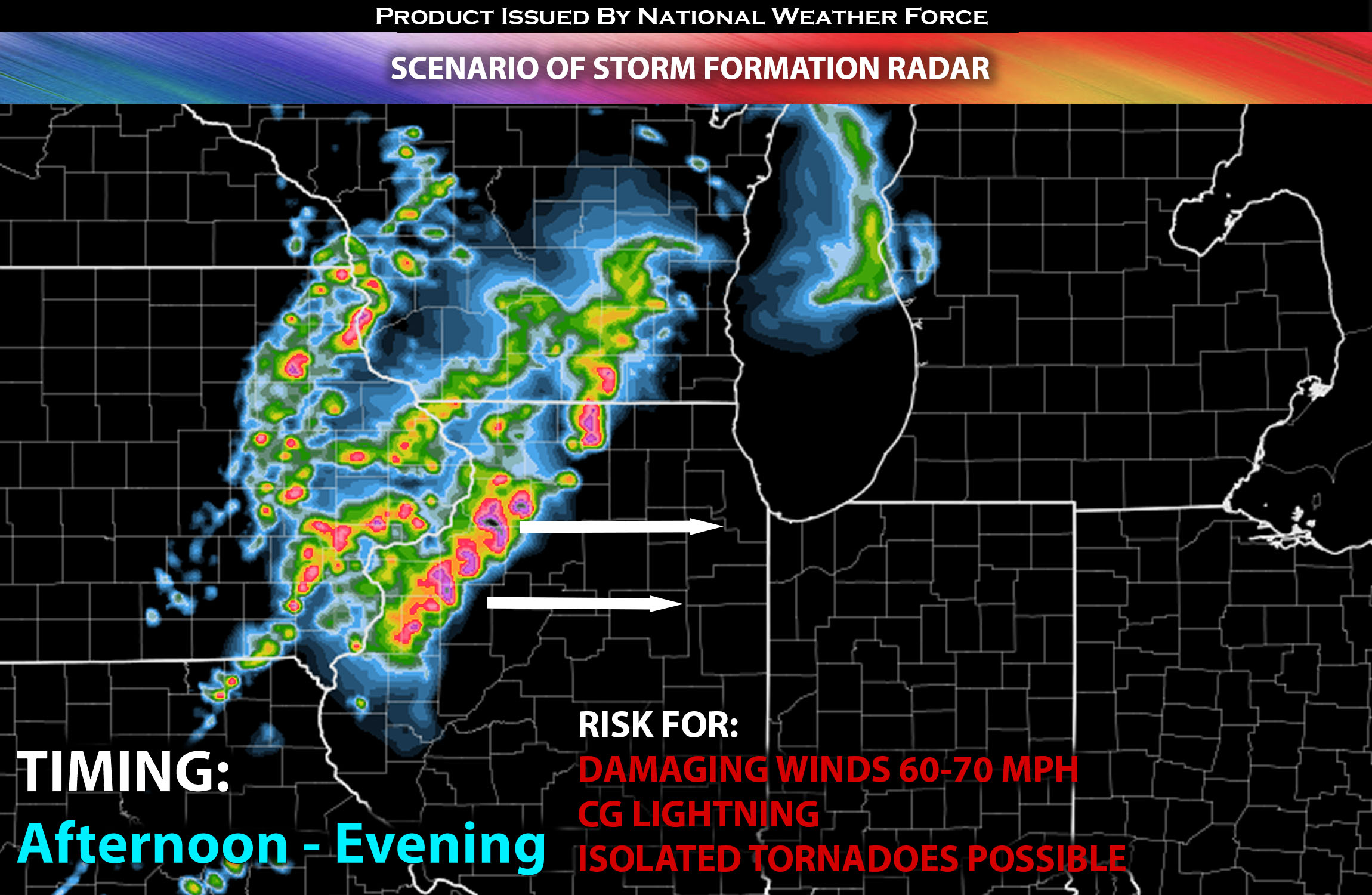
Main Risk: very large hail, damaging winds in excess of 80mph, isolated tornadoes (if ingredients align) and CG lightning (cloud to ground).
Stay tuned for more updates.
Sina⚡⚡
With over a decade of experience in forecasting severe thunderstorms, this individual is a seasoned forecaster and developer. Their expertise in severe weather forecasting and computer science is entirely self-taught, complemented by a foundation in Atmospheric Science from UNCO and an IT background from WGU. They have dedicated their efforts to developing innovative tools that enhance the accuracy of analyzing large hail and tornadoes. As a significant contributor and partner at National Weather Force Innovations LLC, they have played a crucial role in providing accurate and timely information. Additionally, they have been instrumental in developing tools and organizing projects that focus on accuracy and performance, ensuring those affected are well-informed.