
Outlook:
Severe storms are expected to be widespread in multiple rounds across Texas on Tuesday, with damaging winds being the main threat. These storms will also carry the risk of very large hail. For detailed information on timing, impacts, and more, refer below.
Overall Forecast:
Very warm moisture with strong instability will be present across most of Texas on Tuesday morning and throughout the day. An initial cluster or Mesoscale Convective System (MCS) may develop from this activity, reinforcing the boundary and moving into northern Texas and stretching across the state.
Across Texas:
South of this boundary, a very moist and unstable air mass will exist with steep midlevel lapse rates (change in temperature with height). Heating and destabilization will lead to storm development along a dryline over western Texas, with a few large supercells expected to produce damaging, very large hail. As these cells progress east/southeast and the main front shifts south, a focused corridor of damaging wind potential will develop into central Texas.
Given the extreme instability, especially downward, favorable lapse rates aloft, and sufficient westerly flow, several wind gusts over 70-80 mph are anticipated across the area with an expected MCS.
Coverage Details:
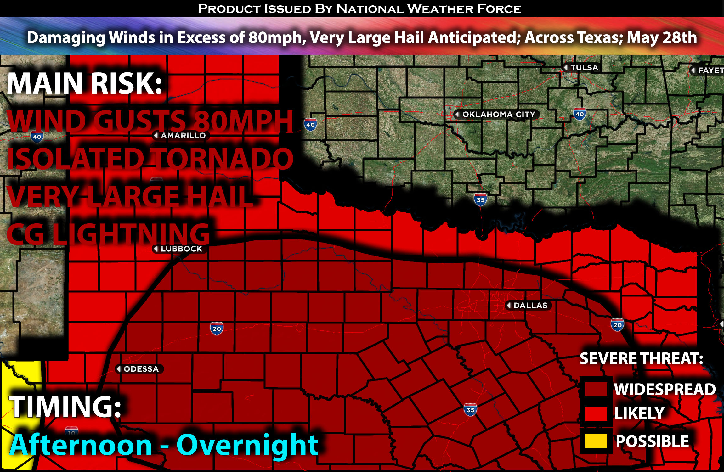
Storms are expected to form along the northern Oklahoma/Texas border initially, with these storms primarily producing large hail in the afternoon. Additional storms will fire up across west Texas, stretching both north and south, eventually organizing into a Mesoscale Convective System (MCS) and moving eastward through the late afternoon, evening, and overnight hours. This line of storms will be capable of producing very damaging winds and large hail.
Future Radar Scenario:
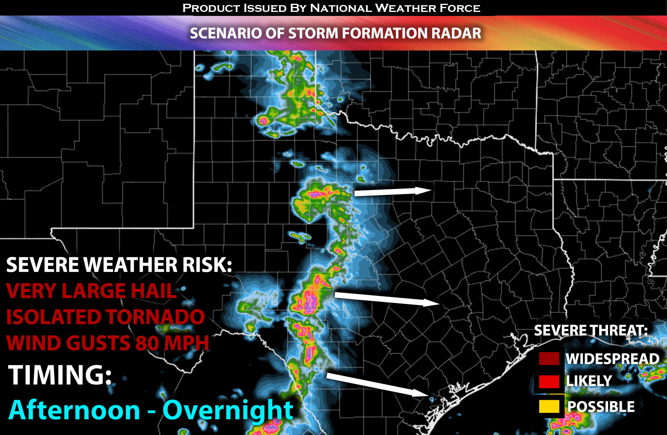 Main Risk: very large hail, very low risk for an isolated tornado, damaging winds in excess of 80mph and CG lightning (cloud to ground).
Stay tuned for more updates.
Sina⚡⚡
With over a decade of experience in forecasting severe thunderstorms, this individual is a seasoned forecaster and developer. Their expertise in severe weather forecasting and computer science is entirely self-taught, complemented by a foundation in Atmospheric Science from UNCO and an IT background from WGU. They have dedicated their efforts to developing innovative tools that enhance the accuracy of analyzing large hail and tornadoes. As a significant contributor and partner at National Weather Force Innovations LLC, they have played a crucial role in providing accurate and timely information. Additionally, they have been instrumental in developing tools and organizing projects that focus on accuracy and performance, ensuring those affected are well-informed.