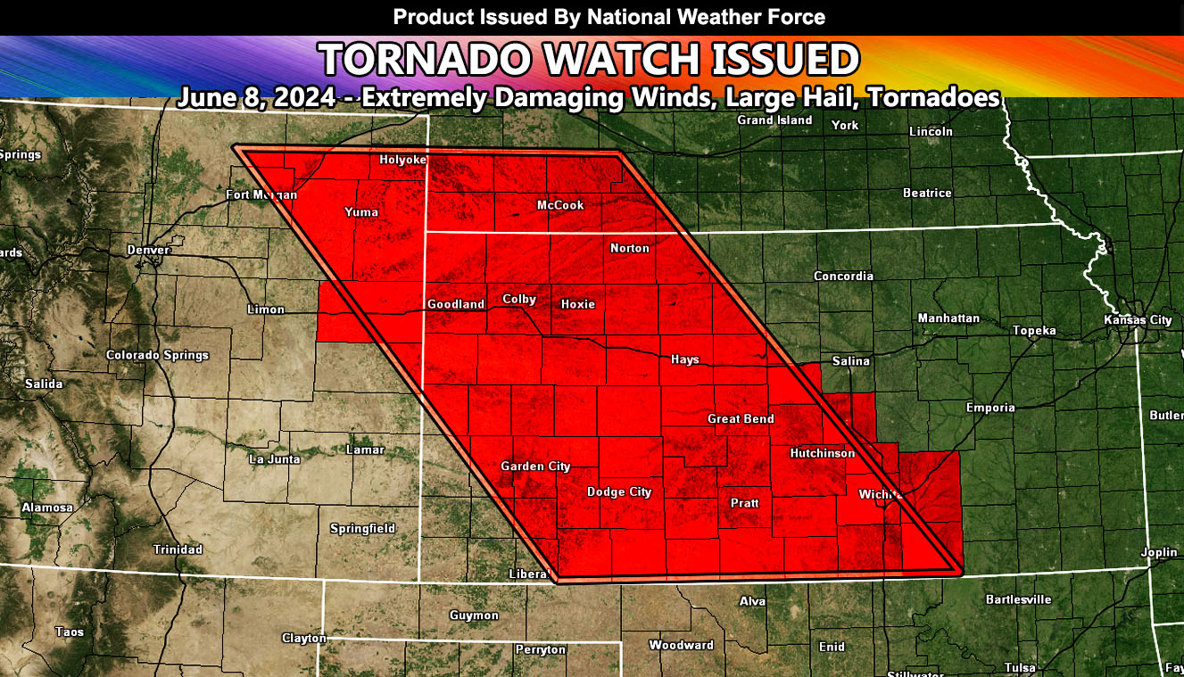
National Weather Force has issued a Tornado Watch, effective this evening until 3am Sunday morning.
Zones Affected: Northeast and Extreme Eastern Colorado – Western half of Kansas, including Dodge City, Central and Southern Kansas, including the Wichita Forecast zones.
A system out of the west will dig into the Rocky Mountains this afternoon. Strong lifting within the upper levels coupled with strong instability will bring rapid severe thunderstorms development around the 5pm local hour across Northeastern Colorado. This development will round the ridge and dive east-southeast through Western Kansas around 9pm local and reaching Wichita’s forecast zone around midnight.
The watch box extends to the Oklahoma and Kansas border just in-case, however I am expecting less activity chances for that border zone, with the most being the Western Kansas section of the watch box.
All modes of severe weather will be expected, including extremely strong winds with the diving bow echo segment, large hail, and tornadoes.
– Raiden Storm –
https://www.nationalweatherforce.com
Master General Meteorologist – is the owner and CEO of National Weather Force and is the only one authorized to issue weather watches such as thunderstorm, tornado, hurricane, and severe. A consulting meteorologist with over 26 years’ experience for over 50 companies, including energy, agriculture, aviation, marine, leisure, and many more areas. He has certs from Mississippi State for broadcast met and Penn State forecasting certs MET 101, 241, 341 and 361 as a meteorologist, but before then was completely self-taught, barely learning a thing from the schools that he did not already know.

