
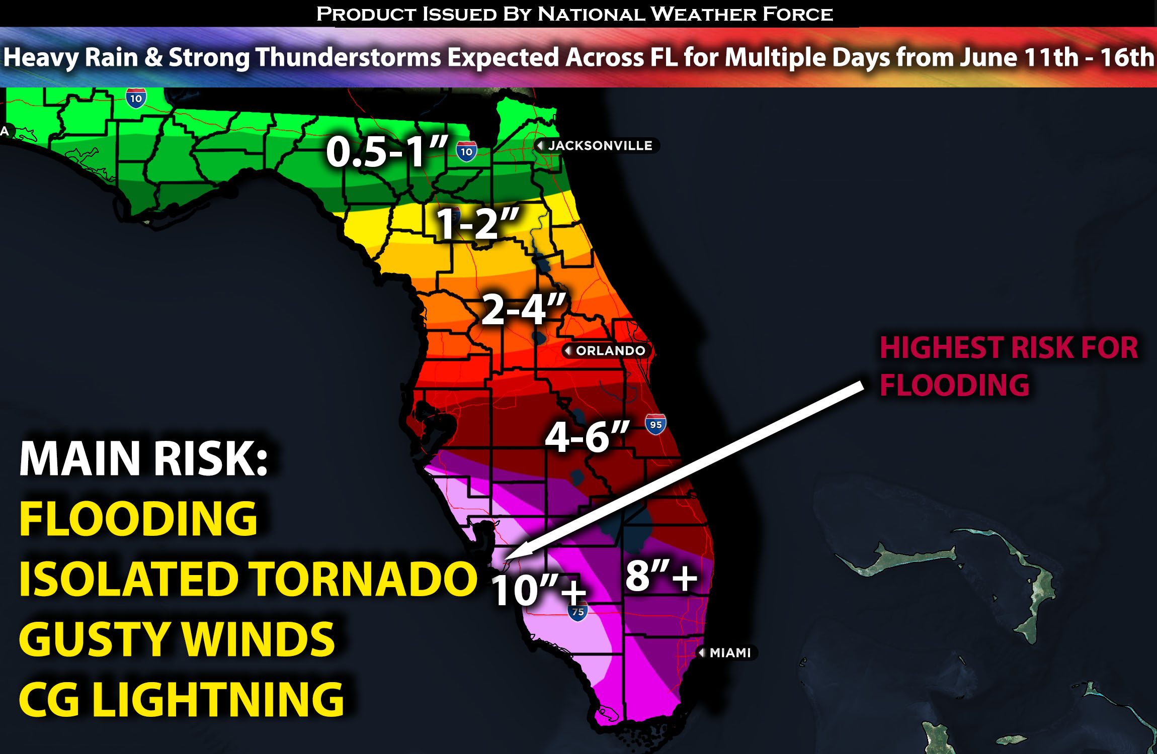
Across Florida:
A powerful complex of systems is expected to bring significant moisture to Florida, especially the southern portions, raising concerns about flooding. Very heavy rain is anticipated over multiple days, with storms repeatedly forming over the same areas, leading to flooding. Refer to the detailed forecast for further specifics.
Overall Forecast:
Heavy rain and thunderstorms continue across Florida, especially in the southern regions, and are expected to persist through at least the end of this week. A stalled frontal boundary to the north, across northern Florida, is providing lift and enhancing moisture influx. In the mid/upper levels, a short-wave over the Deep South stretches into the northern Gulf, while high pressure over the central Atlantic pushes significant moisture into Florida, particularly the southern part, where precipitable water (PW) values are at record levels. This will result in significant heavy rainfall. In the coming days, a subtropical jet stream will also remain over Florida above a positively tilted significant shortwave trough, further feeding deep moisture into the area and allowing for more significant heavy rainfall.
There is also a small risk for severe weather, with discrete cells potentially producing brief isolated tornadoes due to some storms showing rotation. From Wednesday evening through the rest of the week, an additional 4-6 inches of rain, with locally higher amounts in southern Florida, is expected, while other areas may receive between 2-4 inches.
Timing & Impact:
Heavy rain is ongoing and will continue through Wednesday, with embedded thunderstorms, some of which could be slightly severe, with the main risks being isolated tornadoes and waterspouts due to rotating storms. There will also be periods where the rain stops, providing time to clean up and go out before the next round arrives. However, given that cells and storms will produce significant rainfall rates, flooding will be a major concern. Another heavier round of storms is expected with the next surge of moisture around Wednesday late afternoon, continuing through Thursday morning, with more embedded thunderstorms. This pattern will persist through at least Sunday, with multiple rounds of thunderstorms, some potentially strong and locally severe. For rainfall totals please check below.
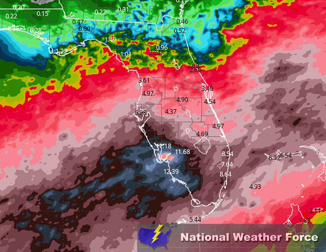
Approximate Rainfall Totals (in inches):
Main impact: heavy rain, CG lightning (cloud to ground), small hail, local gusty winds, brief tornado and waterspouts.
Stay tuned for more updates.
Sina⚡⚡
With over a decade of experience in forecasting severe thunderstorms, this individual is a seasoned forecaster and developer. Their expertise in severe weather forecasting and computer science is entirely self-taught, complemented by a foundation in Atmospheric Science from UNCO and an IT background from WGU. They have dedicated their efforts to developing innovative tools that enhance the accuracy of analyzing large hail and tornadoes. As a significant contributor and partner at National Weather Force Innovations LLC, they have played a crucial role in providing accurate and timely information. Additionally, they have been instrumental in developing tools and organizing projects that focus on accuracy and performance, ensuring those affected are well-informed.