
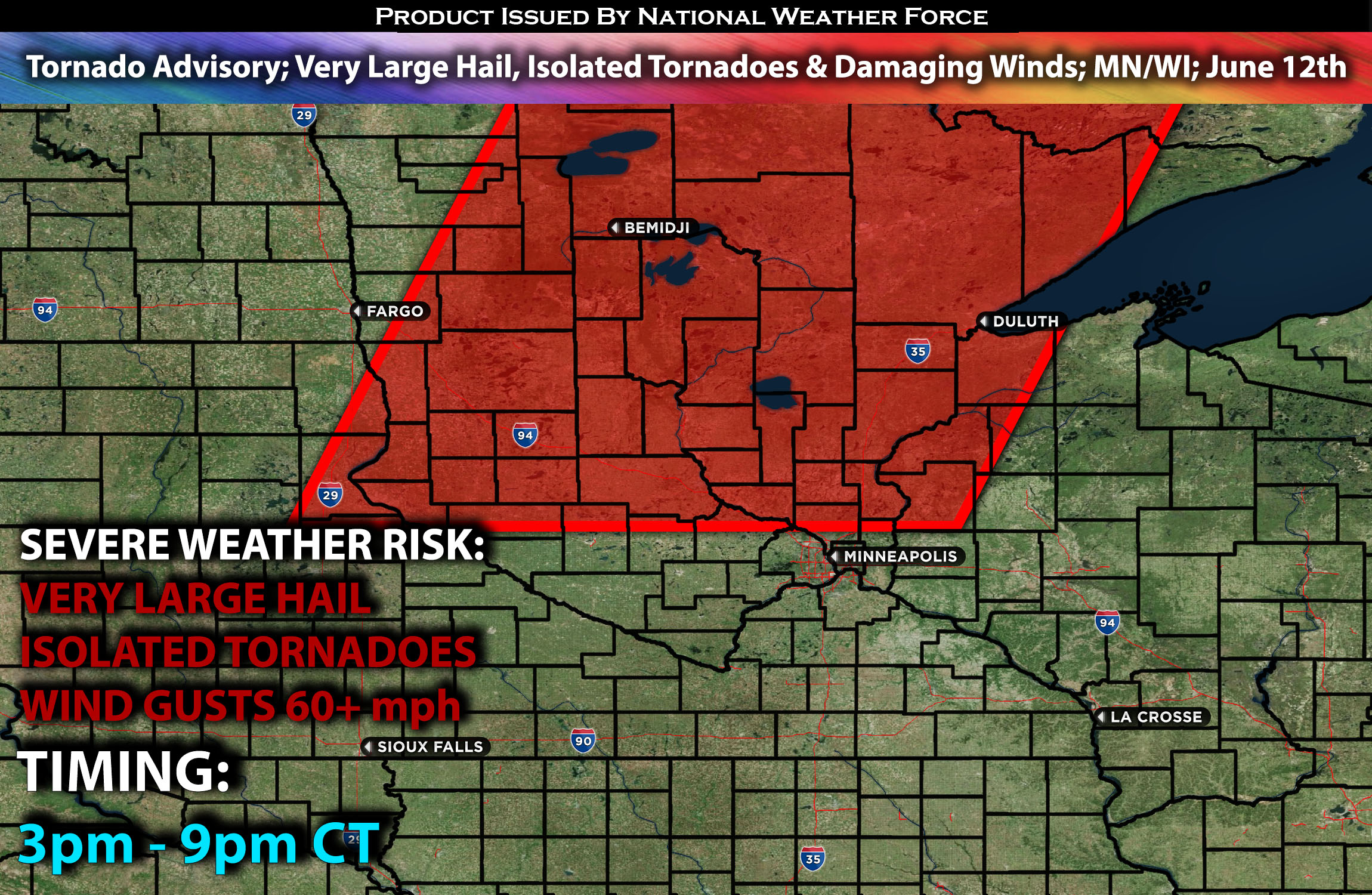
The National Weather Force has issued a Tornado Advisory effective from 3 PM to 9 PM Central Time
Zones affected: central, north, northeast, east portions of MN; portions of west & northwest WI.
Discussion: This late afternoon, daytime heating ahead of an advancing cold front, associated with a shortwave trough embedded in fast westerly flow aloft and moving eastward, will lead to moderate to extreme instability across the warm sector ahead of the front. Near the warm front, there will also be plenty of effective shear and some low-level shear, which could allow storms to hold a discrete mode and potentially produce a few tornadoes.
The main risk will continue to be very large hail and damaging winds. The highest concentration of tornado risk will be in northern portions of MN, where the warm front is anticipated to be.
For further details on the forecast behind it please check our outlook on the severe weather.
Future Radar Scenario:
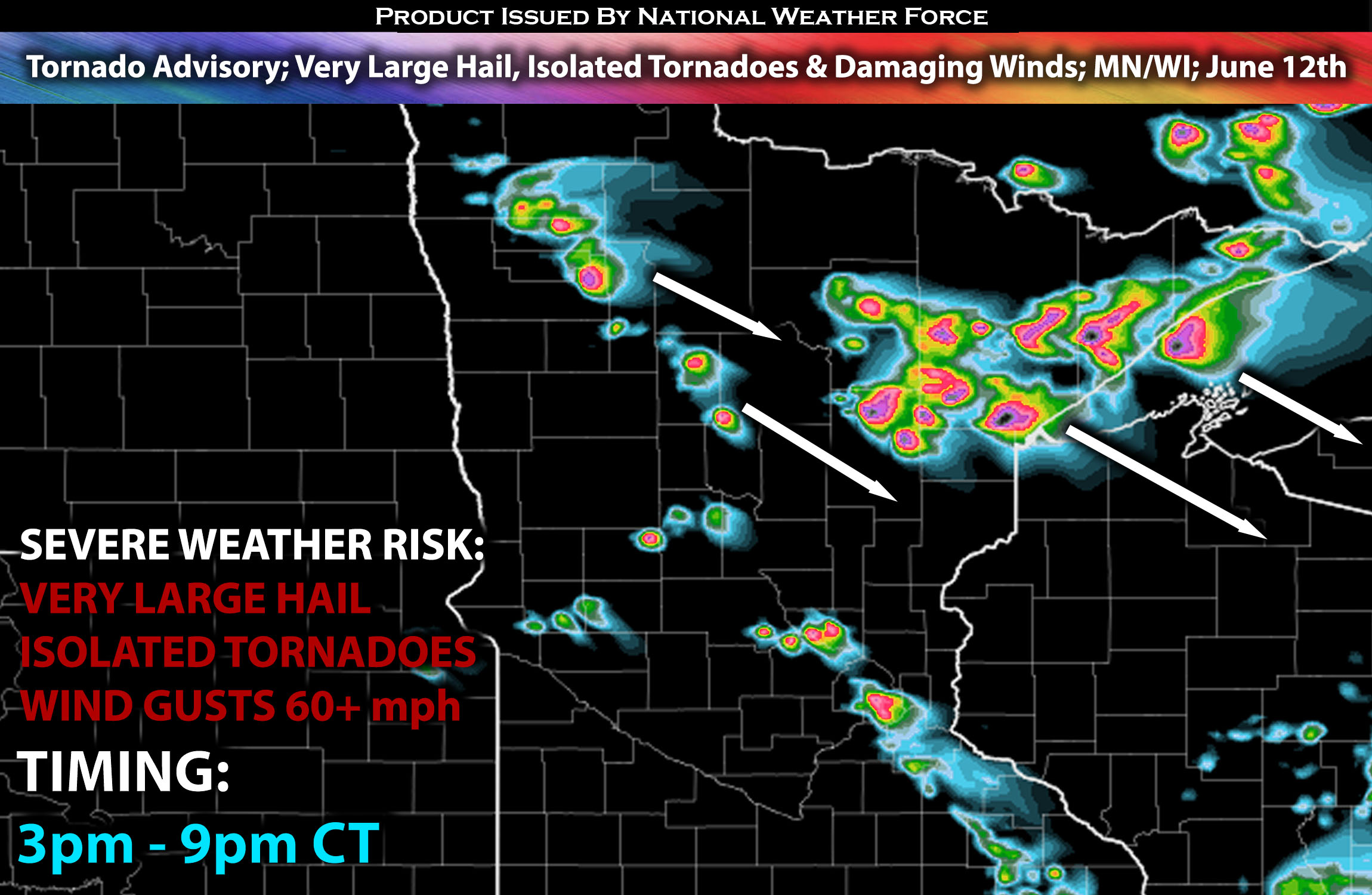 Main risk: very large hail, damaging winds, isolated tornadoes and CG (cloud to ground) lightning.
Stay tuned for more updates.
Sina⚡⚡
With over a decade of experience in forecasting severe thunderstorms, this individual is a seasoned forecaster and developer. Their expertise in severe weather forecasting and computer science is entirely self-taught, complemented by a foundation in Atmospheric Science from UNCO and an IT background from WGU. They have dedicated their efforts to developing innovative tools that enhance the accuracy of analyzing large hail and tornadoes. As a significant contributor and partner at National Weather Force Innovations LLC, they have played a crucial role in providing accurate and timely information. Additionally, they have been instrumental in developing tools and organizing projects that focus on accuracy and performance, ensuring those affected are well-informed.