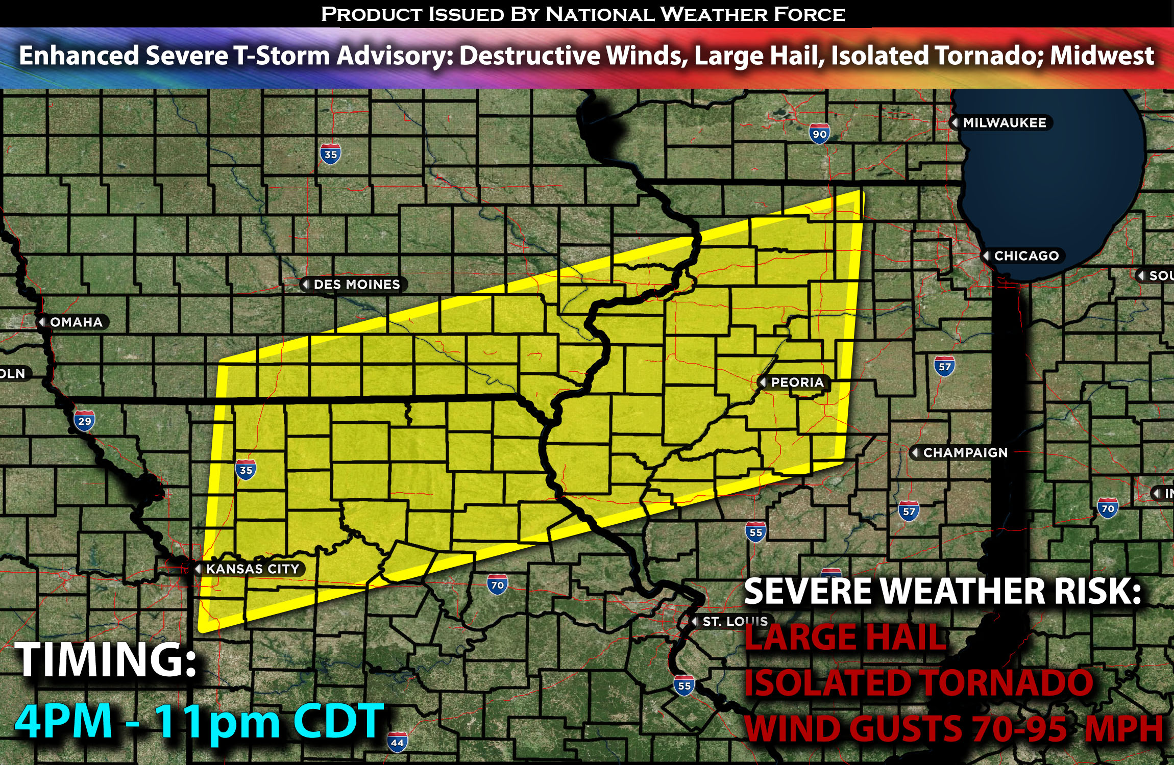
The National Weather Force has issued an Enhanced Severe T-Storm Advisory effective from 4 PM to 11 PM Central Time
Zones affected: southeast, south IA; northeast, north MO; east, northwest, and portions of central IL.
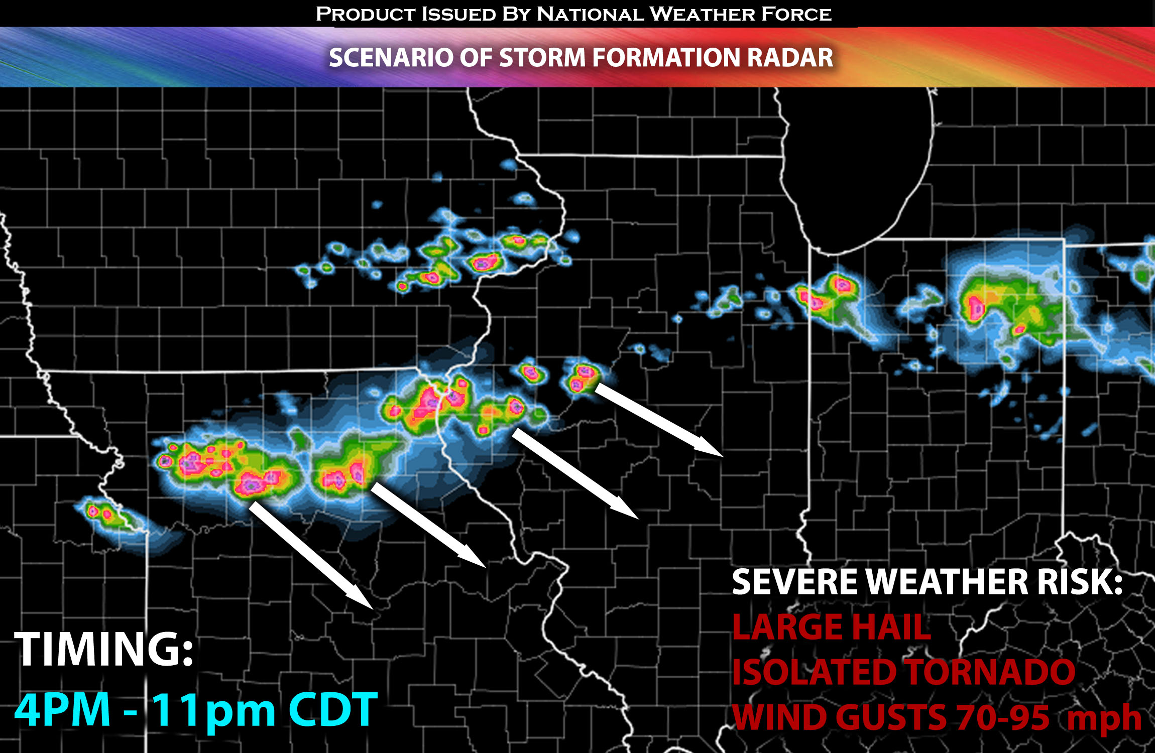
Discussion: Severe storms are expected to form later this afternoon as destabilization occurs, quickly becoming a line with a few discrete cells across the impacted regions. These storms will be very significant, capable of producing very damaging winds of 75-90 mph and very large hail. Given the low-level shear with changing direction with height, if any storms hold a discrete mode, these cells will also be capable of producing a few tornadoes. However, the wind risk will be much greater compared to the tornado risk, as storms will clash and collide together, moving south southeastward.
These storms will continue to move southeastward, eventually dissipating overnight.
For further details on the forecast behind it please check our outlook on the severe weather.
Future Radar Scenario:

Main risk: very large hail, destructive gusty winds, isolated tornadoes and CG (cloud to ground) lightning.
Stay tuned for more updates.
Sina⚡⚡
With over a decade of experience in forecasting severe thunderstorms, this individual is a seasoned forecaster and developer. Their expertise in severe weather forecasting and computer science is entirely self-taught, complemented by a foundation in Atmospheric Science from UNCO and an IT background from WGU. They have dedicated their efforts to developing innovative tools that enhance the accuracy of analyzing large hail and tornadoes. As a significant contributor and partner at National Weather Force Innovations LLC, they have played a crucial role in providing accurate and timely information. Additionally, they have been instrumental in developing tools and organizing projects that focus on accuracy and performance, ensuring those affected are well-informed.
