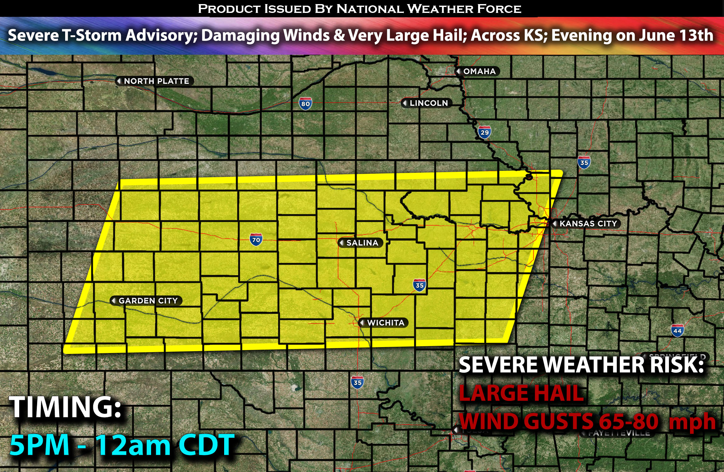
 The National Weather Force has issued an Severe T-Storm Advisory effective from 5 PM to 12 AM Central Time
Zones affected: southern, central, north, northeastern and eastern KS.
Discussion: Destabilization is expected to occur as the cap breaks across central Kansas this late afternoon and into the evening hours along a surface front. A boundary layer of moisture pooling along this front, combined with diurnal heating leading to temperatures in the triple digits, is anticipated to bring extreme instability values with very steep mid-level lapse rates (change in temperature with height). These storms will be capable of producing very large hail and damaging winds in excess of 80 mph in some cells.
The highest concentration of storms is expected to be across central Kansas and into eastern Kansas.
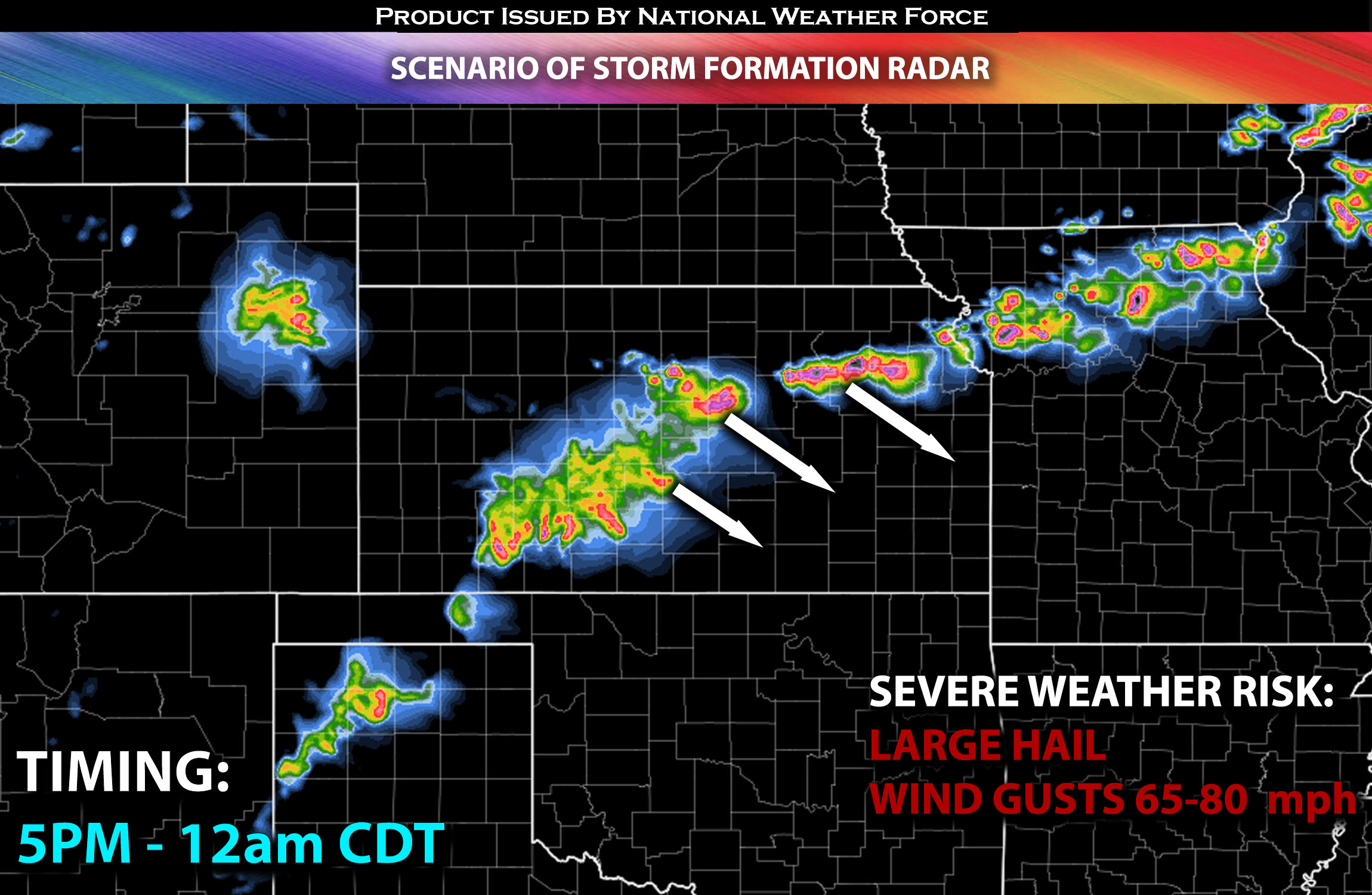
These storms will continue to move southeastward, eventually dissipating overnight.
For further details on the forecast behind it please check our outlook on the severe weather.
Future Radar Scenario:

Main risk: very large hail, destructive gusty winds and CG (cloud to ground) lightning.
Stay tuned for more updates.
Sina⚡⚡
With over a decade of experience in forecasting severe thunderstorms, this individual is a seasoned forecaster and developer. Their expertise in severe weather forecasting and computer science is entirely self-taught, complemented by a foundation in Atmospheric Science from UNCO and an IT background from WGU. They have dedicated their efforts to developing innovative tools that enhance the accuracy of analyzing large hail and tornadoes. As a significant contributor and partner at National Weather Force Innovations LLC, they have played a crucial role in providing accurate and timely information. Additionally, they have been instrumental in developing tools and organizing projects that focus on accuracy and performance, ensuring those affected are well-informed.
