 Across the Ohio Valley:
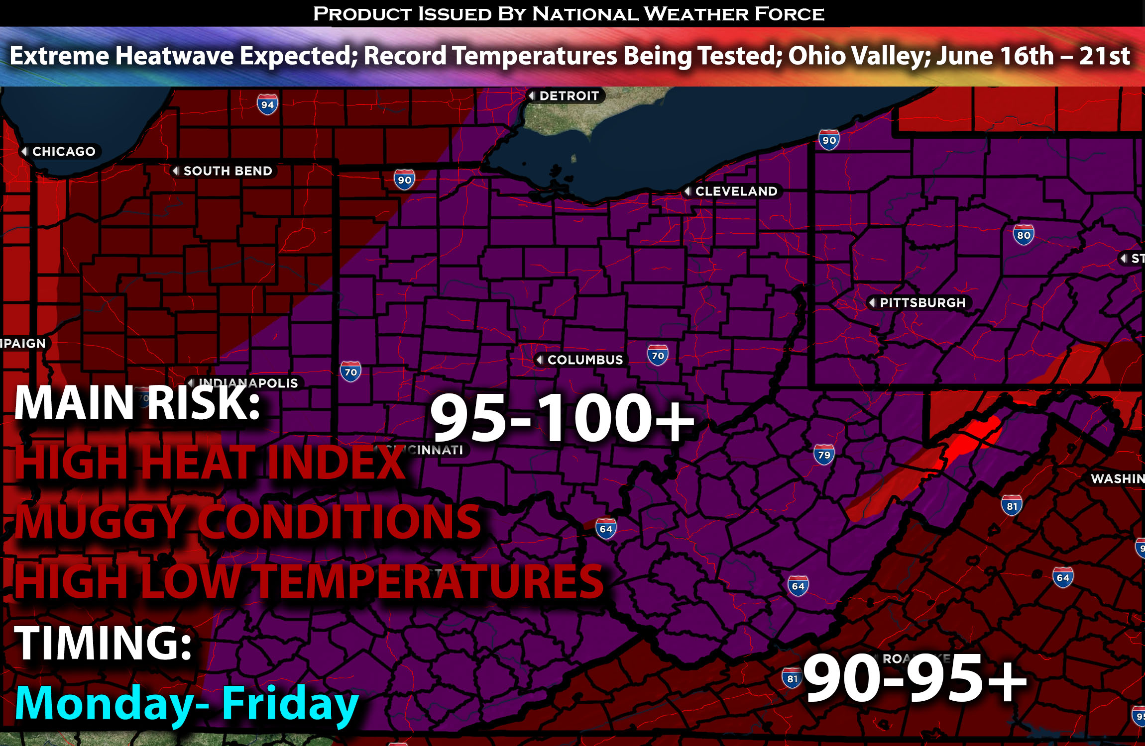
A high-pressure setup is expected to bring an extreme heatwave across the Ohio Valley throughout the work week combined with humid muggy conditions. Refer to the detailed forecast for further specifics below.
Overall Forecast:
An extreme heat wave is expected as a surface high-pressure system builds across most of the eastern U.S. What will make it feel even worse is the combination of hot and humid air masses for most of next week. High temperatures are anticipated to be near or even break records during this heat wave. Temperatures are expected to reach near 100 with locally higher, while heat indexes peaking those numbers across the Ohio Valley. This heatwave is expected to persist from Monday to Wednesday at least and continue through the end of the workweek. Meanwhile, warm overnight temperatures will provide no relief, remaining in the mid-70s and creating a dangerous scenario, especially for those without adequate cooling solutions.
Main impact: excessive heat, high heat index, muggy conditions and low temperature recovery.
Stay tuned for more updates.
Sina⚡⚡
With over a decade of experience in forecasting severe thunderstorms, this individual is a seasoned forecaster and developer. Their expertise in severe weather forecasting and computer science is entirely self-taught, complemented by a foundation in Atmospheric Science from UNCO and an IT background from WGU. They have dedicated their efforts to developing innovative tools that enhance the accuracy of analyzing large hail and tornadoes. As a significant contributor and partner at National Weather Force Innovations LLC, they have played a crucial role in providing accurate and timely information. Additionally, they have been instrumental in developing tools and organizing projects that focus on accuracy and performance, ensuring those affected are well-informed.
