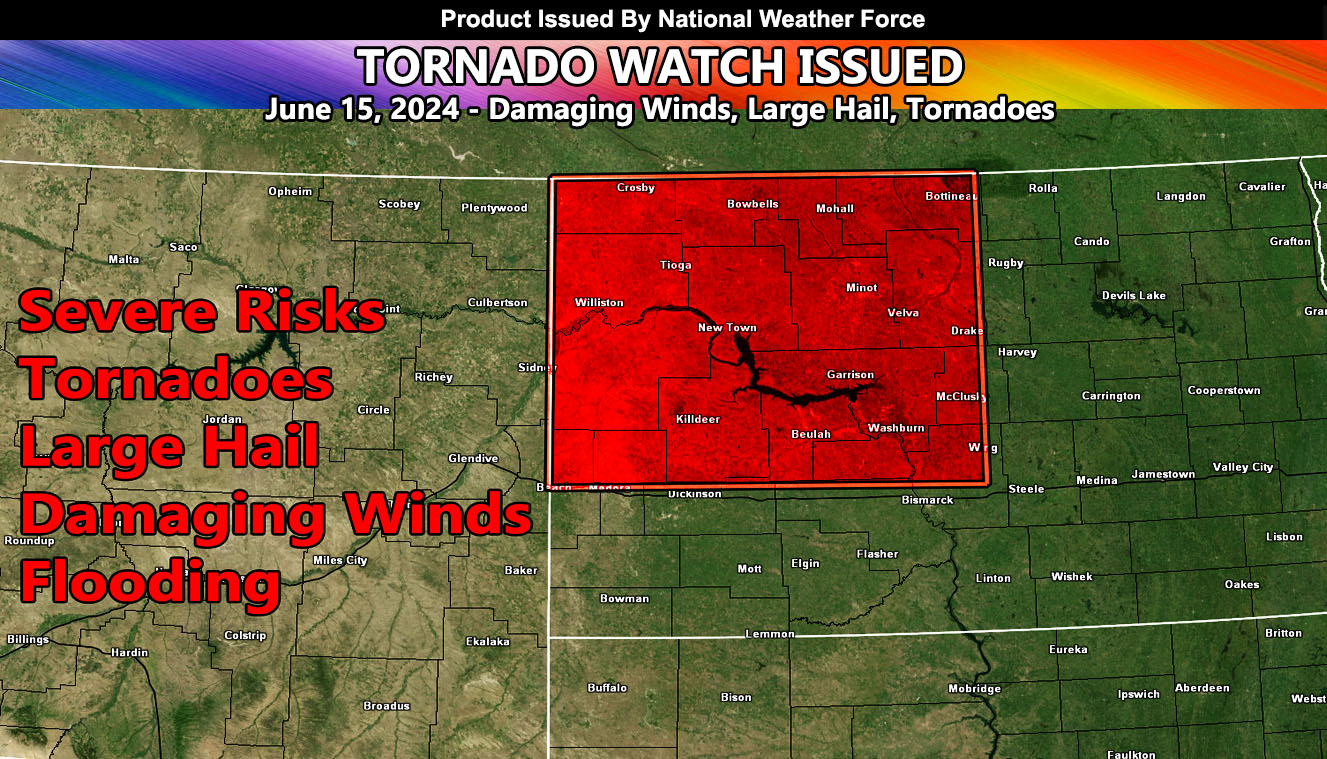
National Weather Force has issued a Tornado Watch, effective this evening until 3am Sunday morning.
Zones Affected: Northwest section of North Dakota.
A system out of the west will dig into the Northern Rocky Mountains this evening through Eastern Montana. Strong lifting within the upper levels coupled with strong instability will bring rapid severe thunderstorms development around the 9pm local hour across the border of Montana and North Dakota. This development will continue with a dragging front in Canada through the watch box area, giving the area a northeast flow through it. Primary target would the highest population zone of Minot, ND – however they target for this would be Tioga, ND.
All modes of severe weather will be expected, including extremely strong winds, large hail, and of course tornadoes.
– Raiden Storm –
https://www.nationalweatherforce.com
Master General Meteorologist – is the owner and CEO of National Weather Force and is the only one authorized to issue weather watches such as thunderstorm, tornado, hurricane, and severe. A consulting meteorologist with over 26 years’ experience for over 50 companies, including energy, agriculture, aviation, marine, leisure, and many more areas. He has certs from Mississippi State for broadcast met and Penn State forecasting certs MET 101, 241, 341 and 361 as a meteorologist, but before then was completely self-taught, barely learning a thing from the schools that he did not already know.

