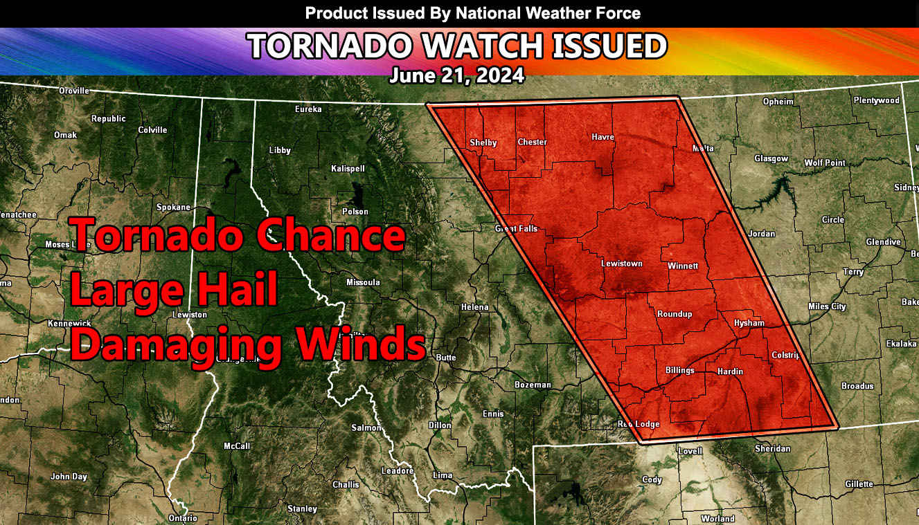
National Weather Force has issued a Tornado Watch, effective this afternoon through evening.
Zones affected: North, Central, and Southern Montana.
Official Discussion: A system out of the Western United States will bring severe thunderstorms and tornado risks across Montana this afternoon and evening. Storms will move from northwest to southeast across the entire length of the watch area.
Select cities included near or in this watch will be Shelby, Chester, Havre, Great Falls, Lewistown, Winnett, Roundup, Hysham, Billings, and Hardin. The areas with the best tornado risk will be a triangle between Lewistown, Winnett, and Roundup.
Severe Thunderstorms capable of damaging winds, large hail, and tornadoes will be likely through the evening.
Alternative Discussion:
...MT/WY...
   Several weak shortwave troughs are noted this morning moving
   east-northeastward across the northern Rockies.  These features,
   combined with persistent easterly low-level winds across
   central/eastern MT will result in scattered afternoon thunderstorm
   development.  Relatively isolated supercells are expected over MT,
   with more convective coverage farther south into eastern WY and
   western SD/NE.  Storms will be capable of large hail and damaging
   winds, along with the possibility of a tornado or two (mainly over
   parts of MT).
– Raiden Storm –
https://www.nationalweatherforce.com
Master General Meteorologist – is the owner and CEO of National Weather Force and is the only one authorized to issue weather watches such as thunderstorm, tornado, hurricane, and severe. A consulting meteorologist with over 26 years’ experience for over 50 companies, including energy, agriculture, aviation, marine, leisure, and many more areas. He has certs from Mississippi State for broadcast met and Penn State forecasting certs MET 101, 241, 341 and 361 as a meteorologist, but before then was completely self-taught, barely learning a thing from the schools that he did not already know.

