
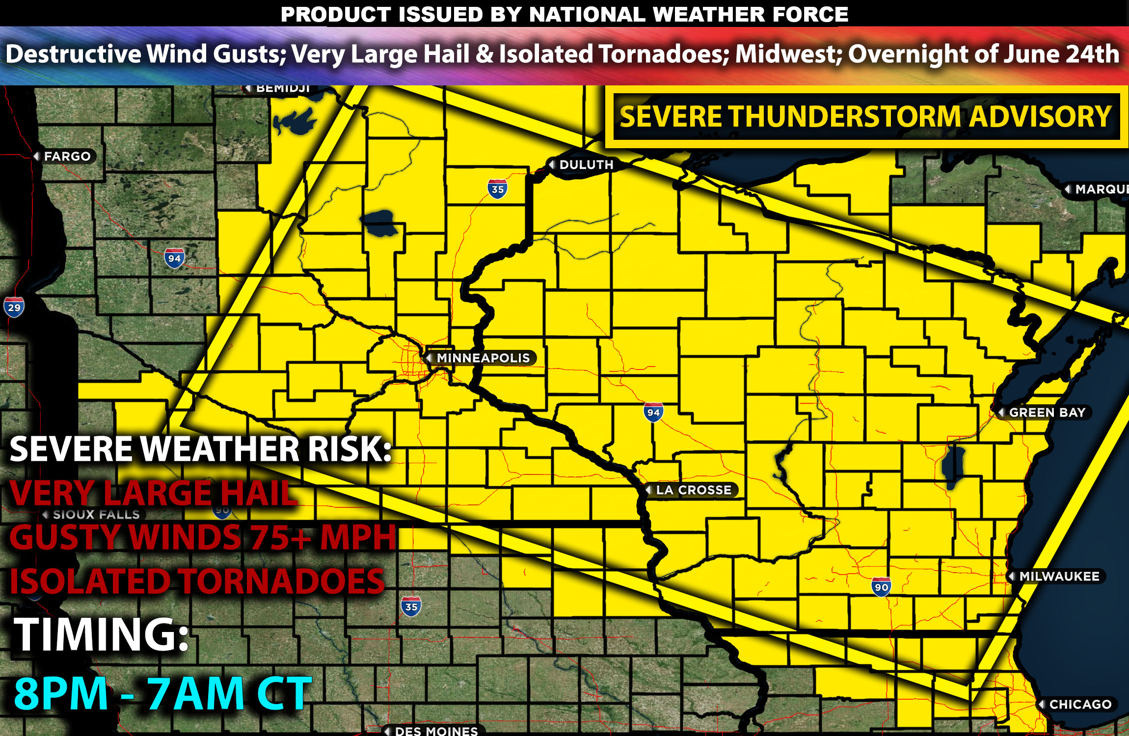
National Weather Force has issued a Severe T-Storm Advisory effective from 8 PM to 7 AM central time for conditions right for severe storms.
Zones affected: north, central, northeast, east, and southeast MN; northwest, north, northeast, west, central, east, southwest, south, and southeast WI; northwest, north, northeast and portions of central IL.
Discussion: A weakening Mesoscale Convective System (MCS) is moving east across central Minnesota, linked to a shortwave trough in the southern Canada area. Extreme instability will develop along the southern edge of this MCS, with hot and humid conditions creating very high instability values (over 4500 J/kg) by late afternoon, especially in southwest Minnesota. Very warm temperatures high up in the atmosphere will likely limit storm development initially as a cap. However, strengthening southwesterly winds by early evening will enhance warm advection, likely leading to thunderstorms over central Minnesota.
Initial storms are expected to be supercells, with conditions supporting a risk of very large hail, damaging winds, and a few tornadoes given the ingredients present.
As the evening goes on, a cluster of supercells will merge into a fast-moving bowing MCS. At this point very powerful wind gusts will become the main risk. These storms are expected to move southeast towards central and southern Wisconsin, eventually reaching northern Illinois.
The highest concentration of severe storms will be from southeastern Minnesota into Wisconsin, especially in central Wisconsin, where damaging winds could be potentially destructive. This will occur during the evening and overnight as the storms push southeastward into northern Illinois weakening as they do.
Main risk: very large hail, destructive winds, isolated tornadoes and CG (cloud to ground) lightning.
Stay tuned for more updates.
Sina⚡⚡
With over a decade of experience in forecasting severe thunderstorms, this individual is a seasoned forecaster and developer. Their expertise in severe weather forecasting and computer science is entirely self-taught, complemented by a foundation in Atmospheric Science from UNCO and an IT background from WGU. They have dedicated their efforts to developing innovative tools that enhance the accuracy of analyzing large hail and tornadoes. As a significant contributor and partner at National Weather Force Innovations LLC, they have played a crucial role in providing accurate and timely information. Additionally, they have been instrumental in developing tools and organizing projects that focus on accuracy and performance, ensuring those affected are well-informed.