
Outlook:
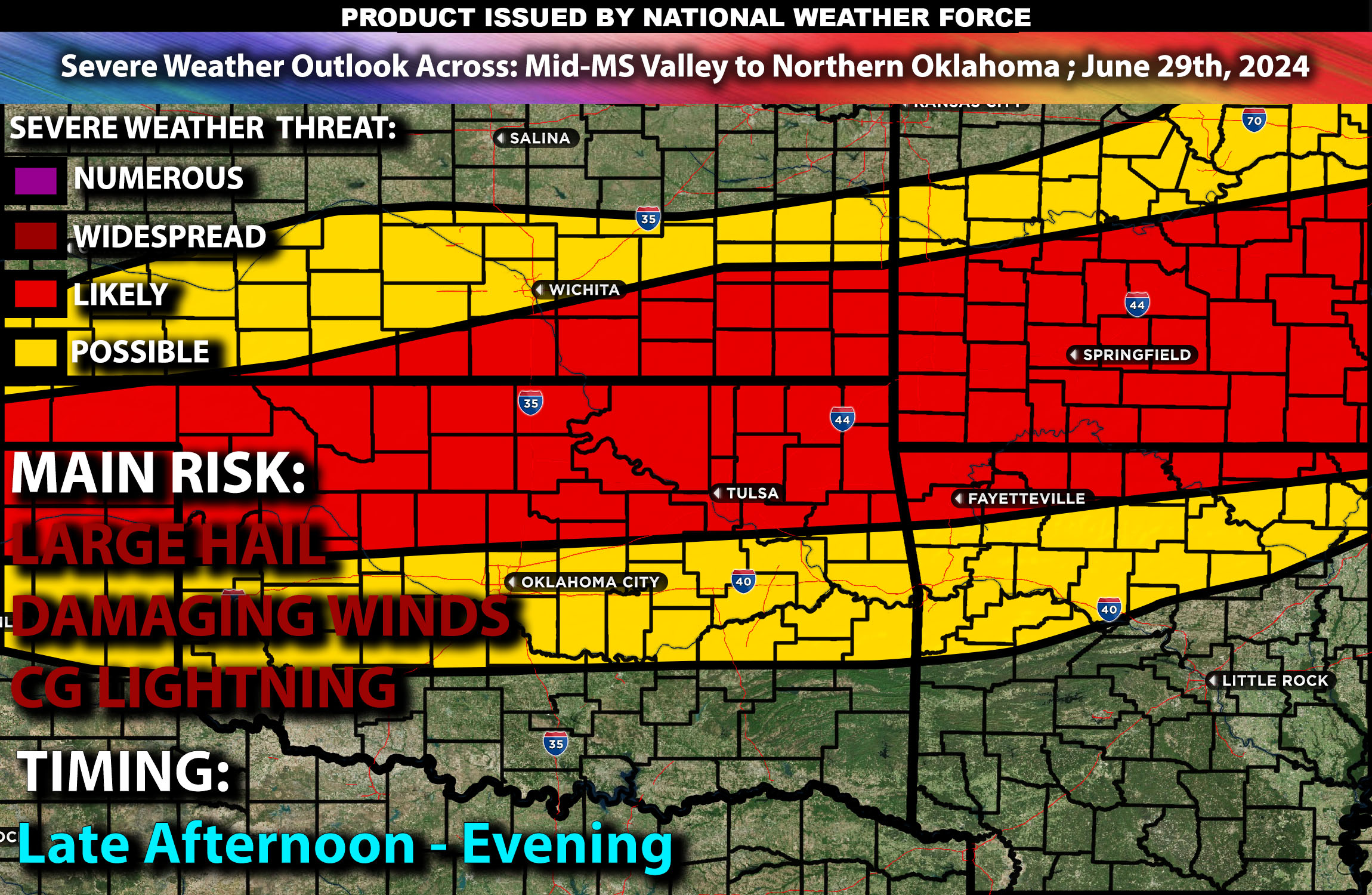
Severe thunderstorms possible with strong winds and large hail from the Mid-Mississippi Valley into Northern Oklahoma, particularly in St. Louis, Springfield, and Tulsa, forming in the late afternoon through the evening hours of Saturday. For detailed information on timing, impacts, and more, refer below.
States and Cities Impacted: Missouri (St. Louis, Springfield), Oklahoma (Tulsa).
Detailed Forecast Across Mid-Mississippi Valley to Northern Oklahoma:
A cold front trailing from a low-pressure system over the Great Lakes will create favorable conditions for severe thunderstorms from the Mid-Mississippi Valley into Northern Oklahoma. The primary threats include strong winds and large hail, with isolated severe storms expected in cities like St. Louis, Springfield, and Tulsa. The warm and moist air mass will support storm development, which is expected to occur in the late afternoon and evening, driven by surface heating and the advancing cold front combined with strong instability across the area.
Coverage Details:
In the morning, some cloud cover and residual morning showers may be present. Then in the afternoon isolated to scattered thunderstorms are expected to develop by late afternoon. The main threat will be during the evening with the threat of damaging winds and hail diminishing by late evening.
Main Risk: large hail, damaging winds, low tornado risk and CG (cloud to ground) lightning.
Stay tuned for more updates.
Sina⚡⚡
With over a decade of experience in forecasting severe thunderstorms, this individual is a seasoned forecaster and developer. Their expertise in severe weather forecasting and computer science is entirely self-taught, complemented by a foundation in Atmospheric Science from UNCO and an IT background from WGU. They have dedicated their efforts to developing innovative tools that enhance the accuracy of analyzing large hail and tornadoes. As a significant contributor and partner at National Weather Force Innovations LLC, they have played a crucial role in providing accurate and timely information. Additionally, they have been instrumental in developing tools and organizing projects that focus on accuracy and performance, ensuring those affected are well-informed.