
Brief Outlook:
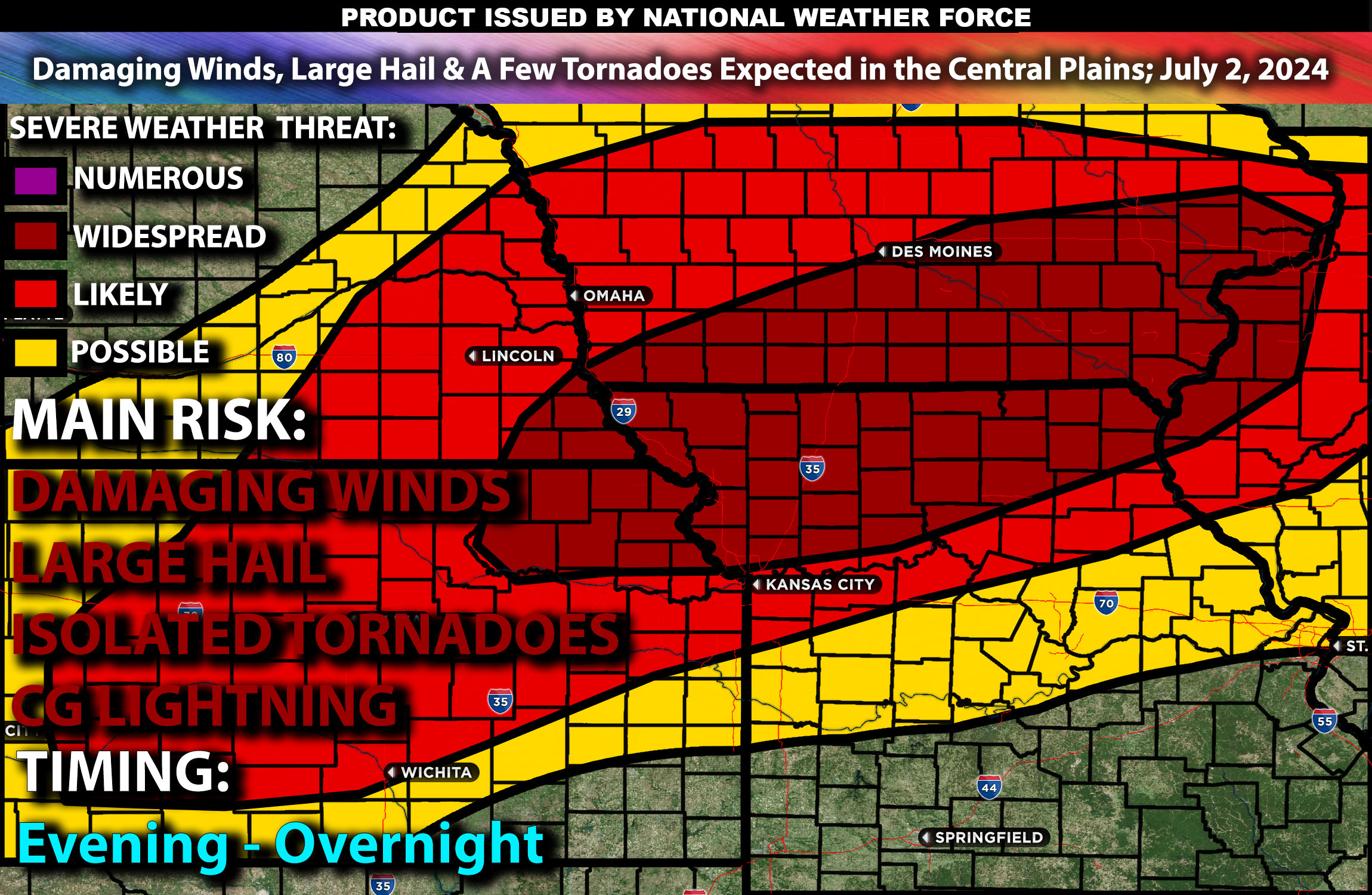
Severe thunderstorms are expected across the Central Plains, bringing threats of damaging winds, hail, and a few tornadoes. Check below for further details, timing and much more information.
States and Cities Impacted: Iowa (Des Moines, Cedar Rapids), Missouri (Kansas City, Columbia), Kansas (Topeka).
Detailed Forecast:
An upper-level trough will progress eastward across the northern Plains and Upper Midwest, bringing significant severe weather potential to the Central Plains. Enhanced wind shear, with values around 40-50 knots in the 0-6 km layer, will support organized storm structures, including supercells capable of producing damaging winds and large hail. This setup is particularly concerning due to the strong wind fields aloft that will help in the development of severe thunderstorms.
At the surface, instability values are expected to reach 2500-3000 J/kg, especially across southern and central Iowa, northern Missouri, and eastern Kansas. The presence of a surface low near the KS/NE border will facilitate the northward advection of rich low-level moisture. The interaction of this moist air with the advancing upper-level trough will create an environment ripe for severe thunderstorm development, particularly during the late afternoon and evening hours.
Timing:
The morning will see some cloud cover and potentially leftover showers. By late afternoon, severe thunderstorms are likely to initiate near the surface low and advancing warm front. Peak activity is expected from mid-afternoon to early evening, transitioning to more linear storm modes that will increase the severe wind threat. These storms are expected to diminish in intensity by late evening.\
Future Radar Scenario:
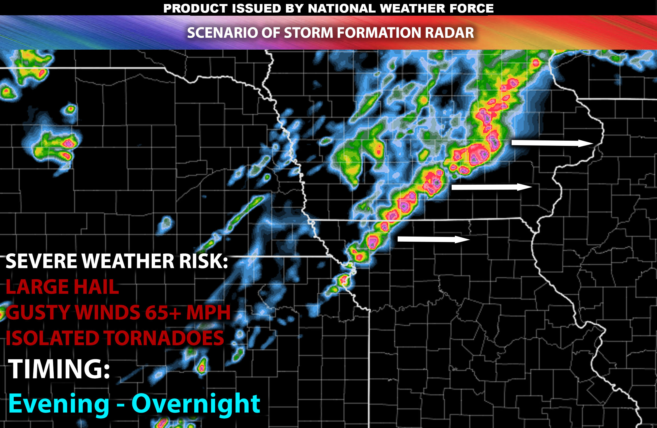
Main Impact: Damaging winds, large hail, a few tornadoes & cg (cloud to ground) lightning.
Stay tuned for more updates.
Sina⚡⚡
With over a decade of experience in forecasting severe thunderstorms, this individual is a seasoned forecaster and developer. Their expertise in severe weather forecasting and computer science is entirely self-taught, complemented by a foundation in Atmospheric Science from UNCO and an IT background from WGU. They have dedicated their efforts to developing innovative tools that enhance the accuracy of analyzing large hail and tornadoes. As a significant contributor and partner at National Weather Force Innovations LLC, they have played a crucial role in providing accurate and timely information. Additionally, they have been instrumental in developing tools and organizing projects that focus on accuracy and performance, ensuring those affected are well-informed.