
Brief Outlook:
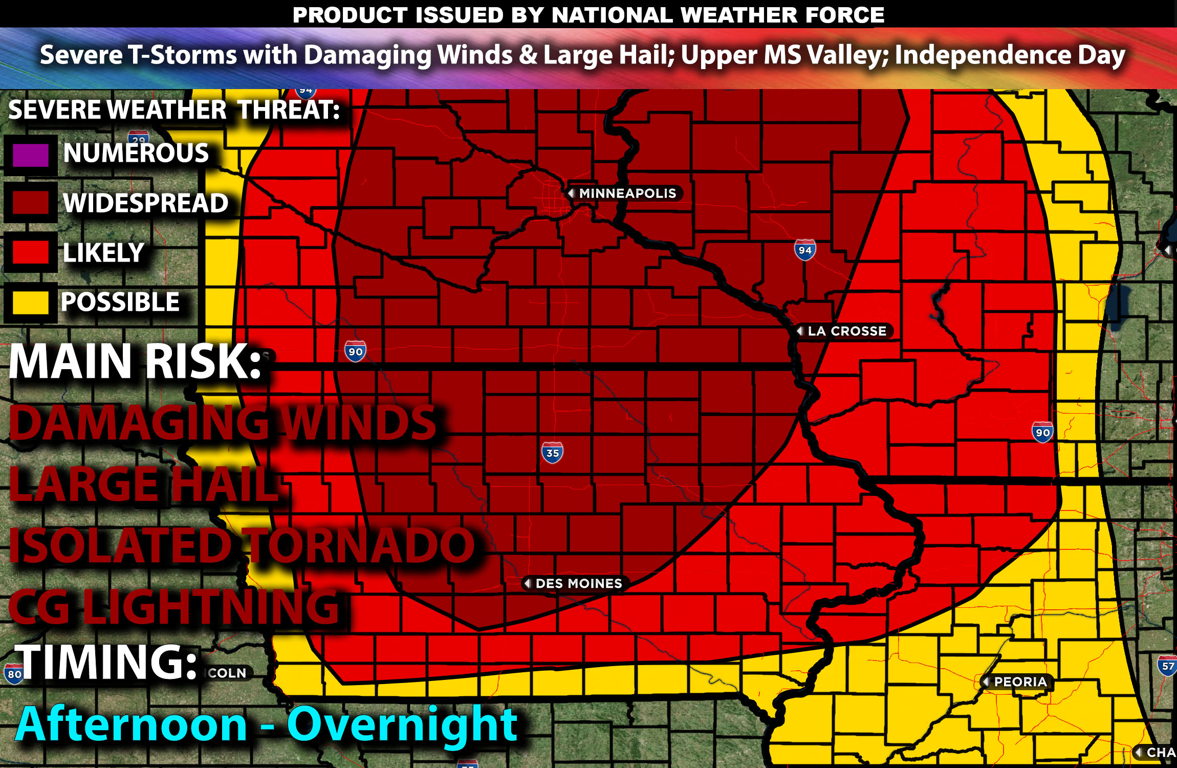
Severe thunderstorms are forecast across parts of the Upper Mississippi Valley, with risks of damaging winds and large hail on Independence Day. Check below for further details, timing and much more information.
States and Cities Impacted: Iowa (Des Moines, Cedar Rapids), Minnesota (Minneapolis, St. Paul), Wisconsin (Madison).
Detailed Forecast:
A weak surface low will develop eastward across the Upper Midwest during the afternoon and early evening as the northern Plains upper trough shifts east. Enhanced wind shear, with values around 25-35 knots in the 0-6 km layer, will support the development of organized storm structures, including a few transient supercells.
At the surface, instability values are expected to reach 1000-1500 J/kg, with temperatures warming into the upper 70s to low 80s. A cold front extending into western Minnesota and eastern Nebraska by midday will provide the focus for storm development. The interaction of this moist and unstable airmass with the advancing front will foster the development of severe thunderstorms capable of producing damaging winds and hail.
Timing:
Morning cloud cover and potentially residual showers will be present over the region. Severe thunderstorms are likely to initiate by early afternoon, with peak activity expected from mid-afternoon to early evening as the storms move southeastward. These storms will weaken after sunset.
Main Impact: damaging winds, large hail & lightning.
Stay tuned for more updates.
Sina⚡⚡
With over a decade of experience in forecasting severe thunderstorms, this individual is a seasoned forecaster and developer. Their expertise in severe weather forecasting and computer science is entirely self-taught, complemented by a foundation in Atmospheric Science from UNCO and an IT background from WGU. They have dedicated their efforts to developing innovative tools that enhance the accuracy of analyzing large hail and tornadoes. As a significant contributor, partner and Co-Owner at National Weather Force Innovations LLC (which own NWF, SCWF, AZWF and DWF), they have played a crucial role in providing accurate and timely information. Additionally, they have been instrumental in developing tools and organizing projects that focus on accuracy and performance, ensuring those affected are well-informed.