 Brief Outlook:
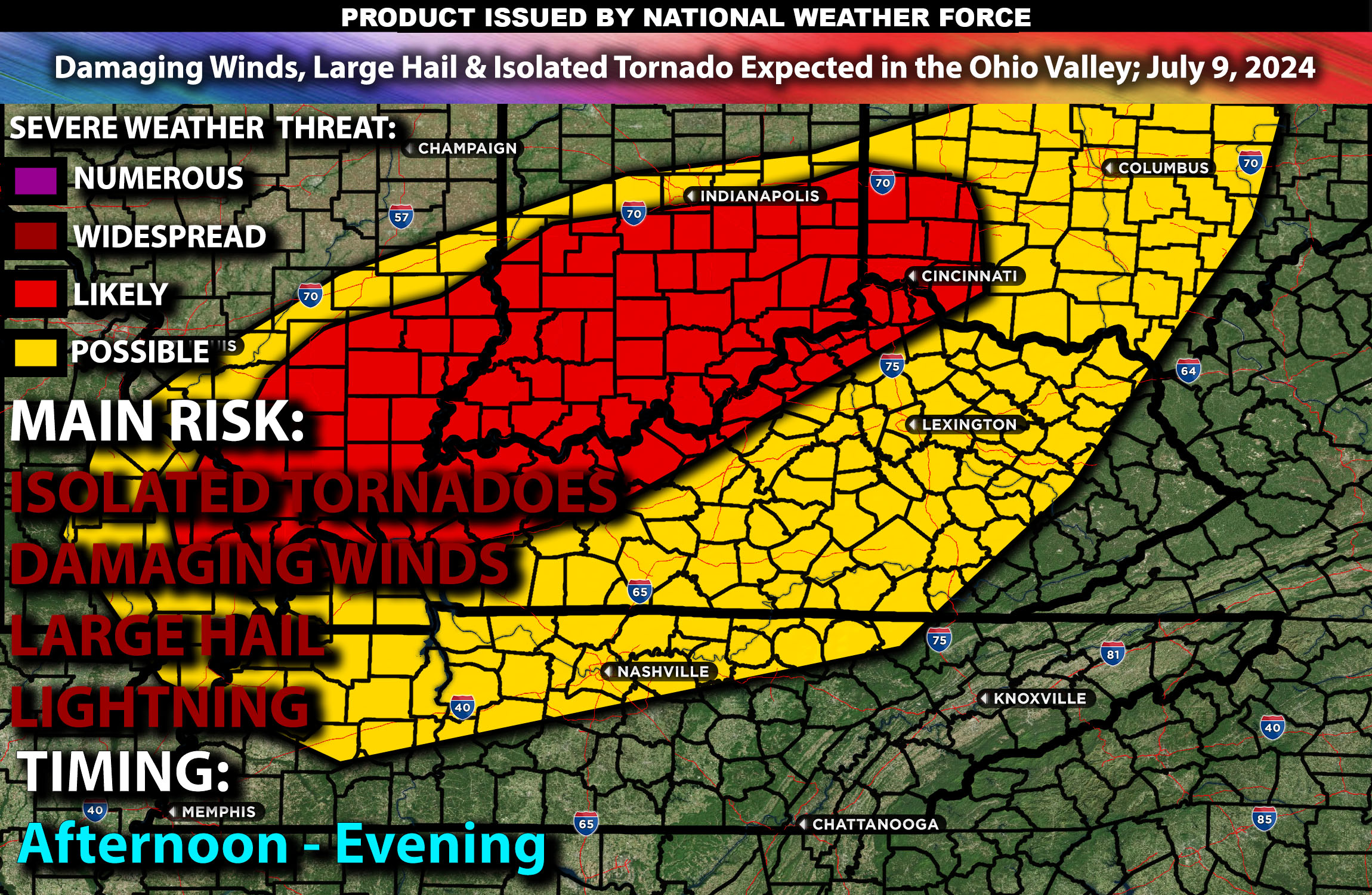
Severe thunderstorms are expected in the Ohio Valley from early afternoon to evening. Main Impact: Damaging winds, hail, and a few tornadoes. Check below for further details, timing and much more information.
States and Cities Impacted: Ohio (Columbus, Cincinnati), Indiana (Indianapolis), Kentucky (Louisville).
Detailed Forecast:
An upper-level trough will extend across the central U.S. early Tuesday morning, with the remnants of Tropical Cyclone Beryl within the southeastern portion of this trough over the Arklatex vicinity. Some modest eastward progression of this trough is anticipated throughout the day, while the remnants of Beryl track within the eastern periphery of the trough through the Mid-Mississippi and Lower/Mid-Ohio Valleys. Enhanced wind shear, with values around 40-50 knots in the 0-6 km layer, will support organized storm structures, including supercells capable of producing severe weather.
At the surface, instability values are expected to reach 1500-2500 J/kg, particularly in eastern Texas and western Louisiana. The tropical airmass accompanying Beryl will bring 70s dewpoints into the Mid-Mississippi and Lower/Mid-Ohio Valleys just ahead of the surface low, contributing to destabilization and modest buoyancy despite widespread cloud cover.
Timing:
Thunderstorms are anticipated throughout the day, especially in the northeastern quadrant of the system where convergence along the warm front will augment lift. The highest tornado threat is expected along the southern Ohio River vicinity from late afternoon to early evening, gradually shifting northeastward into southern Indiana and the Louisville area by early night.
Main Impact: damaging winds, large hail, a few isolated tornadoes possible & lightning.
Stay tuned for more updates.
Sina⚡⚡
With over a decade of experience in forecasting severe thunderstorms, this individual is a seasoned forecaster and developer. Their expertise in severe weather forecasting and computer science is entirely self-taught, complemented by a foundation in Atmospheric Science from UNCO and an IT background from WGU. They have dedicated their efforts to developing innovative tools that enhance the accuracy of analyzing large hail and tornadoes. As a significant contributor, partner and Co-Owner at National Weather Force Innovations LLC (which own NWF, SCWF, AZWF and DWF), they have played a crucial role in providing accurate and timely information. Additionally, they have been instrumental in developing tools and organizing projects that focus on accuracy and performance, ensuring those affected are well-informed.
