
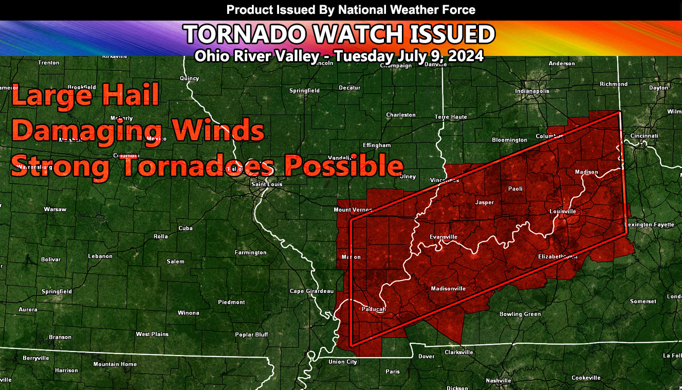
National Weather Force has issued a Tornado Watch effective Tuesday, July 9th, 2024 out ahead of the remnants of Beryl.
Zones affected: West, Southwest, Northwest, Northern Kentucky – South, Southeast Illinois – Southwest, South, Southeast Indiana.
Discussion: The remnants of what is left of Hurricane Beryl will move through the watch zone today. Increasing southeasterly flow in the low levels along with strong instability will make for severe thunderstorm development. Supercells lining through the watch area from southwest to northeast will move through the center of the watch area. Given the surface convergence, the strongest tornado chances will be from Paducah, Kentucky – Evansville, Indiana – Louisville, Kentucky, and Madison, Kentucky. Seems like the river will be the main focus spot for this event.
Strong tornadoes are going to be possible with this event. In addition to the tornado risk, large hail and damaging winds will be likely.
– Raiden Storm –
https://www.nationalweatherforce.com
Master General Meteorologist – is the owner and CEO of National Weather Force and is the only one authorized to issue weather watches such as thunderstorm, tornado, hurricane, and severe. A consulting meteorologist with over 26 years’ experience for over 50 companies, including energy, agriculture, aviation, marine, leisure, and many more areas. He has certs from Mississippi State for broadcast met and Penn State forecasting certs MET 101, 241, 341 and 361 as a meteorologist, but before then was completely self-taught, barely learning a thing from the schools that he did not already know.