
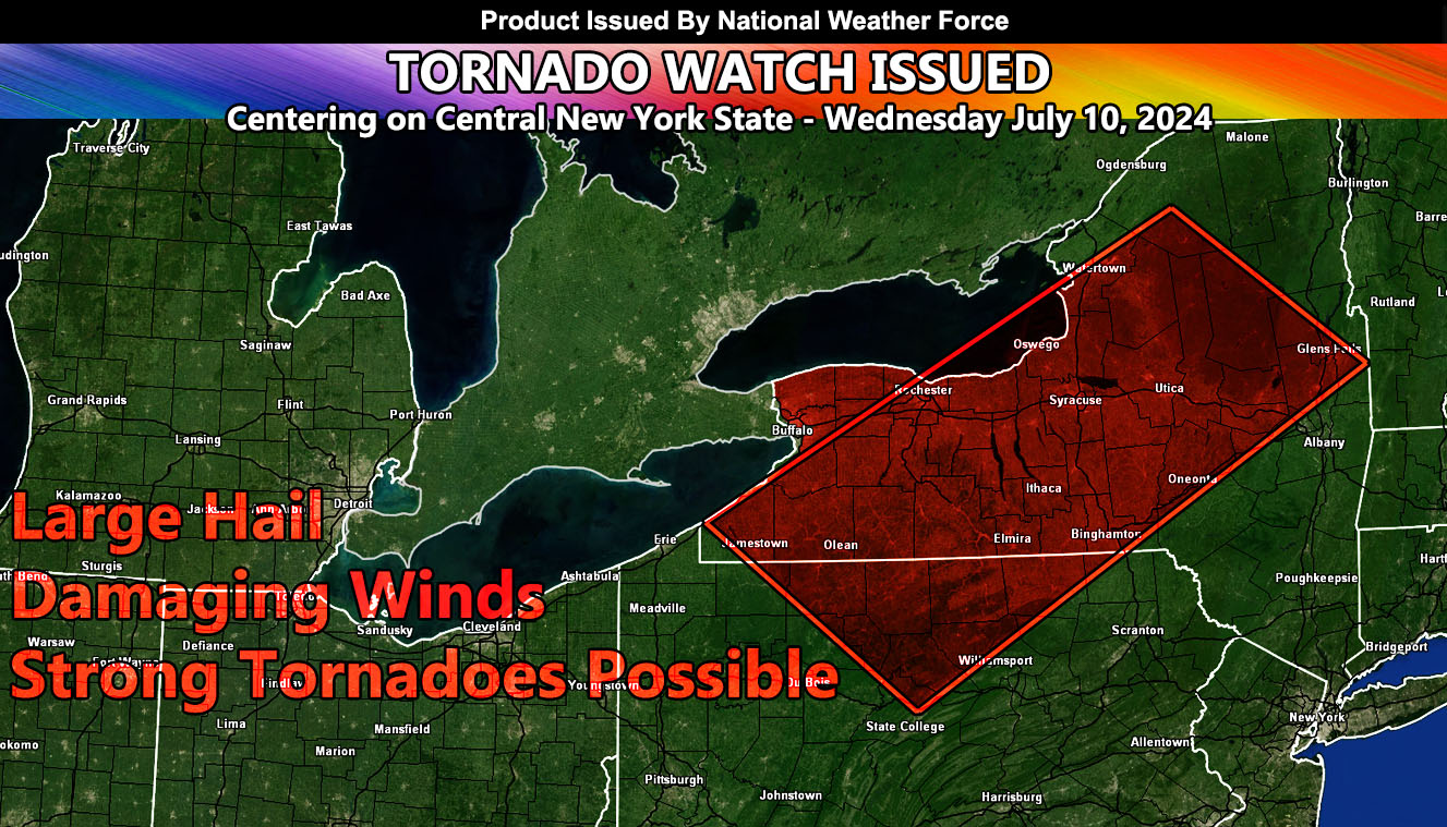
National Weather Force has issued a Tornado Watch effective Wednesday, July 10th, 2024 out ahead of the remnants of Beryl.
Zones affected: Southwest, West, Northwest, East, South, and Central New York State – Northern and Central Pennsylvania.
Discussion: Remnants of what was Hurricane Beryl caused tornadoes from Texas and Louisiana and through the Ohio River Valley over the last couple of days. These remnants and associated low-level shear from backing flow will now move through the Northeastern United States. Today, this evening, and into the night across the watch area, supercells are expected to form on the southeast side of the strong surface low center of what was Beryl, which will be moving through Ontario, Canada at the same time. These cells will be in an environment of strong instability and shear, owning to the chance of tornadoes.
The center of the tornadic dynamics looks to be the city of Syracuse, where I do think we will see tornadic supercells moving through this evening.
Strong tornadoes are going to be possible with this event. In addition to the tornado risk, large hail and damaging winds will be likely.
– Raiden Storm –
https://www.nationalweatherforce.com
Master General Meteorologist – is the owner and CEO of National Weather Force and is the only one authorized to issue weather watches such as thunderstorm, tornado, hurricane, and severe. A consulting meteorologist with over 26 years’ experience for over 50 companies, including energy, agriculture, aviation, marine, leisure, and many more areas. He has certs from Mississippi State for broadcast met and Penn State forecasting certs MET 101, 241, 341 and 361 as a meteorologist, but before then was completely self-taught, barely learning a thing from the schools that he did not already know.