
 Brief Outlook:
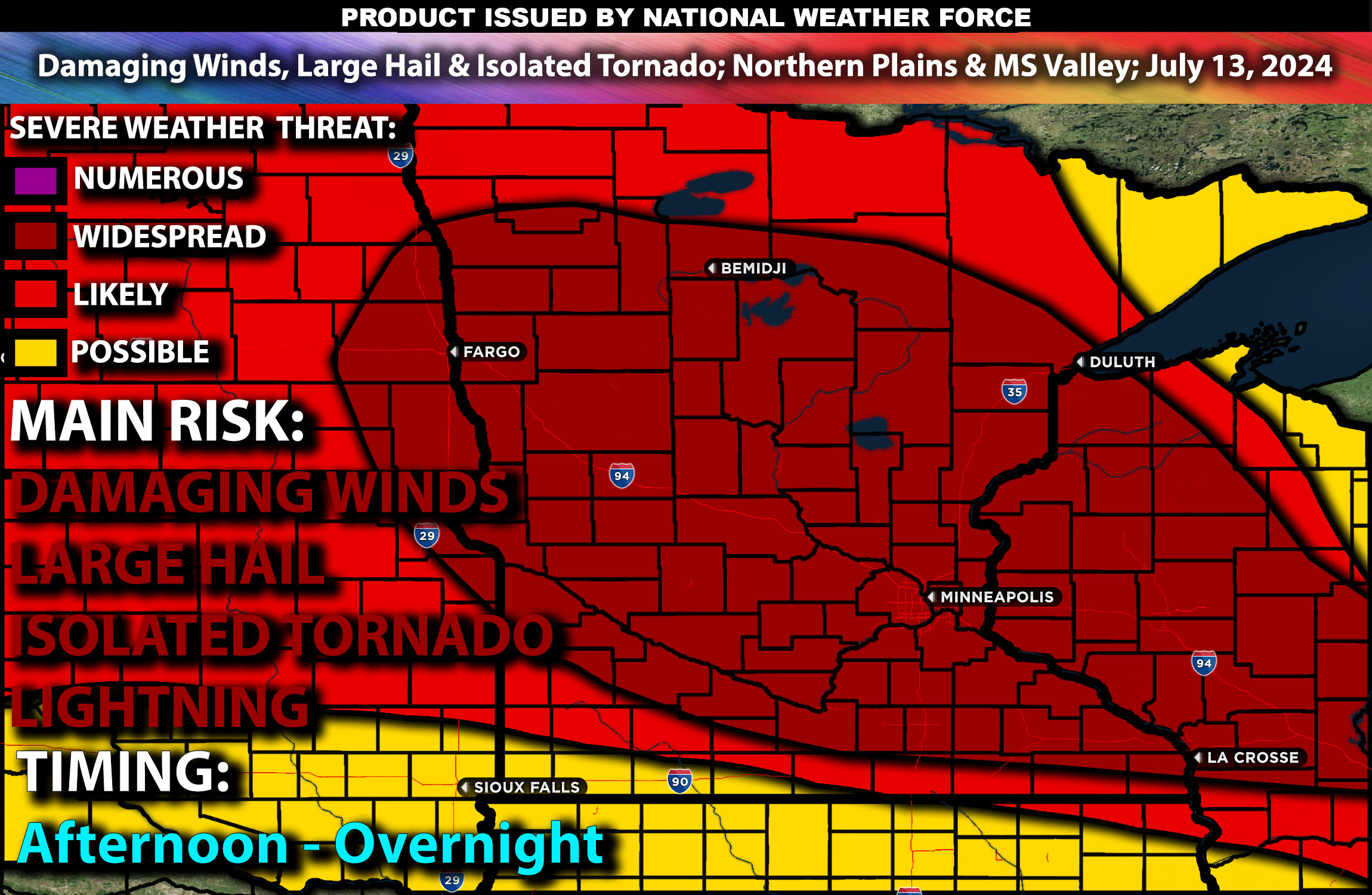
Severe thunderstorms are expected across the Northern Plains and Upper Mississippi Valley from late afternoon to evening and lingering into the overnight hours. Main impact with storms being damaging winds, large hail, and a few tornadoes. Check below for further details, timing and much more information.
Region Impacted: Northern Plains and Upper Mississippi Valley
States and Cities Impacted: Minnesota (Minneapolis, Duluth), Wisconsin (Milwaukee, Madison), South Dakota (Sioux Falls).
Detailed Forecast:
A strong upper high will remain centered over the Four Corners states, while a broad, low-amplitude upper trough covers much of southern Canada. This setup will result in a belt of moderate mid to high-level winds stretching from the northern Rockies to the upper Great Lakes. Enhanced wind shear, with values around 40-50 knots in the 0-6 km layer, will support organized storm structures, including supercells capable of producing severe weather.
At the surface, instability values are expected to reach 2000-3000 J/kg, particularly near and east of a surface trough developing from northern Minnesota into central South Dakota and Nebraska. Southwest low-level flow will maintain a moist and unstable air mass in these areas. This combination of upper-level dynamics and surface instability will create a favorable environment for severe thunderstorm development.
Timing:
Early-day storms are likely over parts of northern Minnesota into Wisconsin, possibly in a mesoscale convective system (MCS) format with strong to locally severe gust threats. Some rejuvenation of these storms may occur into Wisconsin or northern Illinois as the air mass destabilizes by late afternoon. Further storm development is expected near the surface trough over South Dakota and Nebraska by late afternoon, with peak activity from mid-afternoon to early evening. These storms are likely to weaken by late evening.
Main Impact: damaging winds, large hail, a few isolated tornadoes possible & lightning.
Stay tuned for more updates.
-Sina⚡⚡