
 Brief Outlook
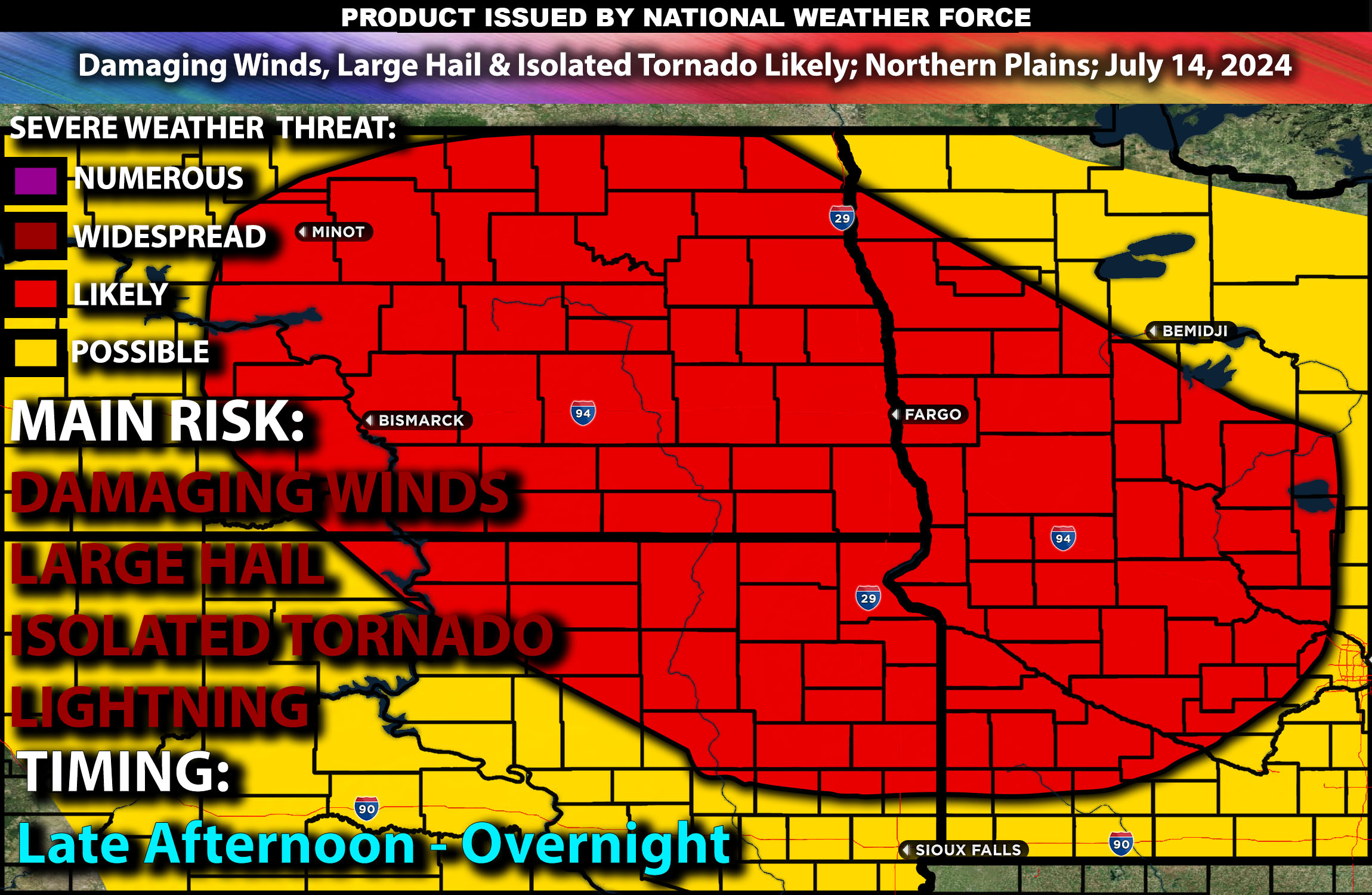
Severe thunderstorms are expected to develop from late afternoon into the evening hours across the Northern Plains. The most significant threats include damaging winds and large hail. Check below for further details, timing and much more information.
Major Cities Potentially Impacted:
North Dakota: Bismarck, Fargo
South Dakota: Sioux Falls, Rapid City
Minnesota: Minneapolis, Duluth
Detailed Forecast:
A strong upper-level trough will move across the Northern Plains, providing substantial lift and support for thunderstorm development. Enhanced mid-level winds will aid in the organization and sustenance of these storms. The presence of a jet streak will further enhance storm potential, promoting thunderstorm activity across the region.
At the surface, a cold front will advance through North Dakota, South Dakota, and Minnesota, interacting with high instability values, around 2500-3500 J/kg. This environment, combined with sufficient shear (35-50 knots), will create conditions favorable for supercells capable of producing large hail and damaging winds. In Minnesota, a warm front will lift northward, contributing to the instability and enhancing the potential for severe thunderstorms.
Timing:
In North Dakota, South Dakota, and Minnesota, severe thunderstorms are expected to begin forming in the late afternoon, around 3 PM, and continue into the evening hours. The most intense storms will likely occur between 6 PM and 10 PM, with a continued risk of damaging winds and large hail through the night.
Main Impact: damaging winds, large hail, isolated tornado & lightning.
Stay tuned for more updates.
Sina⚡⚡