
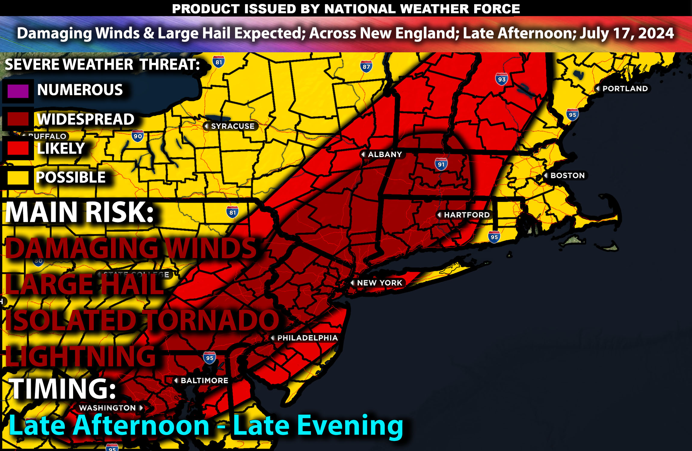
Brief Outlook:
Severe thunderstorms are expected across the Northeast on Wednesday, impacting parts of New York and New England. These storms will develop in the afternoon and continue into the evening. Main impact with these storms will be damaging winds and large hail mainly.
Cities Impacted:
New York: Albany, Syracuse, Buffalo, Rochester
New England Region: Boston, Hartford, Providence, Portland
Detailed Forecast:
Upper Levels: An upper-level trough will move into the Northeast, supported by a strong jet stream enhancing wind shear necessary for severe thunderstorm development. This dynamic system will sustain storm intensity and organization across the region. The trough’s influence will create significant lifting and destabilization, promoting severe weather conditions.
At the Surface: A low-pressure system will advance into the area, pulling moist and unstable air northward. Instability values are forecasted to range between 2000-3000 J/kg, supporting severe thunderstorm formation. Mid-level lapse rates will be around 6.5°C/km, increasing the likelihood of large hail. Effective shear values are expected to be around 35-45 knots, with strong low-level shear (20-25 knots) further enhancing severe potential. The storms are expected to start as discrete cells but may evolve into a more linear system as they progress eastward.
Timing: Storm development is anticipated around 3 PM ET, with peak intensity in the early evening. The most violent phase will likely occur between 5 PM and 8 PM ET. Storms are expected to dissipate by midnight.
Main Impact: damaging winds, large hail & lightning.
Stay tuned for more updates.
Sina⚡⚡