
 Brief Outlook
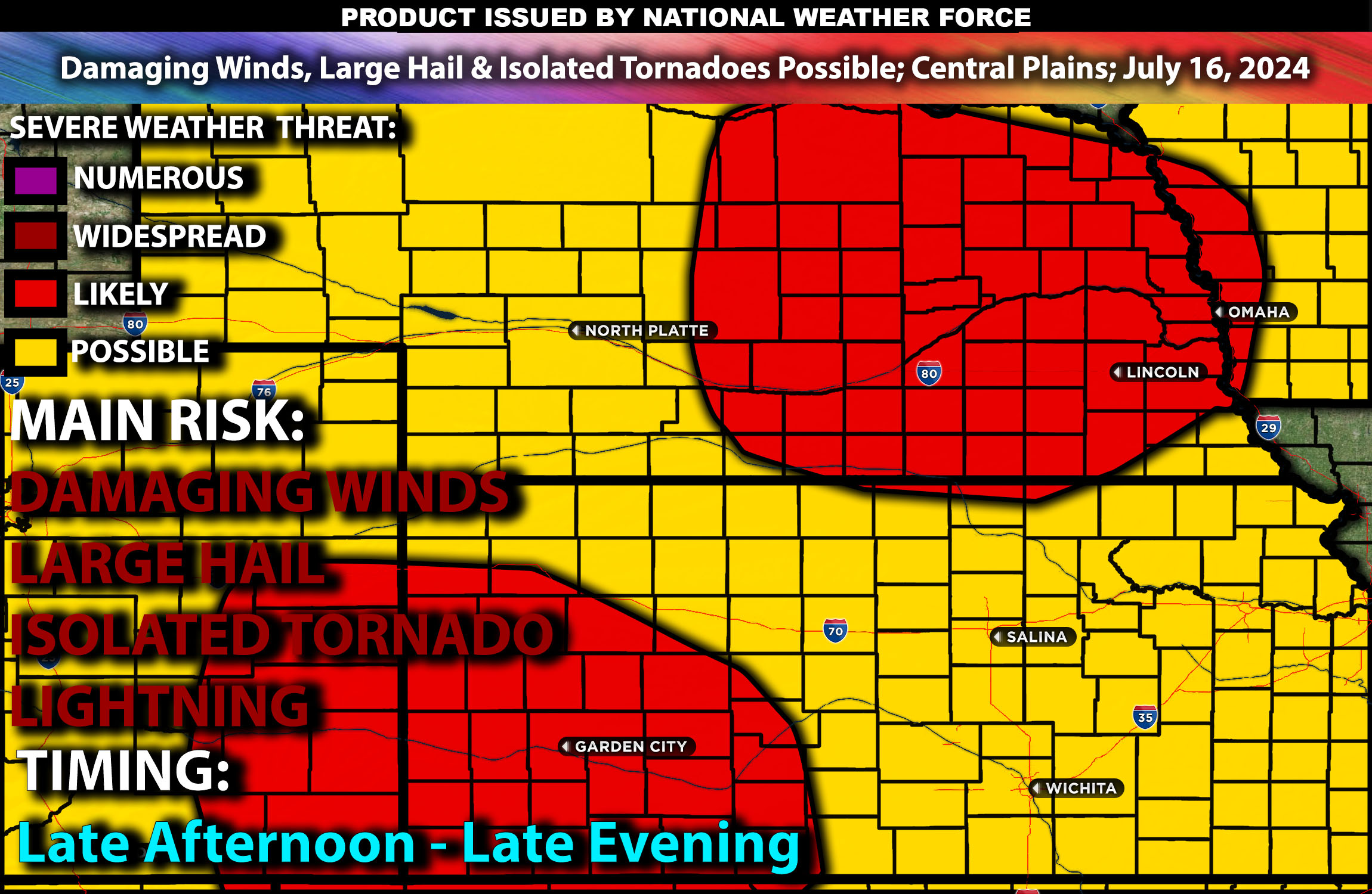
Severe thunderstorms are expected across the Central Plains on Tuesday. These storms will develop in the afternoon and continue into the evening hours. Main risk should be damaging winds, large hail, and isolated tornadoes (low risk).
Main Impact: damaging winds, large hail, isolated tornadoes & lightning.
Regions Impacted
Kansas: Topeka, Wichita, Salina, Hays
Nebraska: Lincoln, Omaha, Grand Island, Kearney
Detailed Forecast
Upper Levels: A robust upper-level trough will move across the Central Plains, accompanied by a powerful jet stream that enhances wind shear, crucial for the development of severe thunderstorms. The trough will provide strong dynamic support for storm organization and intensity.
At the Surface: A low-pressure system over the Central Plains will draw moist, unstable air northward. Instability values are expected to reach up to 3000 J/kg, creating a highly favorable environment for severe thunderstorm development. Mid-level lapse rates will be steep, enhancing the potential for large hail. Effective shear values are expected to be around 40-50 knots, with strong low-level shear (around 25-30 knots) supporting a tornado risk. The combination of high instability, strong wind shear, and favorable lapse rates will likely lead to the formation of supercells capable of producing large hail, damaging winds, and isolated tornadoes.
Timing: Storms will initiate around 1 PM CT, with peak intensity expected during the mid to late afternoon. These storms will continue into the evening, gradually dissipating by late evening.
Stay tuned for more updates.
Sina⚡⚡