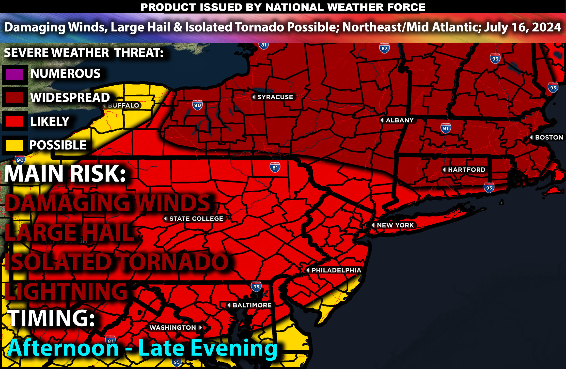
 Brief Outlook:
Severe thunderstorms are expected from the Upper Ohio Valley into the Northeast and Mid-Atlantic on Tuesday, July 16, 2024. The main threats include damaging winds and isolated tornadoes. Check below for further details, timing and much more information.
Regions Impacted: Upper Ohio Valley, Northeast, Mid-Atlantic
States: Ohio, Pennsylvania, New York, West Virginia, Virginia, Massachusetts
Cities: Pittsburgh, Cleveland, New York City, Philadelphia, Washington D.C., Boston
Detailed Forecast:
Upper-level dynamics driven by an upper trough over the Great Lakes will impact the Ohio Valley and Northeast. A surface cold front, combined with outflow boundaries from previous convection, will provide a focus for severe thunderstorm development. Moderate to strong instability (dewpoints in the upper 60s to low 70s°F) and significant vertical shear (30-40 kt effective shear) will support the development of organized cells and line segments capable of producing severe, damaging gusts.
Thunderstorm development is expected to begin by midday, with robust convective activity continuing into the early evening.
Timing:
Thunderstorms are expected to initiate in Ohio by late morning around 11 AM ET, moving eastward into Pennsylvania and New York by early afternoon. Major cities such as Pittsburgh and Cleveland will likely see storm impacts between 1 PM and 3 PM ET. As the storms continue to move eastward, New York City, Philadelphia, and Washington D.C. will be affected by late afternoon around 4 PM ET, with storm activity gradually diminishing by early evening around 7 PM ET.
Main Impact: damaging winds, large hail, isolated tornadoes and lightning.
Stay tuned for more updates.
Sina⚡⚡
