
 Brief Outlook:
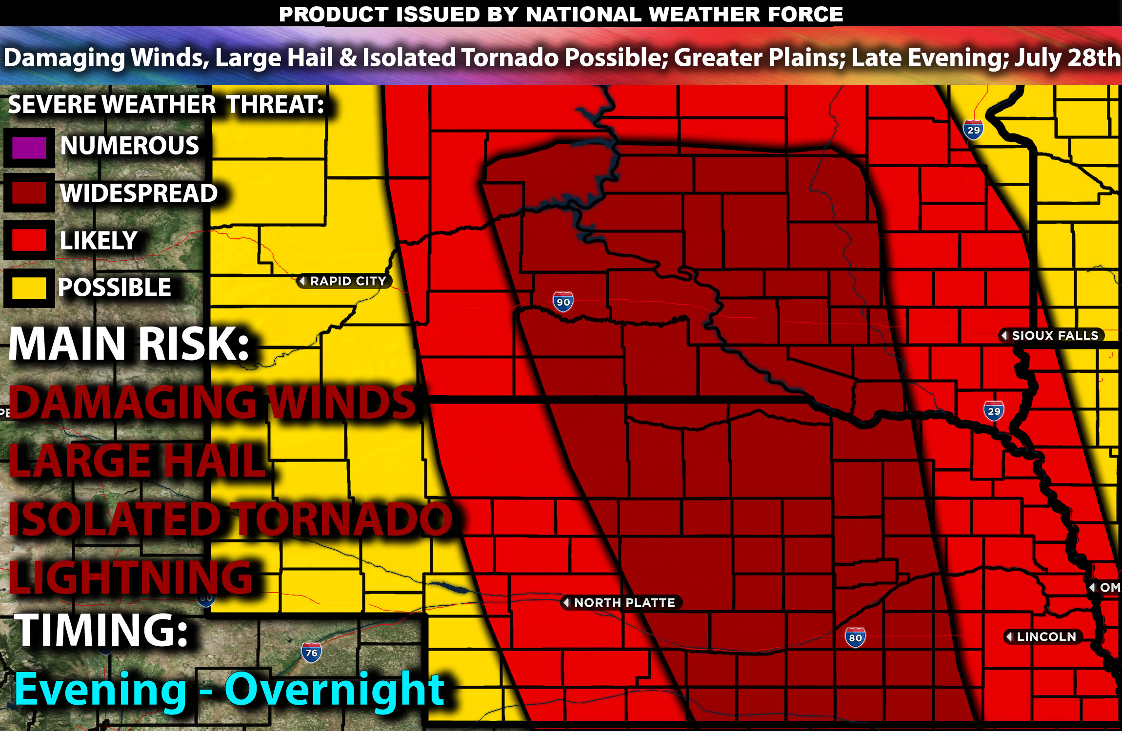
Severe thunderstorms are expected across portions of the central and northern Plains from the very late afternoon into the late evening. The main threat for these storms will be damaging winds, large hail, and isolated tornadoes.
Region Impacted: Central and Northern Plains
States and Cities Impacted: South Dakota (Sioux Falls, Rapid City), Nebraska (Omaha, Lincoln), Iowa (Des Moines).
Detailed Forecast:
An upper-level trough will move eastward from the northern Rockies into the central and northern Plains. This system will enhance mid-level flow, with wind shear values around 40-50 knots in the 0-6 km layer, supporting organized storm structures, including supercells capable of producing severe weather.
At the surface, instability values are expected to reach 2000-3000 J/kg across the region. Low-level moisture with surface dewpoints in the mid to upper 60s will contribute to the instability. Effective shear will be sufficient to support supercell development, while mid-level lapse rates will promote strong updrafts. Storms are expected to be initially discrete before potentially forming clusters or lines, capable of producing large hail and damaging winds. Some areas may also experience isolated tornadoes due to the favorable shear profiles.
Timing:
Storms are expected to initiate by late afternoon in eastern South Dakota and move into Nebraska and Iowa by late afternoon and early evening, possibly continuing through the late evening as well. Peak activity will likely occur from late afternoon through the evening, with the most severe storms occurring during this period. The storms are expected to weaken by late evening as they move into less favorable conditions.
Main Impact: damaging winds, large hail, isolated tornadoes and lightning.
Stay tuned for more updates.
Sina⚡⚡
Managing Partner/CTO and Lead Forecaster of NWF Innovations & NWF Networks