
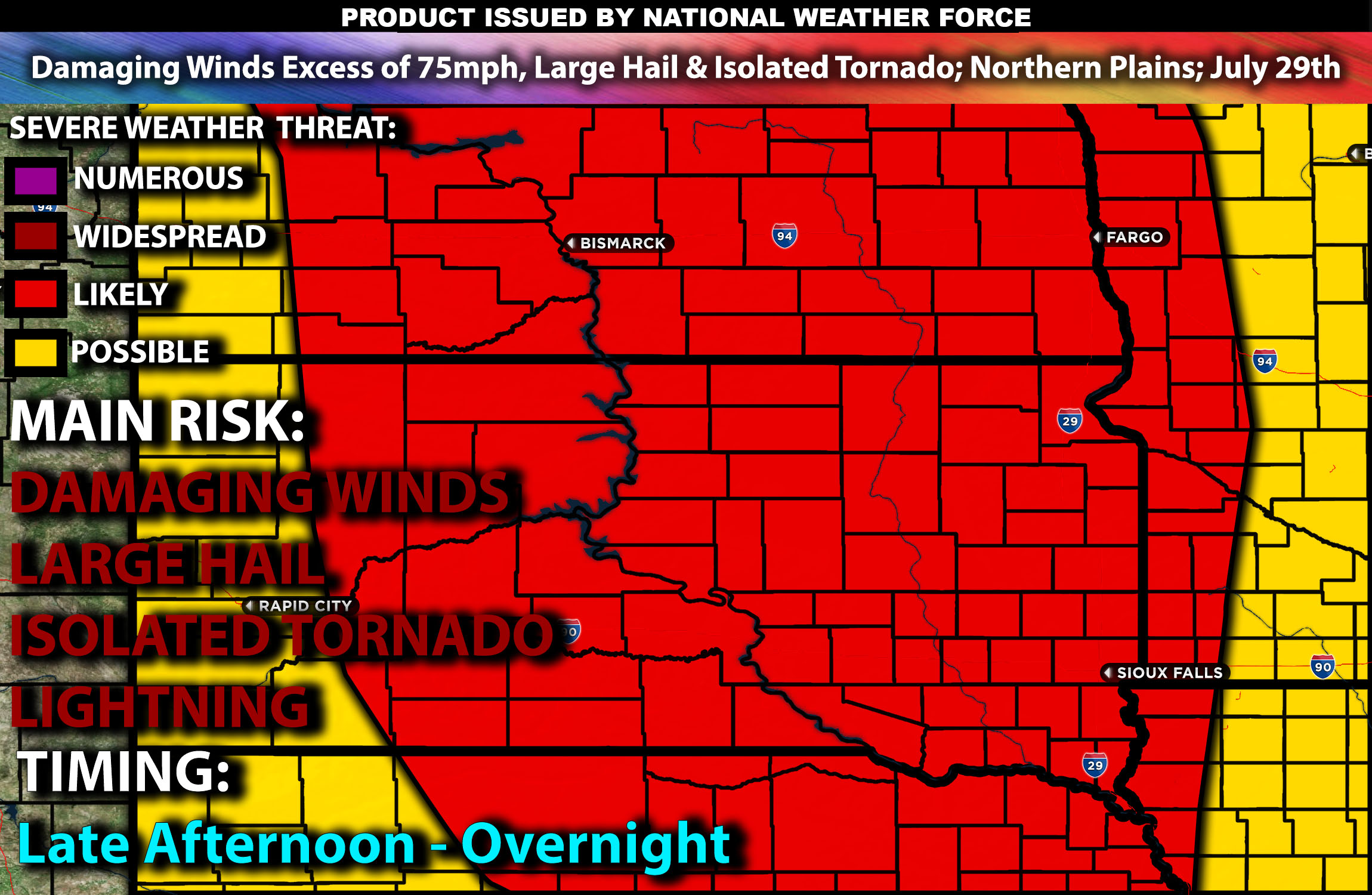
Brief Outlook:
Severe thunderstorms are expected across parts of North Dakota, South Dakota, and Nebraska from the late afternoon into the evening with a few cells lingering into the overnight hours. Storms will be capable of producing mainly damaging winds, large hail, and perhaps an isolated tornado. Check below for further details on the outlook.
Region Impacted: Northern Plains
States and Cities Impacted: North Dakota (Bismarck, Fargo), South Dakota (Sioux Falls, Rapid City), Nebraska (Omaha, Lincoln).
Upper-Level Dynamics:
A broad upper trough with multiple embedded shortwaves will remain over the northern Rockies into the northern Plains. This system will enhance mid-level flow, resulting in strong vertical wind shear, with values around 40-50 knots in the 0-6 km layer. This setup will support the development of organized storm structures, including supercells capable of producing all hazard types but mainly large hail and damaging winds with cluster of storms.
Surface Conditions:
At the surface, instability values are expected to reach 2000-3000 J/kg across parts of North Dakota, South Dakota, and Nebraska. Low-level moisture with surface dewpoints in the mid to upper 60s will contribute to the instability. Strong effective shear will support supercell development, while steep mid-level lapse rates will promote strong updrafts. Storms are expected to be initially discrete before potentially forming clusters or lines, capable of producing large hail and damaging winds. A few clusters may also produce wind gusts of up to 75 mph. Isolated tornadoes are possible due to the favorable shear profiles, but they are not the main risk.
Timing:
Storms are expected to initiate by late afternoon in eastern South Dakota and move into Nebraska and North Dakota by early evening, potentially continuing through the late evening. Peak activity will likely occur from late afternoon through the evening, with the most severe storms occurring during this period. Some of these cluster of storms may produce very strong wind gusts over 75mph as well during the evening. A few storms may also continue to linger into the overnight hours as well. The storms are expected to weaken by this time as they move into less favorable conditions.
Main Impact: damaging winds, large hail, isolated tornadoes and lightning.
Stay tuned for more updates.
Sina⚡⚡
Managing Partner and Lead Forecaster of NWF Innovations & NWF Networks