Brief Outlook:
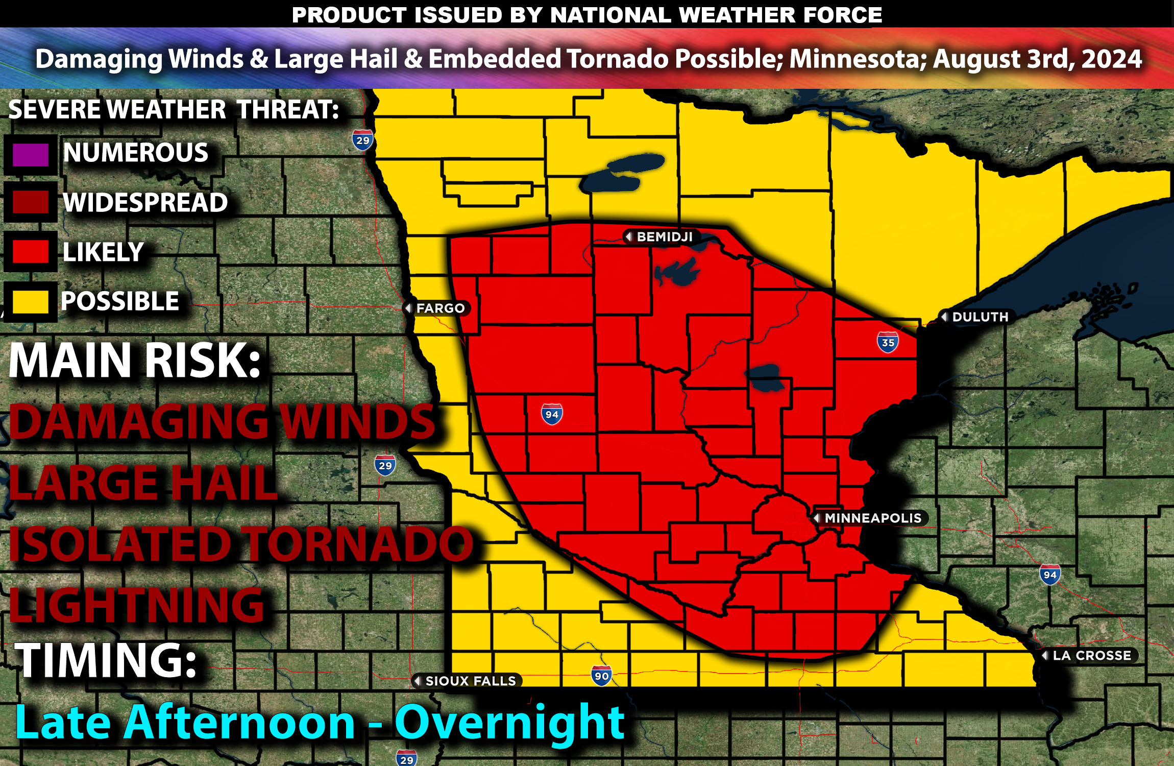
Severe thunderstorms are expected in parts of Minnesota and portions of eastern South Dakota from the afternoon into the late evening with a few storms lingering into the night. The risk with these storms will be damaging winds, large hail, and perhaps isolated tornadoes if ingredients can align (although not the main risk). Check below for further details on timing and location.
Region Impacted: Minnesota and Portions of Eastern South Dakota
States and Cities Impacted: Minnesota (Minneapolis, Duluth, St. Cloud).
Upper-Level Dynamics:
Fast northwest flow aloft across the northern Plains will maintain steep mid-level lapse rates and occasional minor perturbations in the flow through the forecast period across the Dakotas and Minnesota. One such feature has helped to initiate scattered thunderstorms over northern Minnesota this morning. This activity will likely increase in coverage by mid-afternoon and build southwestward into the very moist and unstable air mass over central Minnesota. Enhanced wind shear, with values around 35-45 knots in the 0-6 km layer, will support organized storm structures, including supercells although mainly as a cluster as the collide.
Surface Conditions:
At the surface, instability values are expected to reach 2000-3000 J/kg, particularly across central Minnesota and eastern South Dakota. Low-level moisture with surface dewpoints in the mid to upper 60s will contribute to this instability. Effective shear will support supercell development, while steep mid-level lapse rates will promote strong updrafts. Storms are expected to initially be discrete before potentially forming clusters or lines, capable of producing large hail and especially damaging winds. Isolated tornadoes are also possible due to slight favorable shear profiles but definitely not the main risk. Main risk with these storms as they bow out will be damaging winds especially across south central MN.
Timing:
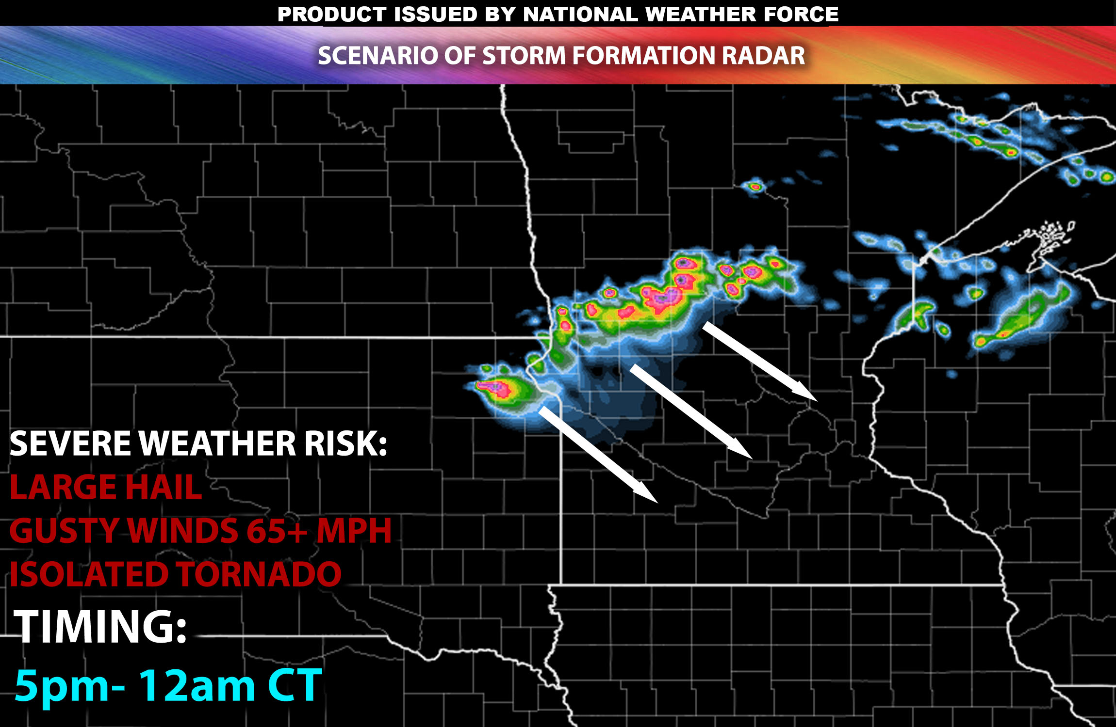
Storms are expected to initiate by mid to late afternoon in northern Minnesota, moving into central Minnesota and eastern South Dakota by late afternoon and early evening and eventually moving south southeastward across the rest of MN with the main risk being damaging winds. Peak activity will likely occur from late afternoon through the late evening, with the most severe storms expected during this period of time. The storms are expected to weaken overnight as they move into less favorable conditions.
Future Radar Scenario:

Main Impact: damaging winds, large hail, isolated tornado and lightning.
Stay tuned for more updates.
Sina⚡⚡
Managing Partner and Lead Forecaster of NWF Innovations & NWF Networks
Our fully integrated private weather offices, the first of their kind, issue weather watches and advisories to the public. Like or follow us, and the newsfeed will target your area.
For more information and services, visit our redesigned website for micro-climate options and personalized alerts: More Info
