
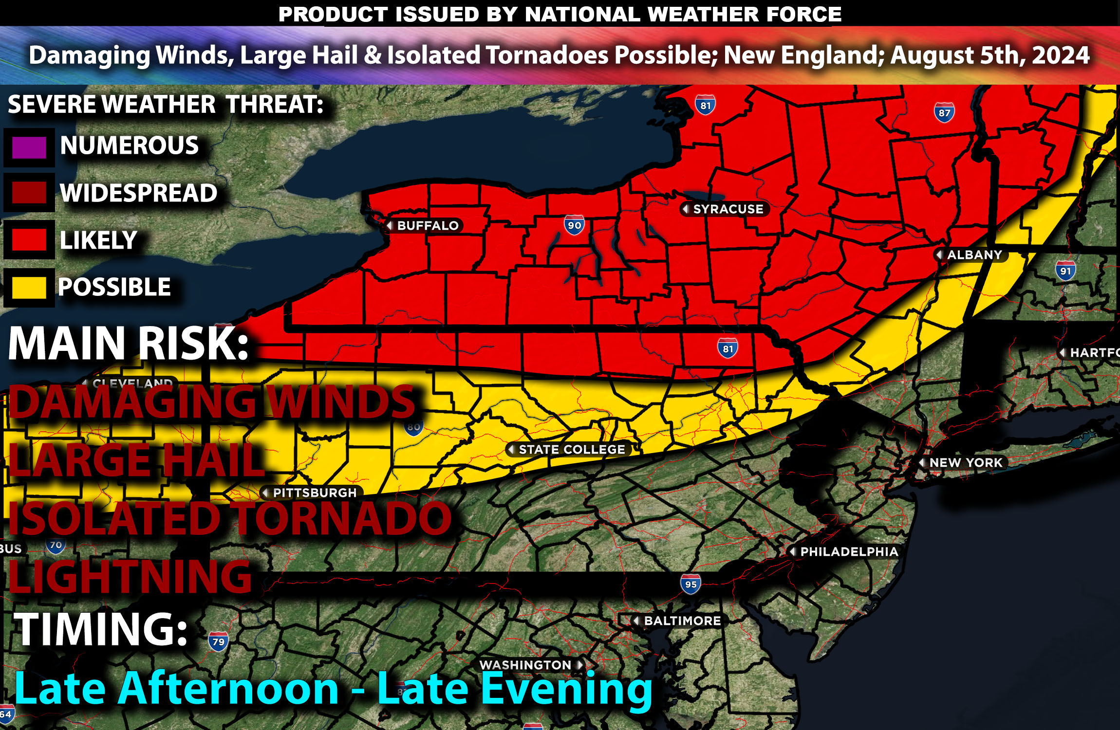
Brief Outlook:
Severe thunderstorms are expected in the Northern Ohio Valley, particularly from Ohio to New England, from the afternoon into the evening. The main risk with these storms will be damaging winds, large hail, and isolated tornadoes. Check below for further details on timing and much more.
Region Impacted: Northern Ohio Valley
States and Cities Impacted: Ohio (Columbus, Cleveland), Pennsylvania (Pittsburgh, Philadelphia), New York (Buffalo, Albany).
Upper-Level Dynamics:
A slow-moving upper trough will impact the Northeast and Mid-Atlantic, bringing enhanced southwesterly flow. This setup will result in wind shear values around 30-40 knots in the 0-6 km layer, supporting organized storm structures, including supercells.
Surface Conditions:
At the surface, instability values are expected to reach 1500-2500 J/kg. Dewpoints in the mid to upper 60s will contribute to significant instability. Effective shear will support supercell development, while moderate mid-level lapse rates will promote strong updrafts. Storms are expected to be initially discrete, with a potential transition to clusters or lines, capable of producing large hail and damaging winds. Isolated tornadoes are possible, especially in regions with enhanced shear (but not the main risk).
Timing:
Thunderstorms are expected to initiate by mid to late afternoon in Ohio, moving into Pennsylvania and New York portions by early evening with a few cells lingering into the overnight hours. Peak activity will likely occur from late afternoon through the late evening, with the most severe storms expected during this period of time.
Main Impact: damaging winds, isolated tornado and lightning.
Stay tuned for more updates.
Sina⚡⚡
Managing Partner and Lead Forecaster of NWF Innovations & NWF Networks