
 Brief Outlook:
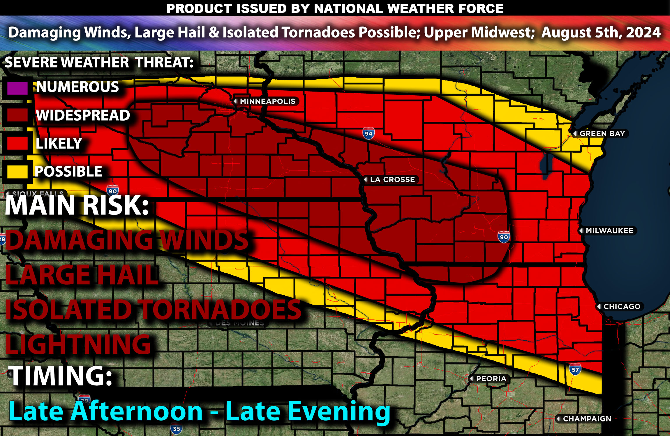
Severe thunderstorms are likely in the Upper Midwest from the late afternoon into the evening of Monday. The main risk with these storms will be damaging winds, large hail, and isolated tornadoes. Check below for further details on timing and much more.
Region Impacted: Upper Midwest
States and Cities Impacted: Minnesota (Minneapolis, Duluth), Wisconsin (Madison, Green Bay), Illinois (Chicago), Iowa (Des Moines, Cedar Rapids).
Upper-Level Dynamics:
A broad upper trough will influence the Upper Midwest, bringing enhanced mid-level flow. This will interact with surface low pressure moving across the Dakotas into Minnesota. Wind shear values are expected to be around 40-50 knots in the 0-6 km layer, which will support organized storm structures, including supercells.
Surface Conditions:
At the surface, a warm front extends east-southeastward from the low across central Iowa. In this area, instability values are expected to reach 2000-3000 J/kg given the dynamics. Low-level moisture with surface dewpoints in the upper 60s to low 70s will contribute to this instability. Effective shear will support supercell development, while moderate mid-level lapse rates will promote strong updrafts. Storms are expected to be initially discrete before potentially forming clusters or lines, capable of producing large hail and damaging winds. Isolated tornadoes are possible due to the favorable shear profiles, especially across the southern portion of Minnesota extending to the southern portion of Wisconsin during the late evening.
Timing:
Storms are expected to initiate by late afternoon in Minnesota and portions of southwestern WI, moving into central/southeastern Wisconsin. By the late evening storms are also expected to start initiating across northeastern Iowa with storms also reaching Chicago IL during late evening hours. Peak activity will likely occur from late afternoon through the late evening, with the most severe storms expected during this period. The storms are expected to weaken by late evening/overnight as they move into less favorable conditions.
Future Radar Scenario:
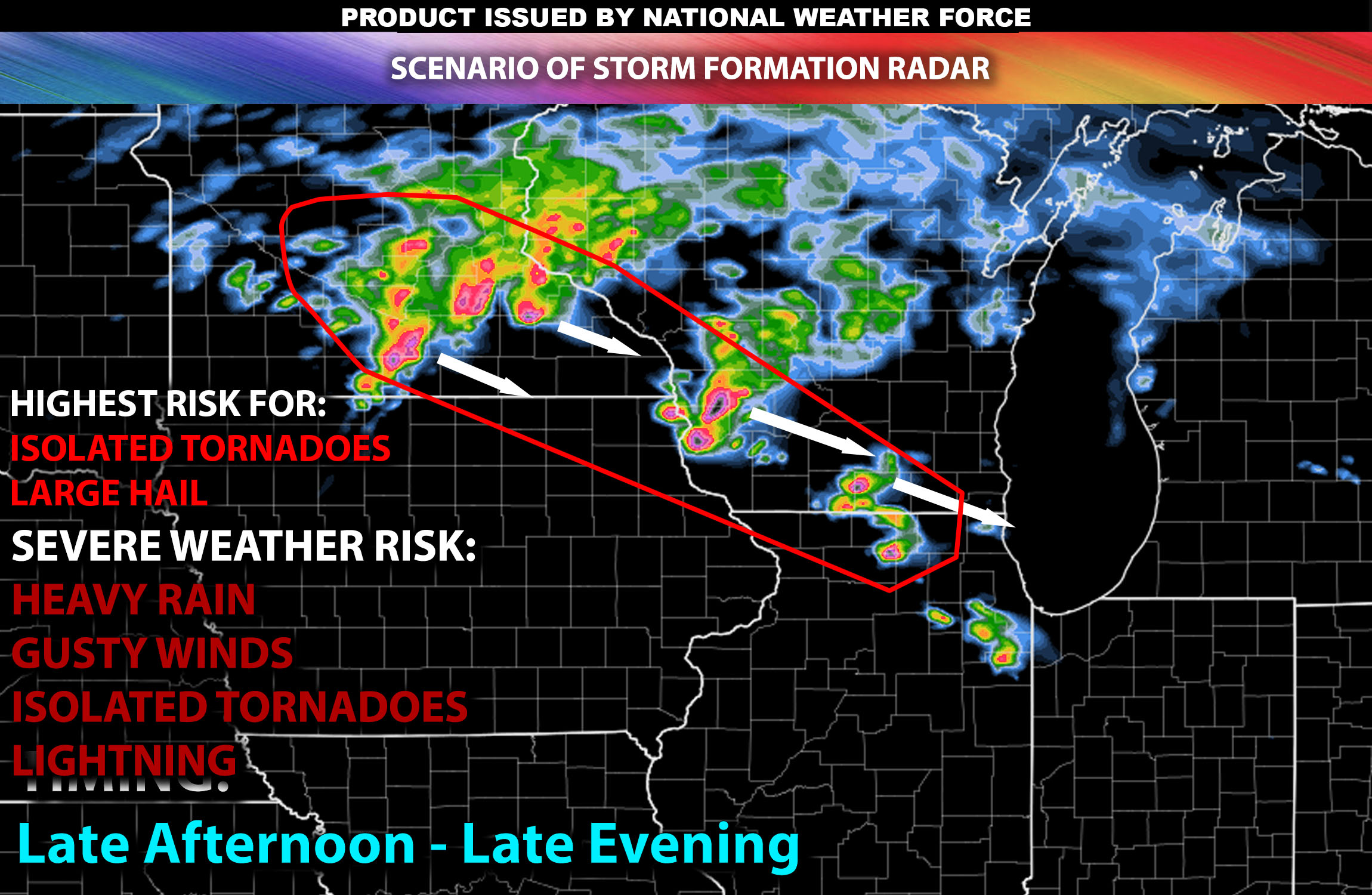
Main Impact: large hail, damaging winds, isolated tornadoes and lightning.
Stay tuned for more updates.
Sina⚡⚡
Managing Partner and Lead Forecaster of NWF Innovations & NWF Networks