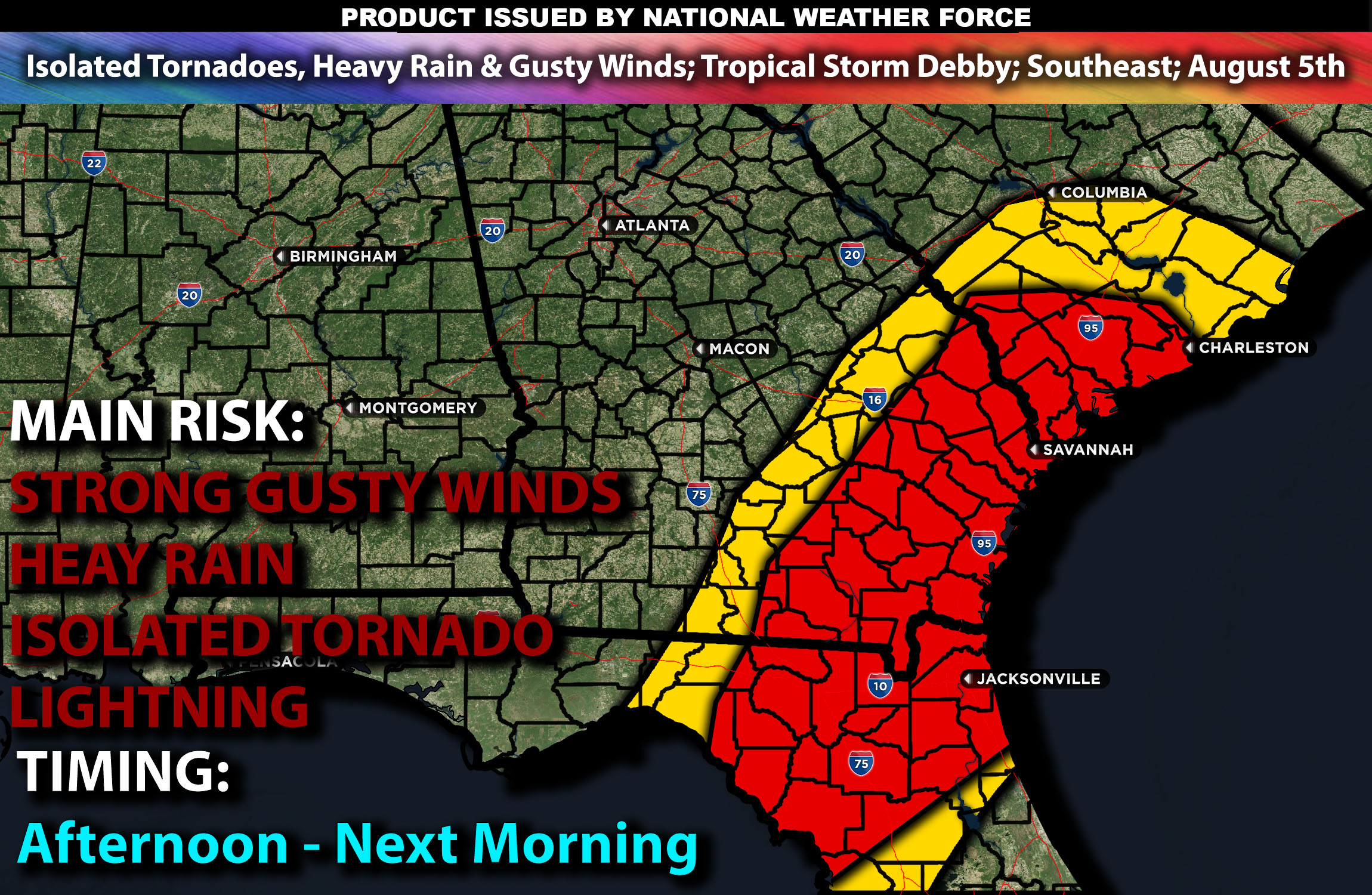
Brief Outlook:
Severe thunderstorms are expected in northern Florida, southern Georgia, and far southern South Carolina due to Tropical Storm Debby. These storms with rain bands will be capable of producing heavy rain, gusty winds, and possible isolated tornadoes. Check below for further details on timing and much more.
Region Impacted: Northern Florida into Southern Georgia and Far Southern South Carolina
States and Cities Impacted: Florida (Jacksonville, Tallahassee), Georgia (Savannah, Valdosta), South Carolina (Charleston, Hilton Head Island).
Upper-Level Dynamics:
The interaction between Tropical Storm Debby and an upper-level trough will bring enhanced southwesterly flow across the region. This setup will result in wind shear values around 25-35 knots in the 0-6 km layer, supporting organized storm structures within the rain bands of the tropical system.
Surface Conditions:
At the surface, instability values are expected to reach 1500-2500 J/kg across the region. Dewpoints in the low 70s will contribute to significant instability. The tropical storm will bring enhanced low-level shear, contributing to the potential for tornadoes within the storm’s rain bands. Moderate mid-level lapse rates will promote strong updrafts. Rain bands from the tropical system will produce heavy rain, gusty winds, and isolated tornadoes.
Timing:
The outer rain bands of Tropical Storm Debby are expected to begin impacting northern Florida by early afternoon, moving into southern Georgia and far southern South Carolina by late afternoon/evening hours of Monday. As it continues to spin northeastward, each band will bring the risk for heavy rainfall, gusty winds and brief potential tornado with isolated tornadoes being a risk throughout the day.
Main Impact: gusty winds, isolated tornado and lightning.
Stay tuned for more updates.
Sina⚡⚡
Managing Partner and Lead Forecaster of NWF Innovations & NWF Networks
