
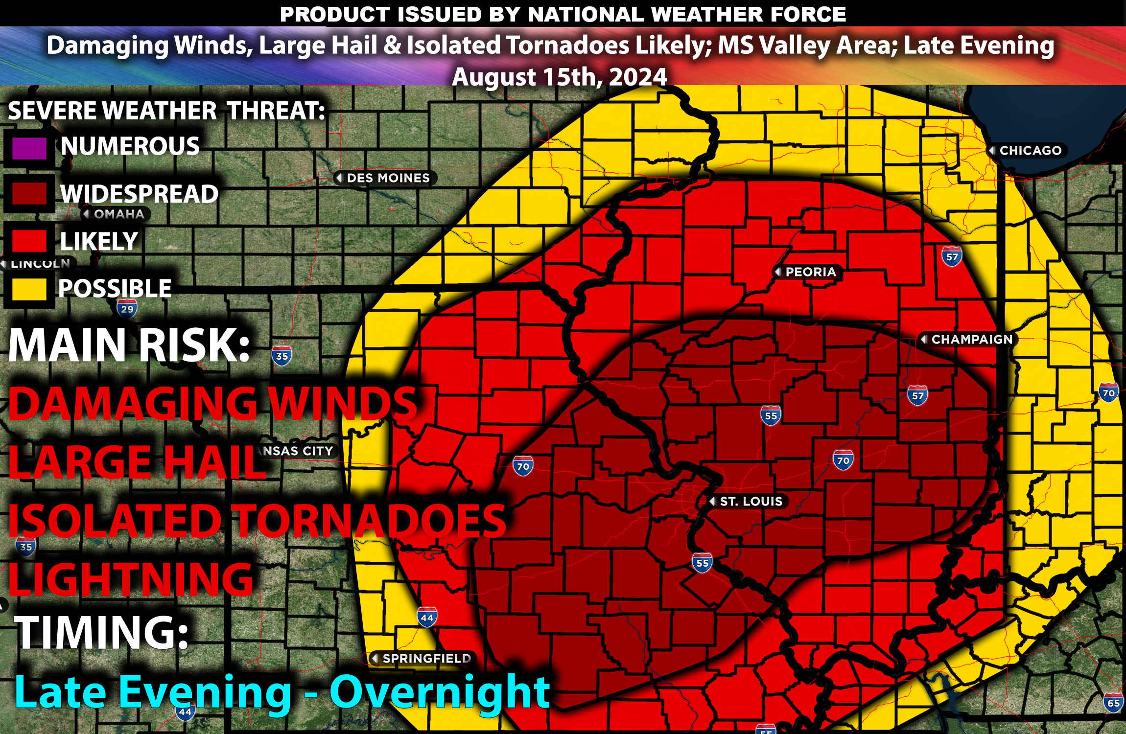
Brief Outlook:
Scattered strong to severe thunderstorms are expected across parts of the Mississippi Valley, especially impacting eastern Missouri, western Illinois, and western Kentucky, from Thursday late evening into the overnight hours. Main Impact: Damaging winds, large hail, and isolated tornadoes. Check below for further details.
Region Impacted: Mississippi Valley
Upper-Level Dynamics:
A mid to upper-level trough will gradually amplify over the Upper Midwest, transitioning into a closed upper low. As this trough deepens, mid-level westerly flow is expected to intensify across the east-central Plains into the mid-Mississippi Valley, creating favorable conditions for severe thunderstorm development. Enhanced wind shear, with values around 30-45 knots, will support the organization of supercells and other severe storm structures.
Surface Conditions:
At the surface, instability values are expected to reach 2500-4000+ J/kg across the Mississippi Valley, driven by hot temperatures and rich low-level moisture, with dewpoints in the upper 60s to mid-70s. This combination will create a highly unstable environment, conducive to severe thunderstorms. The cold front moving southeastward, along with any remnant outflow boundaries from earlier storms, will serve as focal points for new thunderstorm development. The initial storms could be discrete supercells capable of producing large hail and isolated tornadoes. As these storms evolve, they may merge into clusters or lines, with damaging winds becoming the primary threat by overnight.
Timing:
Thunderstorms are expected to initiate by late evening, becoming severe quickly (around 5-7 PM CDT) in eastern Missouri, with cells also rapidly developing across southern Missouri. Activity will gradually increase over time, eventually spreading into western and southern Illinois overnight, with a few storms impacting the Chicago vicinity past midnight. Additionally, storm clusters are expected to reach western Kentucky a few hours after midnight. Peak intensity will likely occur from late evening through the overnight hours, with the most severe storms expected during this period. The storms are likely to weaken gradually overnight into early morning as they move eastward.
Future Radar Scenario:
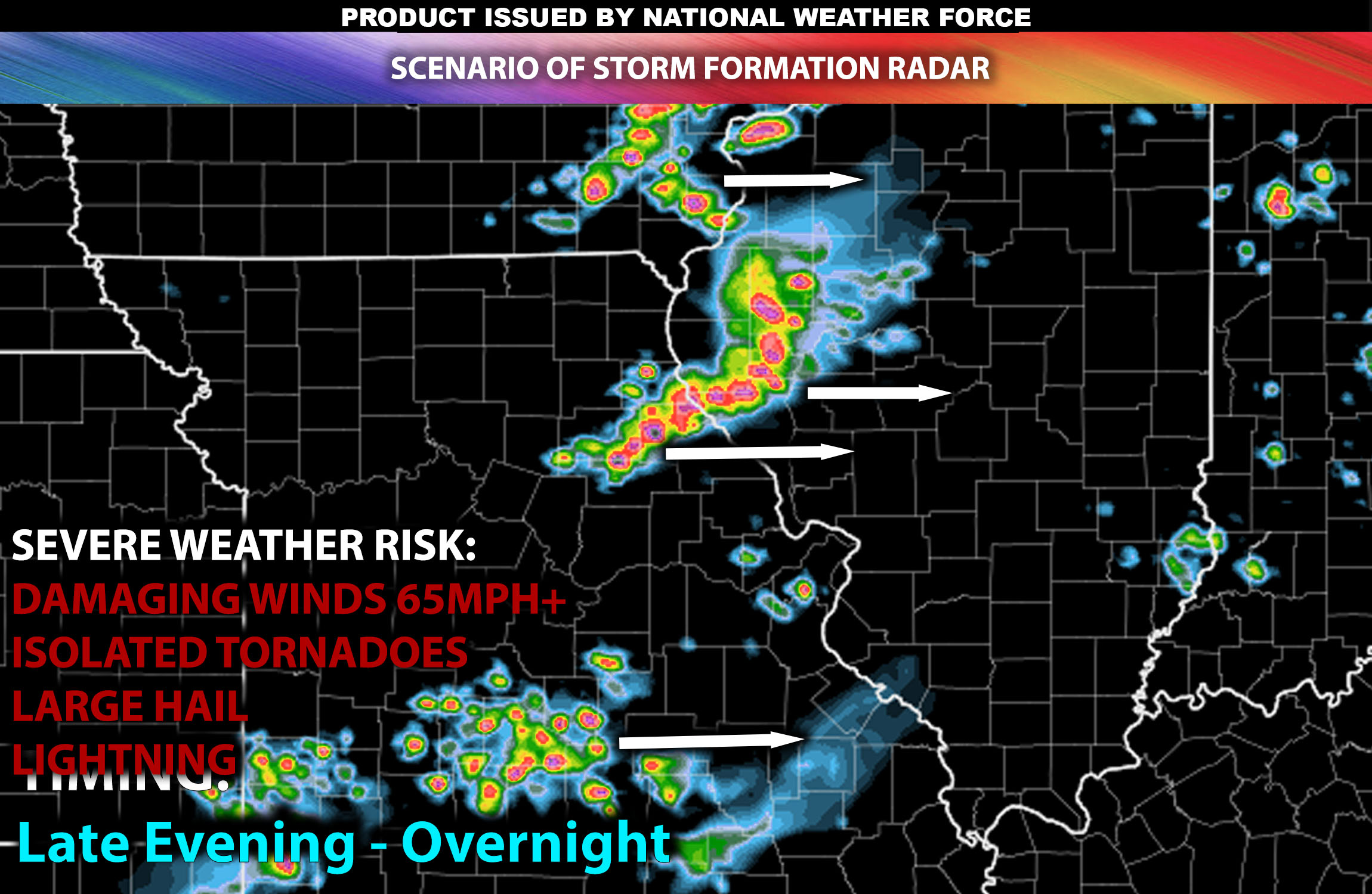
Main Impact: damaging winds, large hail, isolated tornado and lightning.
Stay tuned for more updates.
Sina⚡⚡
Co-Owner/CTO and Lead Forecaster of NWF Innovations & NWF Networks