Brief Outlook:
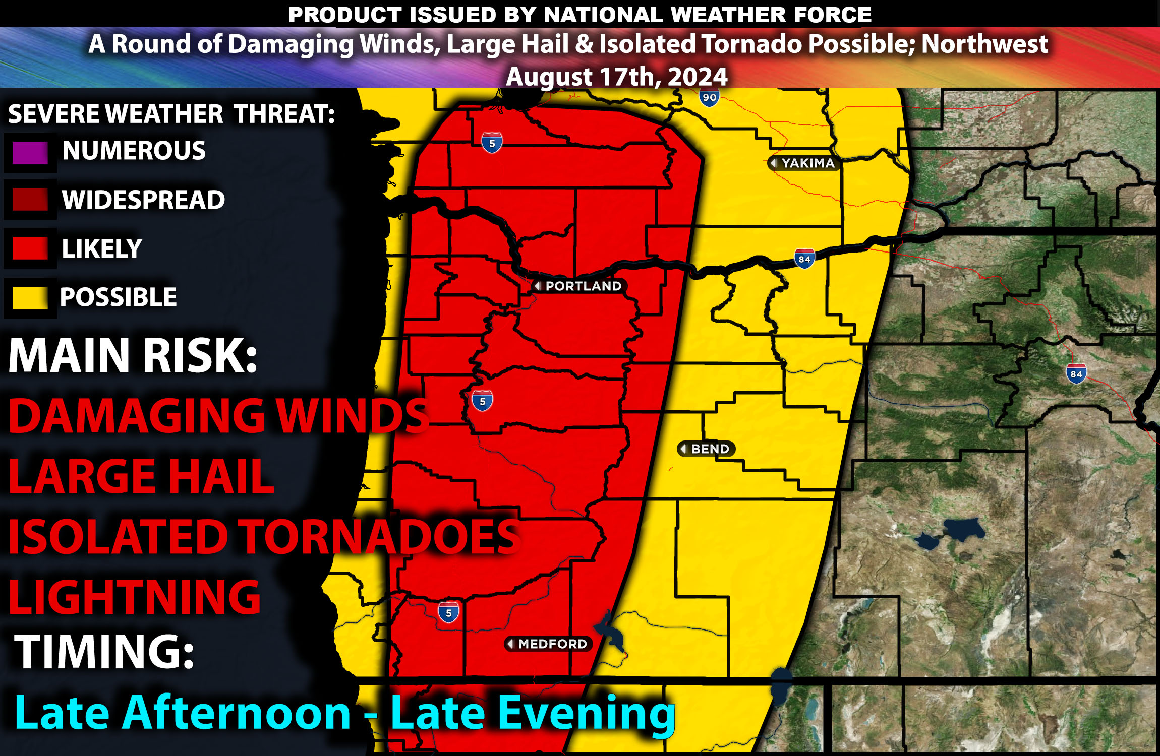
Scattered thunderstorms are anticipated across parts of northern California, Oregon, and Washington today, particularly affecting the Cascades and coastal ranges. These storms will be capable of producing strong winds, hail, and localized flash flooding, with a few storms possibly becoming severe capable of producing microbursts/large hail. Check below for further details on forecast details, timing and more.
Region Impacted: Northern California, Oregon, and Washington
Upper-Level Dynamics:
A strong shortwave trough is moving quickly toward the coast of northern California. As this feature progresses inland, it will significantly impact the Cascades region this afternoon and evening. The trough will enhance lift and increase wind speeds aloft, particularly in the mid-levels, where winds could reach 30-40 knots. This setup is favorable for the development of scattered thunderstorms, some of which could become organized and severe, especially as they move northward into Oregon and Washington.
Surface Conditions:
At the surface, instability values are expected to reach 700-1000 J/kg due to the combination of daytime heating and adequate moisture. Although these values are modest, the presence of steep mid-level lapse rates will contribute to strong updrafts within the developing storms. Effective shear is expected to support the formation of supercells, particularly in Oregon and Washington, where the strongest storms could produce large hail and damaging wind gusts. Additionally, localized flash flooding could occur in areas with slower-moving storms, especially in regions with complex terrain.
Timing:
Thunderstorms are expected to initiate by early afternoon over the mountains and coastal ranges of northern California, spreading quickly northward into southern and central Oregon by late afternoon. By early evening, these storms will likely continue moving into Washington, with peak intensity expected from late afternoon through the evening. The strongest storms will occur during this period, with activity gradually weakening overnight as the push into WA as the atmosphere stabilizes.
Main Impact: localized large hail, damaging gusty winds, isolated tornado and lightning.
Stay tuned for more updates.
Sina⚡⚡
Co-Owner/CTO and Lead Forecaster of NWF Innovations & NWF Networks
