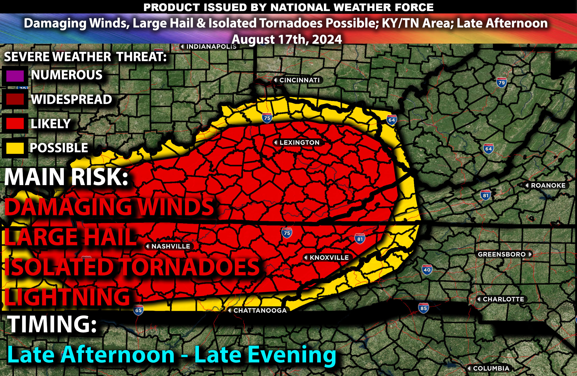
Brief Outlook:
Scattered severe thunderstorms are expected across parts of Kentucky and Tennessee, particularly impacting cities such as Louisville, Lexington, and Nashville, from Saturday afternoon into the evening. These storms are capable of producing damaging winds, large hail, and isolated tornadoes.
Region Impacted: Mississippi Valley (Kentucky and Tennessee)
Upper-Level Dynamics:
A mid to upper-level trough will deepen as it moves over the Upper Midwest and Ohio Valley, leading to increased mid-level westerly winds across Kentucky and Tennessee. These strong westerlies, ranging from 35-40 knots, will create a highly favorable environment for severe weather development, especially during the afternoon and evening hours. The dynamics at play will support the development of supercells and organized storm clusters capable of producing large hail and damaging winds.
Surface Conditions:
At the surface, instability values are expected to reach 1600-2500 J/kg due to hot temperatures and ample moisture, with dewpoints in the upper 60s to low 70s. This will create an unstable atmosphere across the region, conducive to robust thunderstorm development becoming severe quickly. At the same time in the surface, a cold front moving southeastward across the area, combined with local outflow boundaries from earlier convection, will serve as triggers for storm initiation along this unstable airmass. The initial storms are likely to be discrete supercells, which could produce large hail and isolated tornadoes. As the evening progresses, these storms will move east quickly dissipating in the late evening.
Timing:
Thunderstorms are expected to initiate by mid to late afternoon (around 3-5 PM ET) in central/eastern Kentucky and central towards eastern Tennessee, with activity spreading eastward into the evening. Peak intensity is expected from late afternoon through the evening, with the most severe storms likely during this period. The storms are expected to weaken gradually as they move eastward, dissipating by late evening as the atmosphere restabilizes.
Main Impact: damaging winds, large hail, isolated tornado and lightning.
Stay tuned for more updates.
Sina⚡⚡
Co-Owner/CTO and Lead Forecaster of NWF Innovations & NWF Networks
