
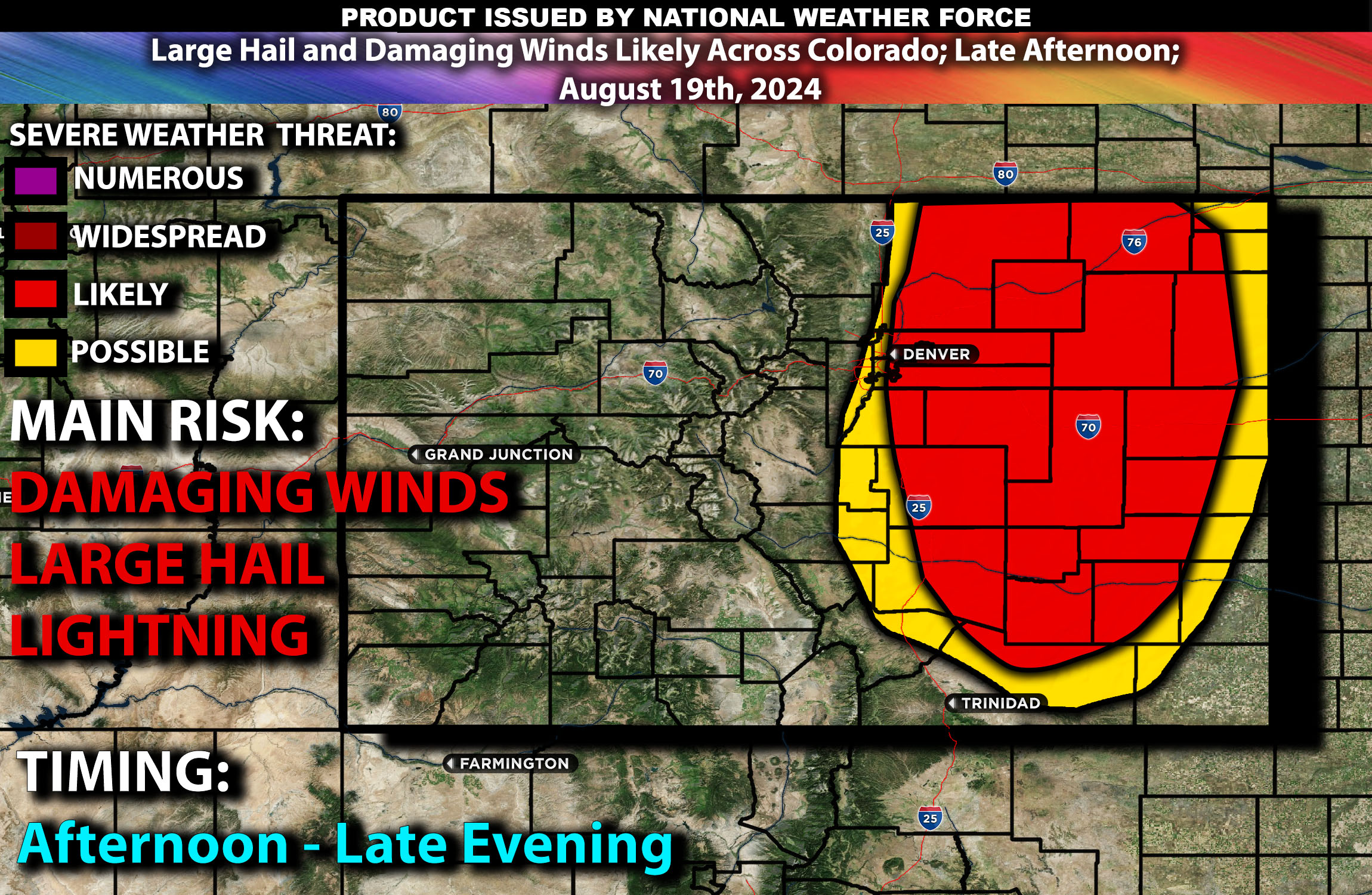
Brief Outlook:
Scattered thunderstorms are expected across parts of Colorado today, particularly in the central and eastern regions, including areas such as Denver, Colorado Springs, and Fort Collins. These storms will be capable of producing damaging winds and large hail mainly given the ingredients present.
Region Impacted: Central and Eastern Colorado
Upper-Level Dynamics:
A mid-level shortwave trough moving across the central Rockies will provide the necessary lift for thunderstorm development this afternoon and evening. Enhanced mid-level flow, with winds of 25-35 knots, will aid in storm organization. These upper-level conditions are conducive to the development of scattered thunderstorms, some of which could become severe as they move eastward across the state.
Surface Conditions:
At the surface, instability values are expected to reach 1500-2500 J/kg across the eastern plains of Colorado, driven by strong surface heating and adequate moisture. Dewpoints in the mid 50s will contribute to a moderately unstable atmosphere. Effective shear will support the initial development of discrete storms, which may then organize into clusters or lines as they progress. The steep mid-level lapse rates will promote strong updrafts, enhancing the potential for large hail and damaging winds. While the primary threats will be hail and strong winds, isolated instances of flash flooding may occur in areas where storms train over the same locations. The tornado risk is very low given the lack of ingredients present in terms of low-level shear.
Timing:
These storms are expected to initiate by early to mid-afternoon (1-2pm MT) across the central Rockies, with activity spreading into eastern Colorado by late afternoon. Peak intensity will likely occur from late afternoon through the evening, with the strongest thunderstorms expected during this period. The storms are likely to weaken gradually by late evening as the atmosphere stabilizes.
Main Impact: localized large hail, damaging gusty winds and lightning.
Stay tuned for more updates.
Sina⚡⚡
Co-Owner/CTO and Lead Forecaster of NWF Innovations & NWF Networks