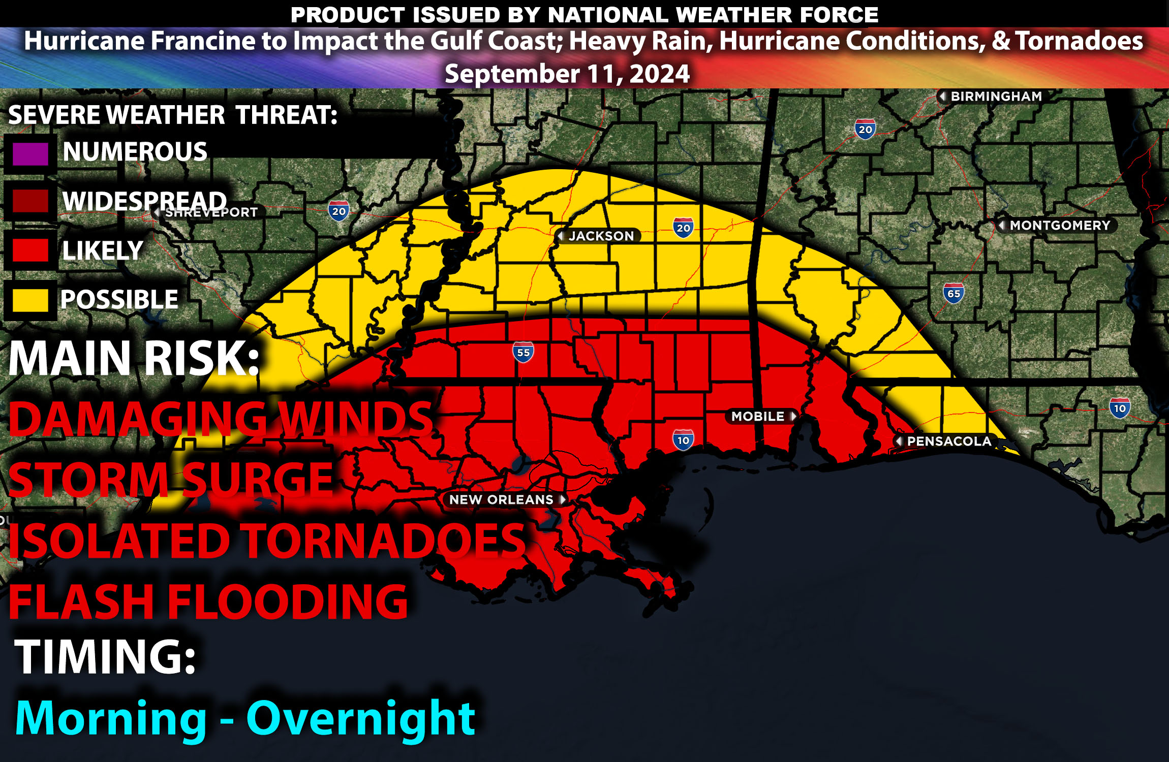
Brief Outlook:
Hurricane Francine is expected to bring significant impacts to coastal Louisiana and southern Mississippi, with hurricane-force winds, heavy rain, and isolated tornadoes. The main impact will be hurricane-force winds, dangerous storm surge, torrential rainfall, and isolated tornadoes along the Gulf Coast.
Region Impacted: Coastal Louisiana and Southern Mississippi
Upper-Level Dynamics:
Hurricane Francine is being influenced by a broad upper-level trough, enhancing wind shear across Louisiana and Mississippi. The interaction between this trough and the hurricane will provide favorable conditions for the development of isolated tornadoes, particularly in the outer rain bands of the storm. As the storm continues its approach, strong winds aloft and upper-level divergence will help intensify thunderstorm activity in the surrounding region.
Surface Conditions:
At the surface, instability values will remain moderate, with deep tropical moisture moving inland from the Gulf of Mexico. Effective shear, enhanced by the circulation of Hurricane Francine, will create an environment conducive to tornado formation, especially in coastal areas. Low-level shear will be highest near the coast, increasing the tornado threat in Louisiana and southern Mississippi. In addition to the tornado risk, hurricane-force winds will result in dangerous storm surge levels along the coast, with localized areas potentially seeing several feet of water inundation. Rainfall totals are expected to exceed 5 inches, leading to flash flooding, particularly in low-lying areas.
Timing:
Conditions will begin to deteriorate by early morning as the outer rain bands of Hurricane Francine move inland. The most severe weather, including hurricane-force winds, heavy rain, and isolated tornadoes, is expected from late morning into the afternoon, particularly as the storm nears landfall. Storm surge and hurricane conditions will continue into the evening and overnight hours, with peak intensity occurring during the afternoon and early evening.
Main Impact: hurricane-force winds, storm surge, heavy rainfall, and isolated tornadoes near the outer rain bands.
Stay tuned for more updates.
Sina⚡⚡
Co-Owner/CTO and Lead Forecaster of NWF Innovations & NWF Networks
