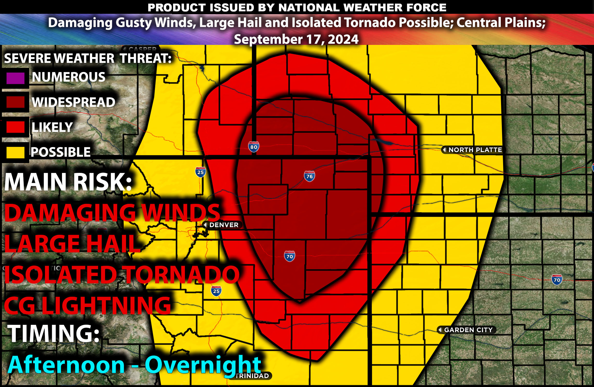
Brief Outlook:
Severe thunderstorms capable of producing damaging winds and isolated large hail are expected across parts of the Central Plains this afternoon and evening. Areas of northeastern Colorado, western Nebraska, and northwestern Kansas are most at risk, with wind gusts exceeding 70 mph possible. The main risk for these storms will be strong winds potentially violent, isolated large hail, perhaps an isolated tornado although low risk.
Detailed Forecast:
A mid-level low will move across the Intermountain West today, accompanied by a negatively tilted upper-level trough. A 50-70 knot mid-level jet will intensify as it moves into the Central Rockies. This system will drive large-scale ascent, contributing to thunderstorm development across the Central and Northern High Plains during the afternoon and evening hours. Expect significant wind shear and strong storm organization across these regions due to the approaching trough.
Surface Conditions: Instability values are forecasted to reach around 1500 J/kg, especially across northeastern Colorado into western Nebraska. Strong surface heating and moisture will lead to a deepening lee trough, which will help initiate convection. Effective shear values will support the development of organized storm systems, with initial supercells potentially transitioning into a line of storms capable of producing damaging winds. While the risk for tornadoes remains low, isolated large hail could occur with stronger storms, especially in areas where the lapse rates (change in temperature with height) are steepened by warmer surface temperatures.
Timing:
Thunderstorms are expected to initiate by early afternoon (2-4 PM CDT) in northeastern Colorado and western Nebraska, progressing eastward into northwestern Kansas by the late afternoon and evening. Peak activity is likely between 4-9 PM CDT, with storms at their most severe during this window. Expect a gradual weakening of storms as they move eastward into the evening, with storm threats diminishing by late night.
Main Impact: Severe wind gusts in excess of 70mph, isolated large hail, and damaging winds.
Stay tuned for more updates.
Sina⚡⚡
Co-Owner/CTO and Lead Forecaster of NWF Innovations & NWF Networks
