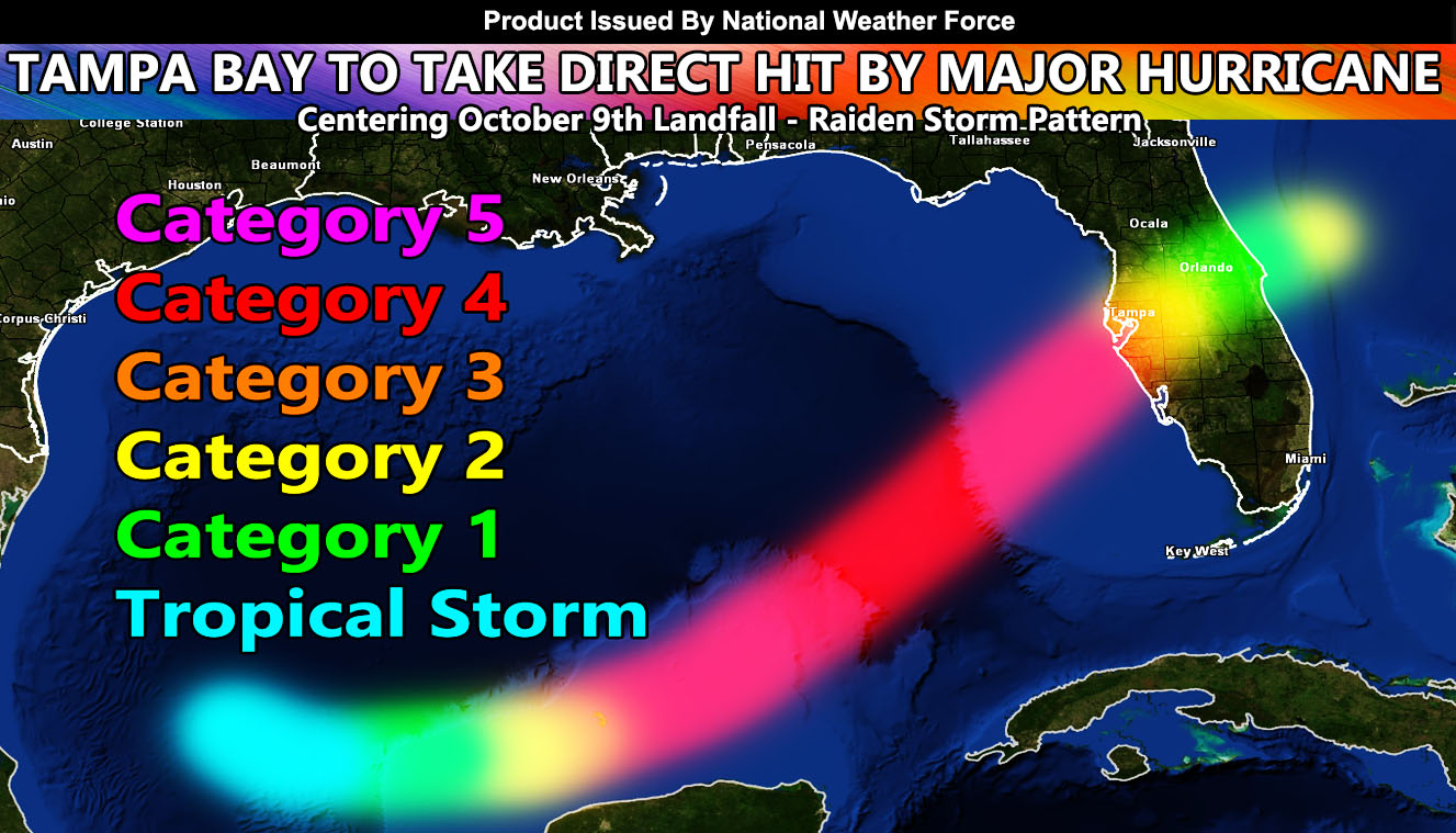
National Weather Force predicted back on September 28th that the Gulf of Mexico would have a hurricane threat. On October 5th, Tropical Storm Milton formed on time and the updated forecast from here stated that it would head to Tampa as a major hurricane. This last update will be the final forecast, without any changes as Tampa Bay is the dead center of this storm.
If you are in the Tampa Bay area, you need to either prepare and then leave, or enjoy your hurricane party on Wednesday, October 9th, 2024.
Latest tracks from here at National Weather Force has been issued, with Tampa Bay in an extremely bad area. Keep in mind that National Weather Force predicted Helene with tracking 3 days before it hit as a category four when others went category two. It is important that you ignore other forecasts saying this will hit south of Tampa Bay when it will not. The track is sealed, and I will not change what I have.
LONG RANGE: The Gulf of Mexico is not done yet. We have heatwaves in the Western United States, which means a ridge if there and a deep trough of low pressure is across the Eastern United States. Such patterns mean that another system is possible into the Gulf of Mexico once again after October 17th to the 25th.
So, you’ve had your warning ahead of time. Take it with what you will, I did my job. Good luck if you are in the path of Major Hurricane Milton.
These are Raiden Storm Patterns. A Raiden Storm Pattern means a prediction was made in the long range before any other source and bears the name of the discover.
Reference A Link – (October 5th call on Milton to Tampa) – https://www.nationalweatherforce.com/2024/10/05/florida-will-be-hit-by-a-major-hurricane-this-week-likely-by-wednesday-october-9th-2024/
Reference B Link – (September 28th call on system into the Gulf of Mexico) – https://www.nationalweatherforce.com/2024/09/28/long-range-weather-advisory-another-hurricane-threat-looms-for-the-gulf-states-the-weekend-of-october-5th-2024-details/
Raiden Storm
Master General Meteorologist

