
National Weather Force has issued a Tornado Watch effective early morning to later evening Wednesday, October 9th, 2024
Zones Affected: Western, Central, Eastern, and Southern Florida.
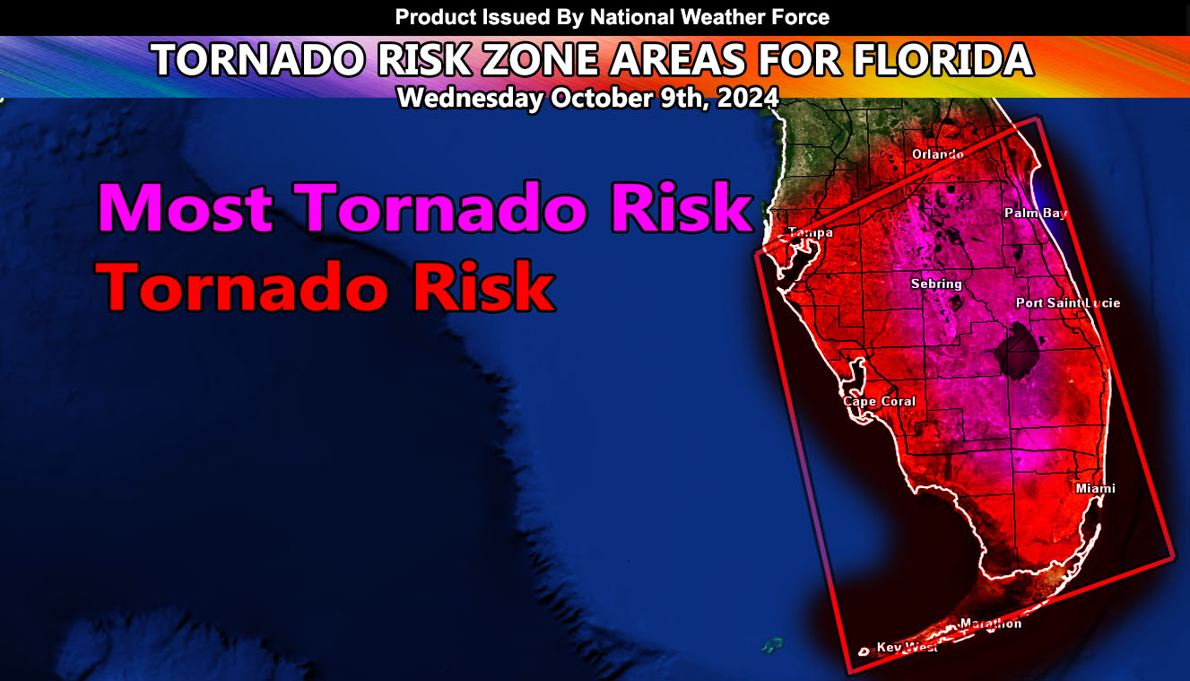
Official Discussion: Major Hurricane Milton has made the east-northeast turn away from the Yucatan Peninsula and is on its way for a Tampa Bay landfall tomorrow (Wednesday October 9th, 2024). This system will not only bring hurricane conditions to those areas, but areas far from the landfall point will also get in on severe weather. Calculations are that several outer bands will develop in Southern Florida early Wednesday morning and sweep northward from there throughout the day. These bands will be in a hostile environment that will have both instability, shear, and upper divergence (lift) for the risk of tornadoes in and around the watch area.
The magenta shaded zone is where the convergence will be the strongest, given the best chance of multiple tornadoes moving south to north during the watch period.
A Tornado Watch is issued here at National Weather Force when conditions are favorable for tornadoes to form in or around the watch area.
Those in the area should remain to whatever source you use for getting warnings from as National Weather Force does not issued warnings, only watches when needed. At this service, there is no waiting. If a threat is there, an alert is issued as I see fit, so heed any words I put as if you heard it on your local news. National Weather Force is the first private/commercial weather alert service that takes on issuing alerts when it is needed.
Raiden Storm
Master General Meteorologist