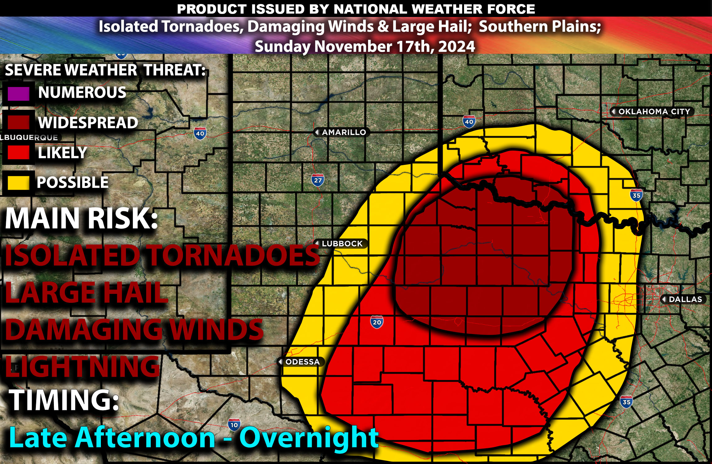
Brief Outlook:
For Sunday, November 17, 2024, parts of the Southern High Plains, particularly western, central, and northwest Texas, are anticipated to experience strong to severe thunderstorms. This is expected to develop from Sunday evening into the early hours of Monday, with risks including severe gusts and possibly a few tornadoes.
Upper Levels:
A mid-level trough will move into the area from northern Mexico, affecting the Southern High Plains by Sunday night. This movement is part of a larger upper-level low that will enhance large-scale atmospheric lifting over the region, creating favorable conditions for severe weather development.
Surface Forecast:
Strong moisture advection is anticipated ahead of the trough, with surface dew points rising into the 50s and 60s Fahrenheit across the region. This increase in moisture, coupled with the dynamic lift from the upper levels, will support the development of a large area of convection by early Sunday evening. The convection is expected to initiate from southeast New Mexico into far west and west-central Texas as a 40 to 50 knot low-level jet strengthens over the Southern High Plains. The expected MLCAPE (Mixed Layer Convective Available Potential Energy) values will range from 500 to 1000 J/kg, indicating sufficient energy for severe thunderstorm development.
Timing:
The thunderstorms are likely to start forming in the late evening and could persist into the night. The main convective activity is expected to evolve into a Mesoscale Convective System (MCS), with the potential for both linear and discrete super cellular storm modes. The severe threat is anticipated to continue throughout the night, with the strongest storms likely occurring between late evening and early morning.
Main impact:
The primary threats from these storms include severe wind gusts along the leading edge of the MCS and potential tornadoes from any discrete supercells that may develop ahead of the main line. The overall severe weather threat is expected to persist into the early morning hours of Monday.
Main impact: isolated tornadoes, damaging winds, large hail and lightning.
Stay tuned for more updates
Sina⚡⚡
Co-Owner/CIO and Lead Forecaster of NWF Innovations & NWF Networks; Founder of WeatherWise Innovations
