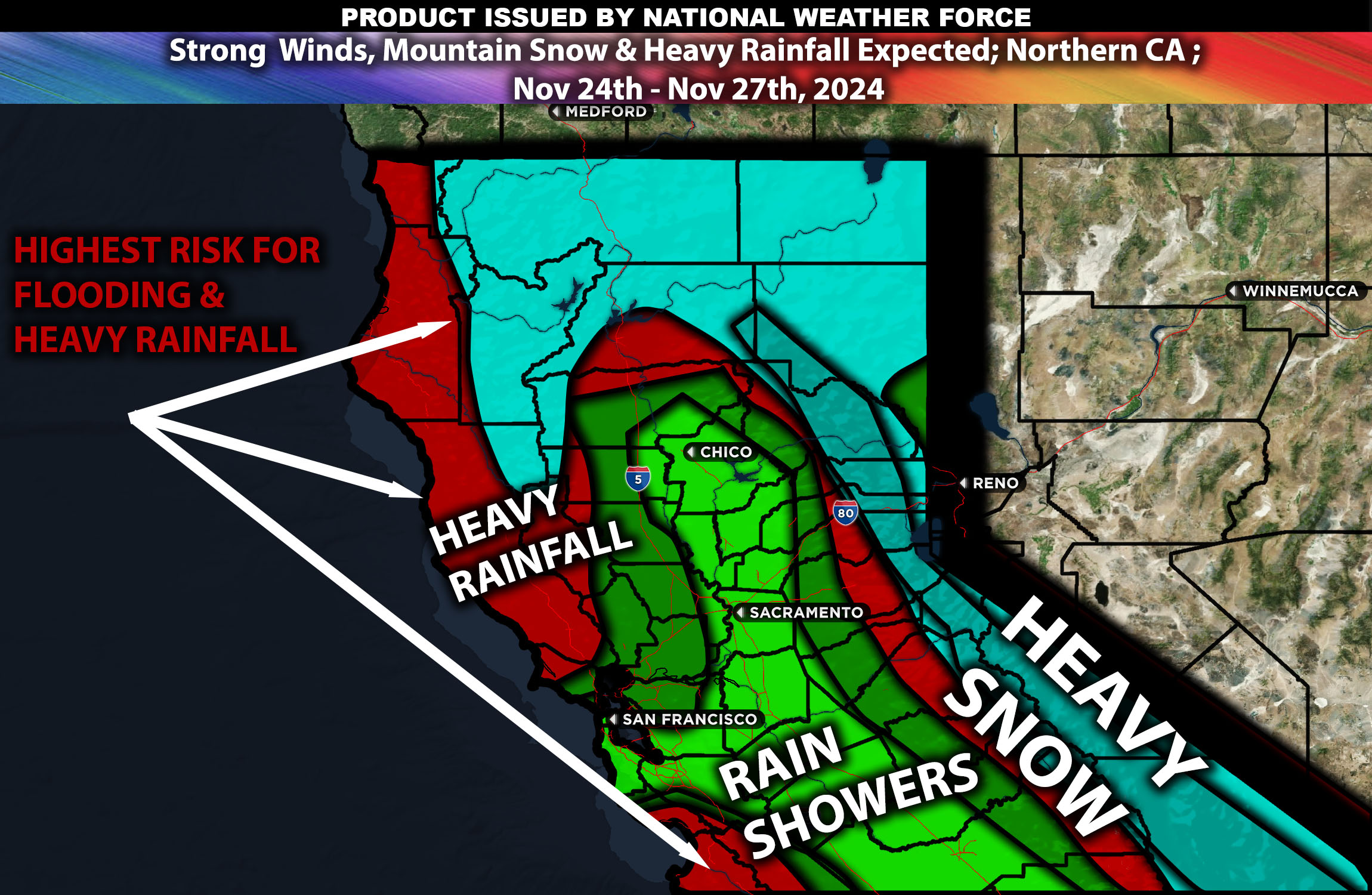
 Overall Forecast for Northern California: Northern California is poised to face another powerful storm system, with impacts expected to begin this evening. The region will experience a range of effects, from heavy precipitation and lower temperatures to strong winds and significant snowfall in the mountains. This weather pattern will significantly impact local climates, particularly in coastal and mountainous regions.
Upper-Level Forecast:
The region will experience significant upper-level atmospheric dynamics driven by a strong mid-level trough that will establish over Northern California. This trough, along with robust jet streams, will enhance the vertical movement of air and facilitate the formation of precipitation. These conditions are expected to contribute to heavy snowfall in the mountains and intense rainfall across broader areas.
Snow Forecast:
Mountainous Regions (Sierra Nevada and Siskiyou): These areas are forecasted to receive substantial snow accumulations, crucial for the regional water supply and winter recreational activities. The highest elevations could see several heavy snowfalls, particularly during the coldest periods of the season.
Upper Inland Areas: Lower elevations, especially those away from the coast, may experience intermittent snowfall, largely dependent on the penetration of colder air masses into the region.
Rainfall Forecast:
Coastal Areas: Heavy rainfall is anticipated, with totals possibly exceeding 2 to 3 inches in some locations, potentially leading to flooding during peak storm periods.
Inland Valleys: Areas like the Sacramento Valley will receive considerable rainfall as well, with amounts typically ranging from 1.5 to 2.5 inches, which may be higher locally.
Wind Forecast:
Coastal Regions: Expect high wind events with gusts potentially surpassing 40 mph during stronger storms, posing risks to driving conditions and coastal integrity.
Inland and Valley Areas: Wind gusts in these areas are likely to reach 25-40 mph during the peak of the storm, affecting tree stability and power lines.
Timing & Impact:
The system is predicted to bring heavy precipitation starting Sunday evening, peaking on Monday night, and continuing into Tuesday. Conditions should start to improve by late Wednesday.
Stay tuned for more updates.
-Sina
