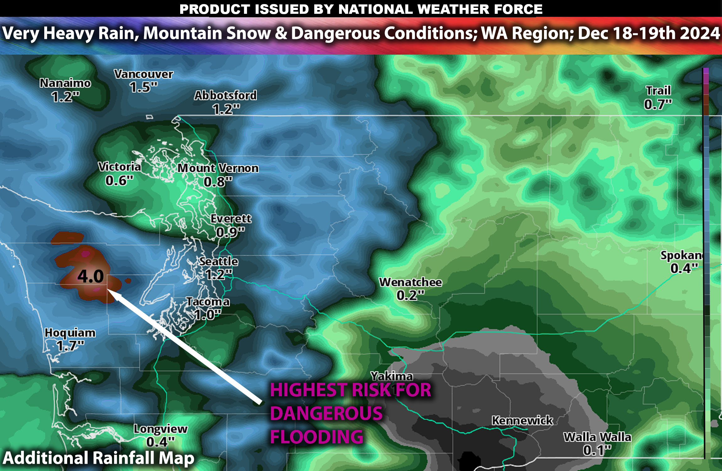
A powerful storm system impacted the Washington area in the last couple of days. Already many reports that this intense precipitation is causing localized flooding, especially in low-lying areas, and increasing the risk of landslides in steeper terrains. Over the next few days, the forecast suggests that the heavy rain will continue, particularly along the coastal areas and the western parts of the state.
Additional Rainfall Forecast
Coastal Areas: The heaviest rainfall is expected along the coast, with amounts potentially reaching or exceeding 3 inches in some places. The intense rainfall may lead to significant flooding issues, especially in areas prone to rapid water accumulation.
Inland Areas: Inland regions are also expected to receive substantial rainfall, with total amounts likely ranging from 1 to 2 inches. While less than the coast, these levels could still heighten flood risks, particularly along rivers and streams.
As the storm progresses, the potential for flash flooding remains a critical concern, especially in areas that have already received significant rainfall. The persistent heavy rain is also likely to impact soil stability, increasing the possibility of mudslides and landslides in vulnerable regions.
Snowfall in Washington State:
Heavy snow has already fallen in higher elevations, particularly in the Cascades, where several inches have accumulated. The snowfall is adding to travel difficulties and enhancing the risk of avalanches as more snow is expected.
Additional Snowfall forecast Wednesday and Thursday:
Mountainous Regions: Additional snowfall is forecasted for Wednesday and Thursday, with new accumulations of up to 12 inches in the highest elevations. This fresh snowfall will continue to impact travel and could lead to further avalanche warnings.
-Sina
