
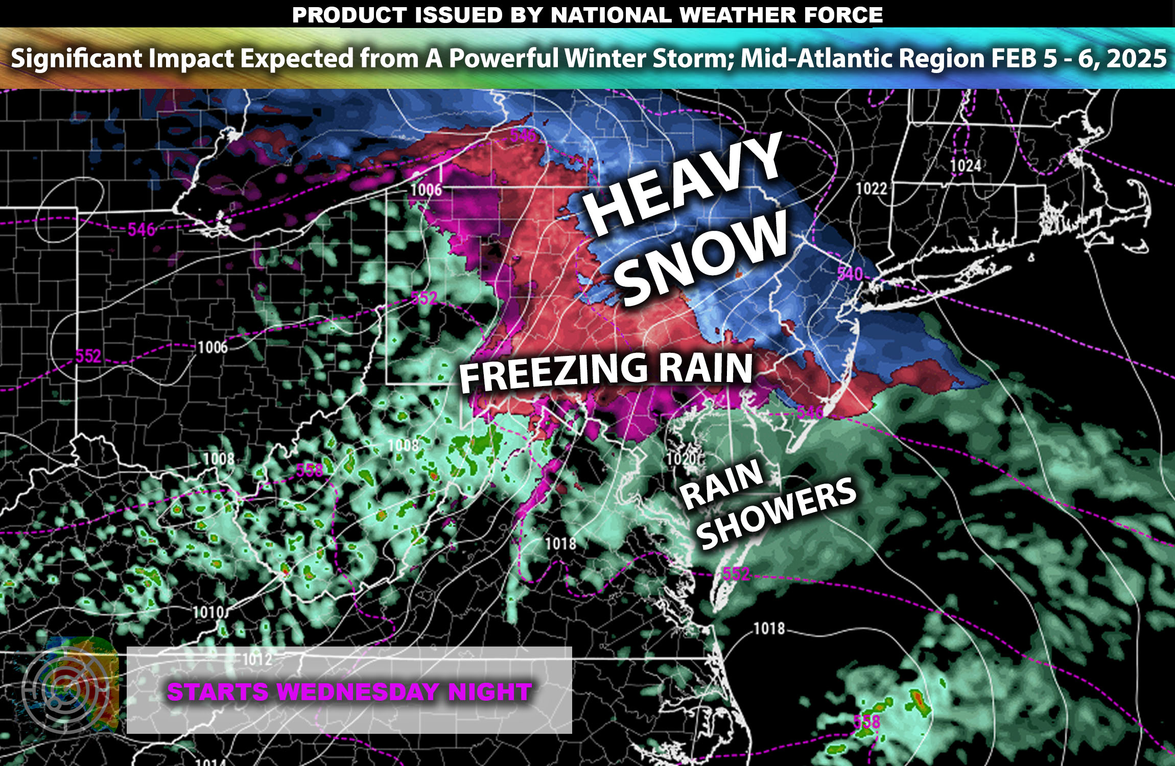
 Overall Forecast: The Mid-Atlantic region is bracing for a complex winter weather system that is expected to bring freezing rain and icy conditions starting Wednesday night and continuing into Thursday. This event is likely to affect a wide area, from northern Virginia through to southern New Jersey, impacting major urban centers along the I-95 corridor.
Upper-Level Forecast: A deep trough in the upper levels of the atmosphere will facilitate the southward movement of cold air, while warm moist air from the Atlantic will be lifted over the cold surface layer. This setup is conducive to the development of freezing rain, as precipitation falls into the sub-freezing air near the ground, leading to significant ice accumulation.
Northern Virginia: Expected to receive a mix of rain and freezing rain, with ice accumulations potentially reaching 0.1 to 0.2 inches, creating slick road conditions and increasing the risk of power outages.
Southern New Jersey: Predominantly freezing rain is forecast, with slightly higher ice accumulations that could exacerbate travel disruptions and affect utility services.
Western Maryland and Eastern West Virginia Highlands: While primarily a freezing rain event, higher elevations could see some snow mixing in, with potential for light accumulations that may complicate the existing icy conditions.
Wind Impacts also for the Coastal and Inland Areas: Accompanying the freezing rain, wind gusts up to 20-30 mph are expected, which may contribute to tree damage and power line issues, especially when combined with ice accumulation.
Timing & Impact: The weather system will begin impacting the region Wednesday night, with conditions deteriorating rapidly. The peak of the event is expected early Thursday morning, during which the heaviest ice accumulation is likely.
Stay tuned for more updates.