
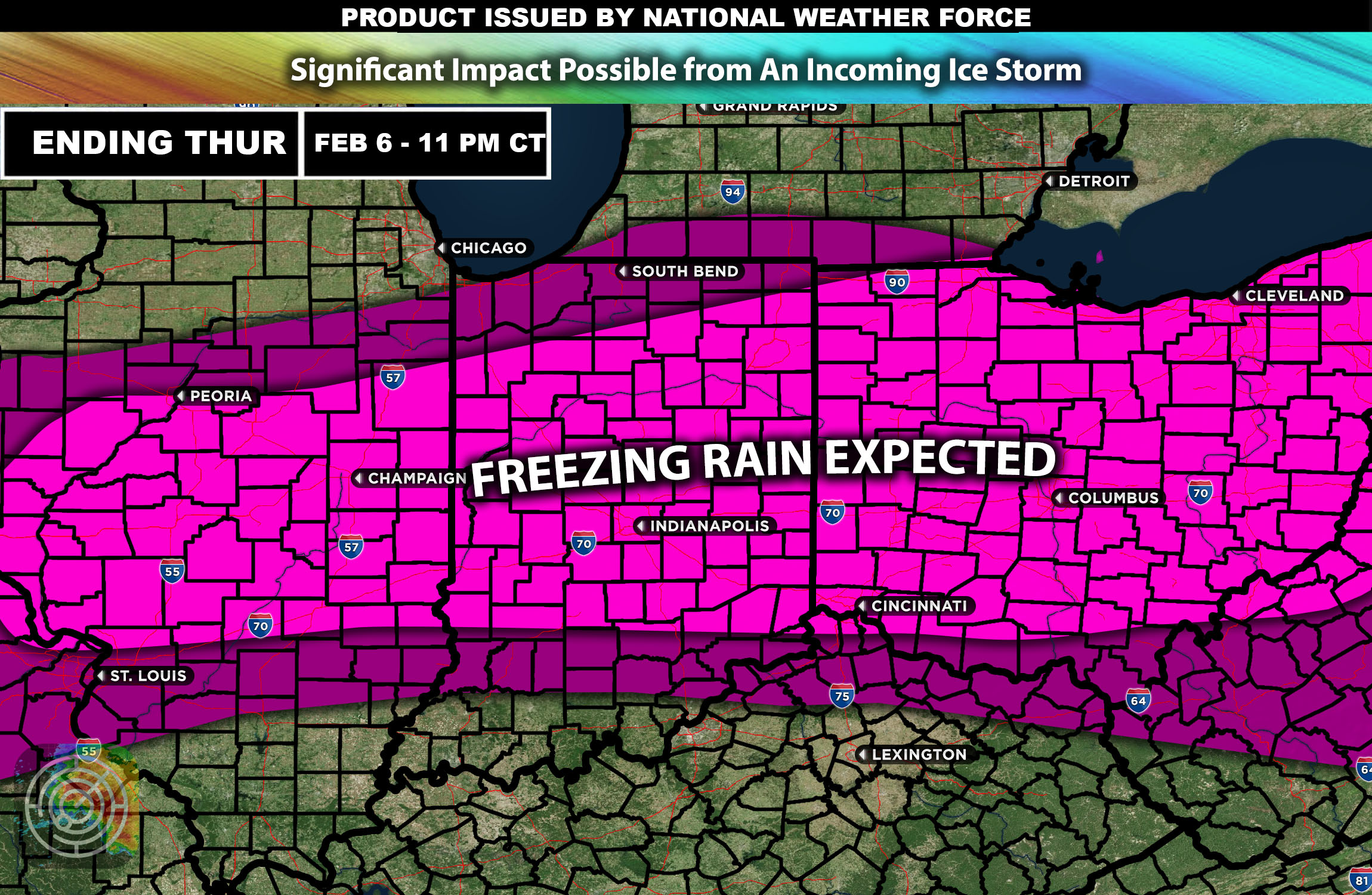
Overall Forecast: The Midwest is bracing for a significant winter weather event characterized by freezing rain, expected to impact the region on Wednesday starting on your afternoon and lasting through Thursday. This event is poised to create hazardous conditions across several states, particularly affecting travel and daily activities (which include driving in dangerous conditions).
Upper-Level Forecast: A strong low-pressure system moving eastward across the central United States will interact with a cold air mass entrenched over the region. This setup will facilitate sustained periods of freezing rain as warm moist air overrides the colder surface layer, leading to precipitation that freezes upon contact with the cold ground. As a result, impact is anticipated.
Freezing Rainfall Forecast:
Southern Midwest: Areas such as southern Illinois, Indiana, and Ohio can expect moderate freezing rain, with ice accumulations potentially reaching a tenth of an inch with local areas much higher, creating dangerous conditions.
Northern Midwest: States like Iowa and northern Illinois will see similar conditions, with the potential for slightly higher ice accumulations due to colder surface temperatures. While the focus is on freezing rain, some northern areas may also experience light snowfall or sleet mixing with ice, especially at the onset of the storm/
Moderate winds with speeds of 15-25 mph are expected, which may exacerbate the impact of the ice by causing additional stress on structures and trees, leading to possible power outages and other impacts as well.
Timing & Impact: The freezing rain is expected to begin early Wednesday The heaviest icing is likely to occur Wednesday night into early Thursday morning. The combination of ice and wind is expected to disrupt power lines and make travel dangerous, particularly on untreated roads and bridges.
Stay tuned for more updates.
-Sina