
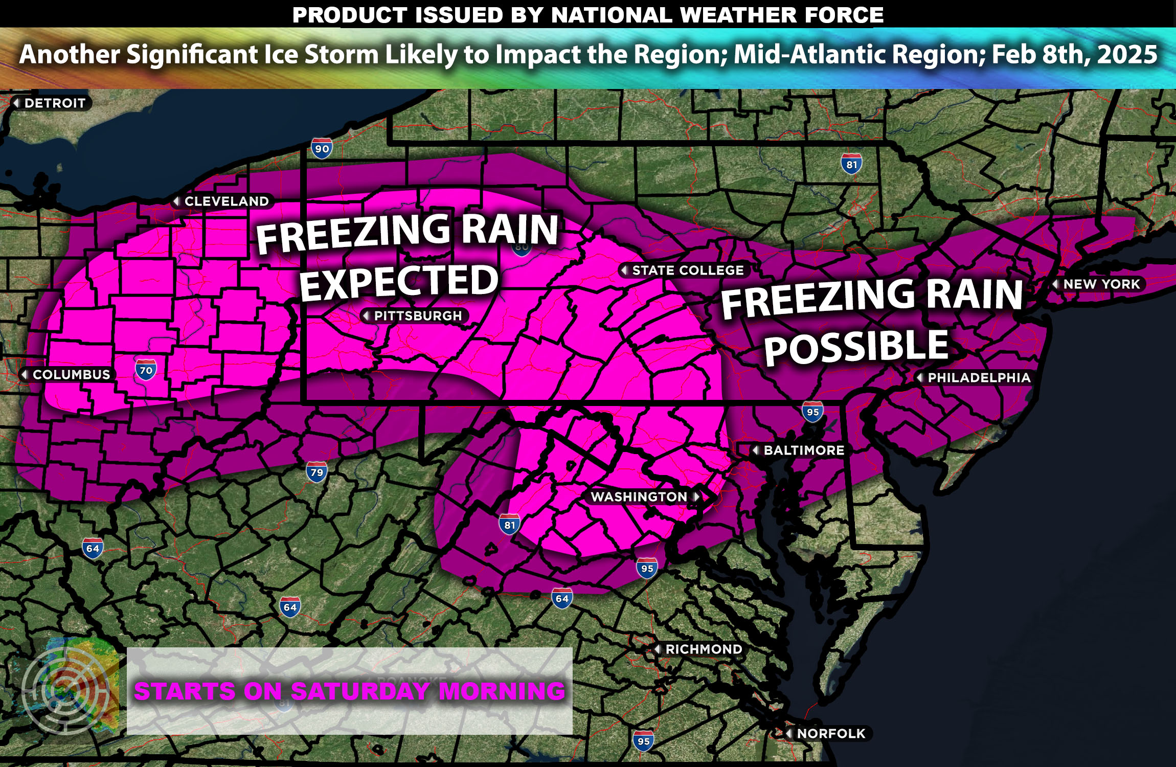
Overall Forecast: The Mid-Atlantic region is bracing for a significant winter weather event characterized by freezing rain and icy conditions. This weather pattern is expected to impact a wide swath of the area, from northern Virginia through parts of Maryland and into southern Pennsylvania.
Upper-Level Forecast: A strong upper-level low will track across the Mid-Atlantic, bringing with it a surge of cold air aloft. This setup will facilitate the development of freezing rain as warmer air overruns the cold surface layer, creating ideal conditions for ice formation.
Freezing Rain Forecast:
Northern Virginia: Residents can expect moderate to heavy freezing rain, with ice accumulations potentially reaching up to a quarter of an inch.
Maryland and Southern Pennsylvania: These areas will likely see similar conditions, with significant ice build-up leading to hazardous travel and potential power outages.
Snow Forecast:
While snow is not the primary concern with this system, the northernmost areas of the Mid-Atlantic may experience light snowfall before the precipitation transitions to freezing rain.
Wind Forecast:
Coastal and Inland Areas: Accompanying the freezing rain, the region could experience gusty winds, with speeds reaching up to 20-30 mph. These winds may exacerbate the impact of the ice, increasing the risk of downed trees and power lines.
Timing & Impact: The freezing rain event is expected to begin late Saturday evening and will continue through Sunday. The peak of the impact is likely to occur overnight into early Sunday morning, when temperatures will be at their lowest, maximizing the potential for ice accumulation. Residents are advised to prepare for potential power outages and to limit travel during the event to avoid hazardous conditions especially where the amounts of ice accumulation are expected to be significant.
Stay tuned for more updates.
-Sina